

Last updated: July 24, 2026
Quick Answer: An expert witness in a boundary dispute is a qualified surveyor or specialist appointed by the court or a party to provide independent, evidence-based opinion on where a legal boundary lies. In 2026, expert witness roles in boundary disputes increasingly depend on LiDAR evidence and party wall integration, combining high-resolution terrain data with Land Registry records and Party Wall Act documentation to produce court-admissible reports that are harder to challenge and faster to prepare than traditional survey methods alone.
Key Takeaways
- Expert witnesses in boundary disputes must hold recognised surveying qualifications and comply with Civil Procedure Rules Part 35, owing their duty to the court rather than the instructing party.
- LiDAR (Light Detection and Ranging) produces millions of precise elevation data points that can reveal historic ditches, hedgerow bases, and encroachments invisible to the naked eye or conventional 2D plans.
- Environment Agency LiDAR datasets at 1-metre resolution are available under the Open Government Licence and are now routinely used in litigation-support mapping for English boundary cases.
- LiDAR evidence can be challenged in court, but its strength lies in reproducibility: the data does not degrade and can be re-examined independently.
- The Party Wall Act 1996 and boundary disputes are legally distinct matters, though they frequently overlap in practice and a single expert can address both.
- Expert witness reports for boundary cases typically take 6 to 16 weeks to prepare, depending on complexity and data availability.
- Costs for a boundary dispute expert witness in England range from roughly £1,500 for a straightforward written report to £10,000 or more for full court attendance and cross-examination.
- When LiDAR data contradicts old survey records, the expert must explain the discrepancy rather than simply prefer one source, which is where professional judgement adds the most value.
What Is an Expert Witness in a Boundary Dispute Case
An expert witness in a boundary dispute is an independent professional, usually a chartered surveyor, appointed to give the court an informed, objective opinion on the location of a legal boundary. Unlike a factual witness who reports what they saw, an expert witness is permitted to express professional opinion based on evidence they have gathered and analysed.
In England and Wales, expert witnesses are governed by Civil Procedure Rules (CPR) Part 35. This means their primary duty is to the court, not to the party paying their fee. That independence is what gives their evidence weight. A judge will discount a report that reads like advocacy rather than objective analysis.
For boundary disputes specifically, the expert's role typically covers:
- Interpreting title deeds, conveyance plans, and Land Registry data
- Conducting or commissioning physical surveys of the land
- Analysing historic maps, aerial photographs, and now LiDAR terrain data
- Producing a written report that sets out findings and a clear opinion
- Attending court or a joint experts' meeting if required
The expert witness reports service provided by chartered surveyors covers all these stages and is structured to meet CPR Part 35 requirements from the outset.
How Is LiDAR Evidence Used in Property Boundary Disputes
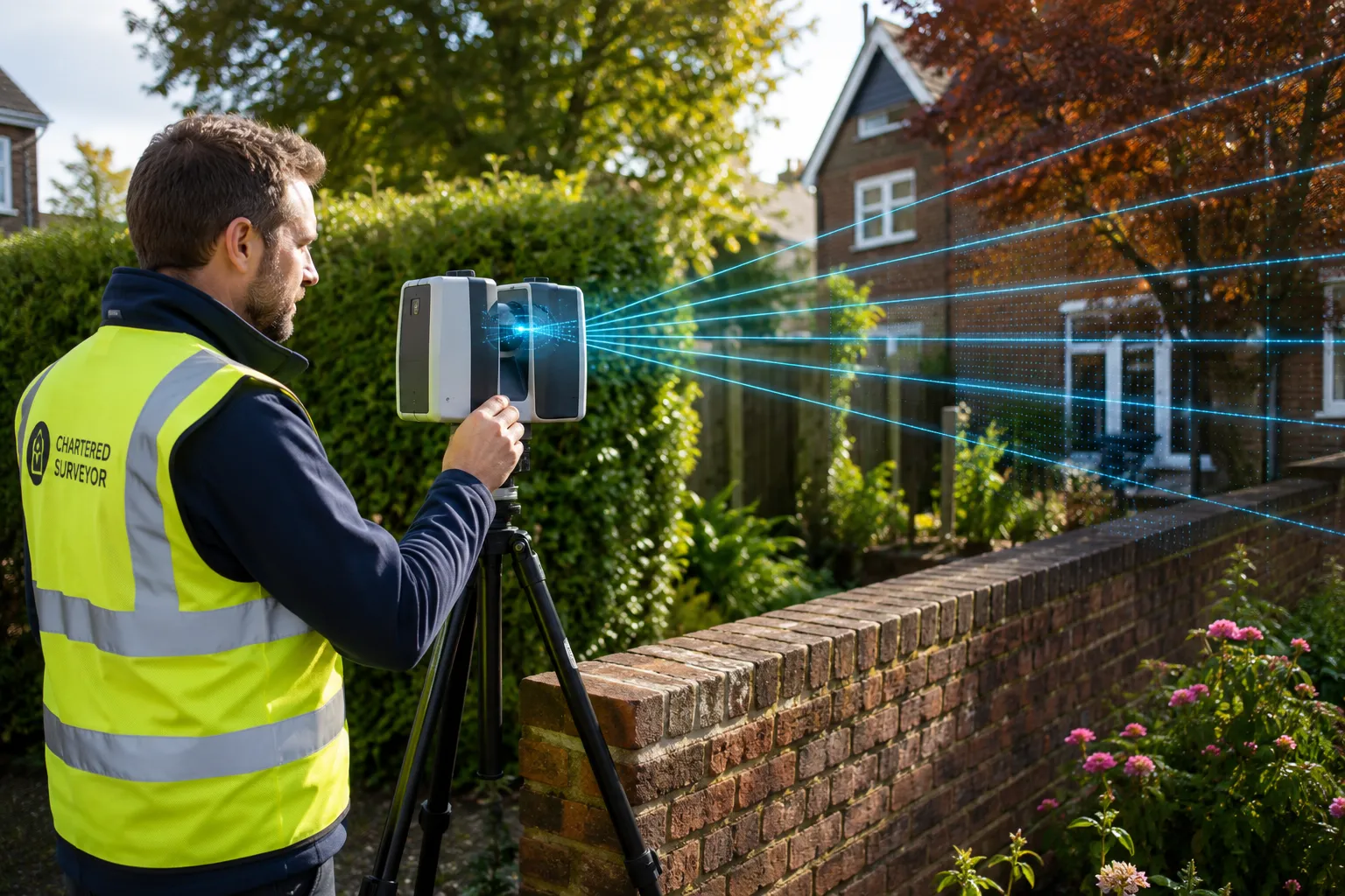
LiDAR evidence is used in boundary disputes to create precise, three-dimensional models of the land surface that reveal physical features relevant to boundary position. The technology fires millions of laser pulses from airborne or ground-based sensors, recording the exact distance to every surface point and building a dense point cloud.
For boundary cases, the practical outputs include:
- Digital Elevation Models (DEMs): Show subtle changes in ground level that indicate historic ditches, banks, or hedgerow roots, features courts recognise as long-standing boundary markers.
- Encroachment mapping: Overlaying LiDAR data on HM Land Registry INSPIRE index polygons allows side-by-side comparison of registered title boundaries versus actual physical features on the ground.
- Slope and drainage analysis: Relevant where disputes involve drainage rights or where water runoff patterns are used as evidence of the intended boundary.
- 3D mesh reconstructions: Provide visual and numerical support that judges and lay parties find easier to follow than traditional 2D conveyance plans.
Environment Agency aerial LiDAR surveys of England, available at 1-metre resolution under the Open Government Licence, are now a standard starting point for boundary analysis. These datasets can reveal ditches, embankments, and hedgerow bases that have been obscured by vegetation or development for decades, yet remain legally significant as evidence of historic boundary positions.
What Qualifications Does a Boundary Dispute Expert Witness Need
A boundary dispute expert witness in England should hold chartered membership of the Royal Institution of Chartered Surveyors (RICS), typically as an MRICS or FRICS, with a specialism in land or boundary surveying. RICS membership signals that the individual has met professional competency standards and is bound by a code of conduct.
Beyond RICS membership, courts expect expert witnesses to demonstrate:
- Specific experience in boundary dispute work, not just general surveying
- Familiarity with CPR Part 35 and the Protocol for the Instruction of Experts
- Ability to interpret historic title documents, Ordnance Survey data, and modern geospatial datasets including LiDAR
- Professional indemnity insurance appropriate to the work
Some experts also hold accreditation from the Academy of Experts or the Expert Witness Institute, which provides additional credibility during cross-examination. Instructing a surveyor who lacks boundary-specific experience, even if they are otherwise competent, is a common and costly mistake.
How Much Does an Expert Witness Cost for a Boundary Dispute
Expert witness costs for boundary disputes in England vary significantly based on the complexity of the case, the volume of evidence to be reviewed, and whether court attendance is required. As a general guide for 2026:
| Stage | Estimated Cost Range |
|---|---|
| Initial review and written report | £1,500, £3,500 |
| Full expert report with LiDAR analysis | £3,500, £7,000 |
| Joint experts' meeting | £500, £1,500 |
| Court attendance and cross-examination | £1,500, £3,000 per day |
| Total (contested case, full attendance) | £6,000, £12,000+ |
These are estimates based on typical market rates; actual fees depend on the surveyor's experience and the case specifics. For context on related surveying costs, the average cost of a boundary dispute article provides a broader breakdown of what property owners typically spend across all stages of a dispute.
Party Wall Act and Boundary Disputes: What Is the Difference
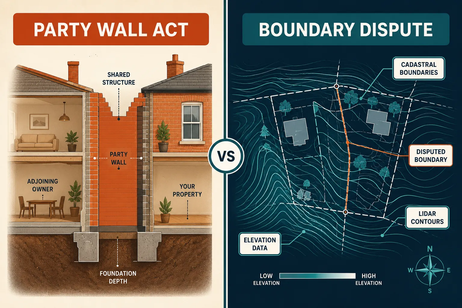
The Party Wall Act 1996 and boundary disputes are legally separate matters, though they frequently arise together on the same property. Understanding the distinction matters because the procedures, timelines, and professional roles differ.
The Party Wall Act 1996 governs works to shared walls, floors, and excavations near neighbouring properties. It creates a statutory process for notifying neighbours, appointing surveyors, and producing a Party Wall Award that protects both parties. It does not determine where a boundary lies.
A boundary dispute concerns the legal position of the line dividing two properties. It may involve courts, Land Registry adjudication, or mediation, and requires evidence-based analysis of title documents, physical features, and survey data.
Where they overlap: if a building owner proposes work under the Party Wall Act and the neighbour disputes whether the party wall sits on the correct boundary, both issues must be addressed. The Party Wall surveyor can deal with the works procedure, but a separate expert witness opinion may be needed for the boundary question.
For a clear explanation of how the Party Wall Act works in practice, the complete guide to party wall disputes covers the statutory process in detail. If you are unsure whether you need a Party Wall surveyor, an expert witness, or both, the guide to party wall surveyor roles and appointment is a useful starting point.
Can LiDAR Evidence Be Challenged in Court for Boundary Cases
Yes, LiDAR evidence can be challenged in court, but it is considerably more resilient to challenge than traditional survey notes or witness recollections. The key strengths are reproducibility and objectivity: the raw data exists independently of the expert who interpreted it, and another surveyor can re-examine the same point cloud and reach their own conclusions.
Common lines of challenge include:
- Data vintage: Airborne LiDAR captures the land at a specific date. If the dispute concerns a boundary position before that date, the opposing party may argue the data does not reflect the historic situation.
- Interpretation methodology: Two experts can apply different analysis methods to the same LiDAR dataset and reach different conclusions. Courts will scrutinise whether the methodology is accepted practice.
- Ground cover interference: Dense vegetation can cause LiDAR returns to reflect off canopy rather than ground level, potentially misrepresenting the true terrain. Competent experts filter for ground returns and document their methodology.
- Resolution limitations: Standard Environment Agency data at 1-metre resolution is suitable for identifying large features but may not resolve fine boundary details at sub-metre scale. Higher-resolution ground-based scans may be needed for precision cases.
A well-prepared expert report addresses these limitations proactively, which is far more persuasive than having them raised for the first time during cross-examination.
How Accurate Is LiDAR for Measuring Property Lines
Airborne LiDAR at 1-metre resolution is accurate enough to identify boundary-relevant terrain features such as ditches, banks, and hedgerow bases, but is not precise enough to determine a boundary line to centimetre accuracy on its own. Ground-based terrestrial LiDAR scanners can achieve sub-centimetre accuracy and are used where fine measurement is required.
For most boundary disputes in England, the workflow combines:
- Environment Agency airborne LiDAR for landscape context and historic feature identification
- HM Land Registry INSPIRE index polygons for registered title footprints
- Ground-based survey (total station or terrestrial LiDAR) for precise measurement of physical features
- Overlay analysis comparing all three datasets to identify agreements and discrepancies
The combination is more reliable than any single source. LiDAR alone does not define a legal boundary; it provides physical evidence that an expert then interprets in the context of title documents and legal principles.
What Documents Do Expert Witnesses Need for Party Wall Boundary Cases
An expert witness preparing a report for a case involving both party wall and boundary issues needs a specific set of documents to produce a credible, court-ready opinion. Missing documents are a leading cause of delayed or weakened reports.
Essential documents:
- Title deeds and conveyance plans for both properties (ideally originals or certified copies)
- HM Land Registry official copies of the register and title plan (scale 1:1250 for urban properties)
- Any existing Party Wall Awards, notices, and acknowledgements
- Schedules of condition prepared before any works commenced
- Planning permissions and approved drawings for any relevant works
- Historic Ordnance Survey maps (1:2500 or 1:1250 scale, ideally multiple dates)
- Aerial photographs from the Ordnance Survey, Google Earth historical imagery, or the National Library of Scotland map archive
- LiDAR terrain data from the Environment Agency (downloaded directly or via a mapping tool)
- Any previous survey reports or expert opinions already produced in the case
For cases involving construction works, structural drawings and engineer's calculations may also be relevant. The party wall schedule of condition is particularly important where damage to a neighbouring property is alleged, as it establishes the pre-works baseline.
What Happens If LiDAR Data Contradicts Old Survey Records
When LiDAR data contradicts old survey records, the expert witness must investigate the reason for the discrepancy rather than simply preferring the more modern or more precise source. This is one of the most technically demanding aspects of boundary dispute work in 2026.
Possible explanations include:
- Physical change: Fences, walls, or hedges have moved since the old survey was conducted. LiDAR reflects current conditions; the old survey may be more relevant to the historic boundary position.
- Survey error: The old survey may contain measurement errors, particularly if conducted with less accurate equipment. However, courts are cautious about dismissing old surveys without clear evidence of error.
- Different reference points: Old conveyance plans often used different datum points or reference lines. The apparent contradiction may resolve once both datasets are brought to a common reference frame.
- LiDAR interpretation error: The expert may have misidentified a feature in the point cloud. Independent peer review of the LiDAR analysis is good practice in contested cases.
The expert's report must explain the discrepancy transparently, set out the possible explanations, and give a reasoned opinion on which evidence better represents the legal boundary position. A report that ignores the contradiction will be exposed in cross-examination.
Are There Alternatives to LiDAR for Boundary Dispute Evidence
LiDAR is not the only tool available, and in some cases traditional methods remain more appropriate. The choice depends on the scale of the dispute, the age of the property, and the budget available.
Alternatives and complements to LiDAR:
- Total station survey: High-precision ground measurement using a theodolite and electronic distance meter. Accurate to millimetre level, but only captures what the surveyor physically measures rather than the full terrain.
- GNSS/GPS survey: Satellite-based positioning, suitable for larger plots but less accurate in urban areas with signal obstruction.
- Photogrammetry: Creating 3D models from overlapping photographs. Lower cost than LiDAR but less accurate in areas with poor texture or uniform surfaces.
- Historic map analysis: Ordnance Survey maps, tithe maps, and enclosure awards can establish boundary positions going back centuries. Often used alongside LiDAR rather than as a replacement.
- Drone survey: Aerial photography and photogrammetry from unmanned aircraft. Useful for large or inaccessible sites, and increasingly combined with LiDAR sensors on the same platform.
For straightforward urban residential disputes where the boundary is a brick wall or close-boarded fence, a total station survey combined with title document analysis is often sufficient. LiDAR adds most value where terrain features, drainage, or rural land are involved.
Do I Need Both a Surveyor and an Expert Witness for Boundary Issues
In many cases, one chartered surveyor can fulfil both roles. A surveyor instructed as an expert witness will conduct or commission the physical survey, analyse all available evidence, and produce the expert report. There is no requirement to appoint two separate professionals.
However, there are situations where separate appointments make sense:
- You already have a surveyor advising you: A surveyor who has been acting as your adviser cannot then act as an independent expert witness, because they owe a duty to you rather than the court. A separate expert must be appointed.
- The case involves specialist engineering issues: A boundary dispute involving structural damage, drainage engineering, or geotechnical matters may require a structural or civil engineer as a co-expert alongside the surveying expert.
- Joint expert appointment: Where both parties agree to a single joint expert (common in lower-value disputes), that expert must be genuinely independent of both sides.
If you are unsure whether you need a Party Wall surveyor, an expert witness, or both, reviewing the party wall agreement essentials alongside the expert witness service information will help clarify which appointment is appropriate for your situation.
When Should You Hire an Expert Witness for a Boundary Dispute
Hire an expert witness when the dispute cannot be resolved through direct negotiation or mediation, when court proceedings are likely or have already started, or when the financial value of the disputed land justifies professional evidence. Earlier instruction generally produces better outcomes because the expert can advise on the strength of the evidence before significant legal costs are incurred.
Specific triggers for instruction include:
- A neighbour has erected a fence, wall, or structure that you believe encroaches on your land
- You have received a letter before action or a court claim relating to a boundary
- A Party Wall dispute has escalated to include a boundary question
- You are buying or selling a property where a boundary is unclear or disputed
- Planning permission has been refused or challenged on the basis of boundary uncertainty
Instructing an expert early also allows them to advise on evidence preservation, which matters if physical features such as old fences or vegetation are at risk of being removed before the case is heard.
How Long Does a Boundary Dispute Expert Witness Case Take
A boundary dispute expert witness case typically takes 6 to 16 weeks from initial instruction to delivery of the final report, assuming all documents are available promptly. Court attendance adds further time depending on the court's listing schedule.
Typical timeline:
- Weeks 1-2: Initial instructions, document review, site visit booking
- Weeks 2-4: Site survey and LiDAR data analysis
- Weeks 4-8: Historic map research, title document analysis, draft report preparation
- Weeks 8-12: Report finalisation, peer review if required
- Weeks 12-16: Exchange with opposing expert, joint statement preparation
- Beyond week 16: Court attendance if the case proceeds to trial
Complex cases involving multiple title documents, extensive LiDAR analysis, or disputed engineering matters can take longer. Cases where documents are incomplete or where the opposing party delays providing information also extend the timeline.
Common Mistakes in Boundary Dispute Expert Reports
Poor expert reports are a significant cause of boundary disputes being lost or settled on unfavourable terms. Judges are experienced at identifying reports that fail to meet the required standard, and a weak report can undermine an otherwise strong case.
The most common mistakes:
- Advocacy instead of objectivity: Writing the report to support the instructing party's position rather than giving an independent opinion. This is the most serious error and can result in the report being excluded.
- Ignoring contradictory evidence: Failing to acknowledge or explain evidence that does not support the expert's conclusion.
- Inadequate methodology: Not explaining how LiDAR data was processed, which filters were applied, or how the analysis was validated.
- Overconfidence in data: Treating LiDAR or GPS coordinates as definitive without acknowledging resolution limitations.
- Missing the legal question: Confusing the physical boundary (where features are on the ground) with the legal boundary (where the title documents say it is). These are not always the same thing.
- Failure to comply with CPR Part 35: Omitting the required statement of truth, not disclosing the range of opinion, or failing to state the facts and assumptions on which the opinion is based.
A well-structured expert report addresses all these points systematically and will withstand scrutiny at a joint experts' meeting or in cross-examination.
Frequently Asked Questions
What is the difference between a party wall surveyor and an expert witness?
A party wall surveyor is appointed under the Party Wall Act 1996 to administer the statutory process for notifying neighbours and producing a Party Wall Award. An expert witness is appointed to give independent evidence to a court on a disputed factual or technical matter. The same chartered surveyor can sometimes fulfil both roles in different proceedings, but not simultaneously in the same dispute.
Is LiDAR evidence admissible in English courts?
Yes. LiDAR-derived data and analysis are admissible as part of an expert witness report in English courts, provided the expert explains the methodology, acknowledges limitations, and complies with CPR Part 35. Courts have accepted LiDAR evidence in boundary and property cases where it has been properly presented.
Can I use free Environment Agency LiDAR data for my boundary dispute?
Environment Agency LiDAR data is available free under the Open Government Licence and can be downloaded by anyone. However, interpreting the data for legal purposes requires professional expertise. Downloading the data yourself and presenting it without expert analysis is unlikely to carry weight in court.
What happens at a joint experts' meeting?
A joint experts' meeting is a without-prejudice discussion between the expert witnesses for each party, usually directed by the court. The experts work through the issues in dispute, identify points of agreement, and record remaining disagreements in a joint statement. This process often narrows the issues significantly and can lead to settlement.
Can a boundary dispute be resolved without going to court?
Yes. Many boundary disputes are resolved through negotiation, mediation, or the Land Registry's boundary determination process without ever reaching court. An expert witness report can support these processes as well as court proceedings, and having a strong expert opinion often encourages the other party to settle.
How does the Party Wall Act affect a boundary dispute if works have already started?
If a building owner has started notifiable works without serving a Party Wall notice, the consequences of ignoring the Party Wall Act can include injunctions and liability for damage. If a boundary dispute also exists, the courts can consider both the procedural breach and the boundary question, but they remain legally separate issues requiring separate analysis.
What is the INSPIRE index polygon and why does it matter for boundary disputes?
The INSPIRE index polygon is HM Land Registry's spatial dataset showing the approximate footprint of each registered title in England and Wales. It is the official digital representation of registered ownership extents. In boundary disputes, it provides the baseline against which LiDAR terrain data and physical survey measurements are compared, though it is not itself a definitive legal boundary.
Conclusion
Expert witness roles in boundary disputes have become considerably more technical in 2026, with LiDAR evidence and party wall integration now forming a core part of how chartered surveyors build and present their cases. The combination of high-resolution terrain data, Land Registry INSPIRE polygons, and historic title documents gives expert witnesses a stronger evidentiary foundation than was available even five years ago, but it also demands higher standards of methodology and transparency in reporting.
Actionable next steps for property owners and professionals:
- If a boundary dispute is developing, instruct a chartered surveyor with specific boundary dispute experience as early as possible, before physical evidence is disturbed.
- Gather all title documents, conveyance plans, and any existing Party Wall documentation before the first meeting with your expert.
- Ask your surveyor whether LiDAR analysis is appropriate for your case and what resolution of data will be needed.
- If Party Wall works are also involved, clarify whether the same expert can address both issues or whether separate appointments are needed.
- Review the party wall services available and the expert witness reports service to understand what a full instruction covers.
- Do not delay instruction in the hope that the dispute will resolve itself; boundary disputes rarely improve with time and physical evidence can be lost.
The strength of an expert witness opinion in 2026 rests not just on the technology used, but on the professional judgement applied to it. Choosing a surveyor who understands both the technical and legal dimensions of boundary work remains the single most important decision in any disputed boundary case.
Tags: boundary disputes, expert witness, LiDAR evidence, party wall act, chartered surveyor, boundary survey, property disputes UK, party wall surveyor, land registry, boundary determination, expert witness report, civil procedure rules