

Last updated: July 24, 2026
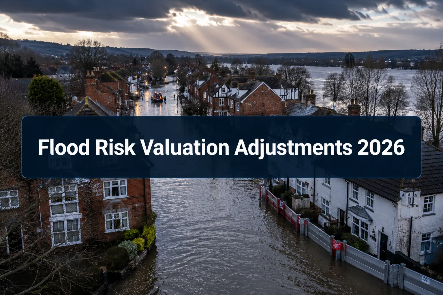
Quick Answer: Flood risk now directly reduces residential and commercial property values in England, with Flood Zone 3 properties seeing discounts of 12% to 20% compared to equivalent properties outside flood-prone areas. Following the Environment Agency's May 2026 update to its Flood Map for Planning and the spring 2026 flood events across southern England, building surveyors are applying more rigorous flood risk assessments as standard practice. Understanding valuation adjustments for flood risk in 2026 is essential for any buyer, seller, landlord, or lender dealing with property in or near a flood zone.
Key Takeaways
- 6.3 million properties in England are currently at risk of flooding, with projections suggesting this could rise to 8 million by mid-century.
- The Environment Agency updated its Flood Map for Planning in May 2026 to incorporate surface water flood risk data, including future extents and depth information.
- Properties in Flood Zone 3 without resilience measures are typically valued 12% to 20% below comparable properties outside flood zones.
- Installing flood resilience measures (flood doors, raised electrics, water-resistant flooring) can reduce that discount to between 5% and 10%.
- An AI model developed by Snowflake and Ordnance Survey has flagged up to 1.2 million buildings in England as flood-vulnerable despite sitting outside current flood defence frameworks, with 85% at surface water risk.
- RICS updated its global ESG valuation standards in April 2026, making flood risk and climate resilience a formal part of the valuation process.
- Lenders increasingly require flood risk assessments before issuing mortgage offers on Level 2 and Level 3 survey properties.
- Property values in flooded areas typically recover to pre-flood levels within three years, but repeated flooding can cause permanent value suppression.
- Checking the updated EA flood maps before exchange is now a standard due-diligence step, not an optional extra.
What Are Valuation Adjustments for Flood Risk?
Valuation adjustments for flood risk are percentage reductions (or, in rare cases, premiums) that a chartered surveyor applies to a property's market value to reflect the financial consequences of its flood exposure. These adjustments account for higher insurance costs, potential mortgage restrictions, reduced buyer demand, and the cost of flood resilience works.
In practice, a surveyor assessing a semi-detached house in Flood Zone 3 will compare it against recent sales of similar properties in lower-risk zones. The gap between those comparables and the subject property, after accounting for condition and location, forms the basis of the flood risk adjustment. This is not guesswork: it is a structured, evidence-based process guided by RICS valuation standards and informed by the latest Environment Agency mapping data.
Who this applies to: Any property transaction, remortgage, insurance reinstatement valuation, or inheritance tax valuation where the subject property falls within or near a designated flood zone. For commercial properties, see commercial property valuations which follow the same RICS framework but with additional considerations around business interruption.
How Do Updated Environment Agency Maps Affect Property Values?
Updated EA maps directly expand the pool of properties subject to flood risk adjustments. When a property moves from Flood Zone 1 (low risk) to Flood Zone 2 or 3 on a revised map, its valuation profile changes immediately, even if no physical flooding has occurred.
The May 2026 update to the EA's Flood Map for Planning was particularly significant. For the first time, surface water flood risk datasets were consolidated into the same planning tool used by surveyors, developers, and lenders. This means properties that previously appeared safe from river and coastal flooding may now show elevated risk from surface water run-off, particularly in urban areas where drainage systems struggle during heavy rainfall.
Key consequences of the May 2026 update:
- Properties newly placed in a higher flood zone face immediate reassessment by lenders and insurers.
- Surface water risk is now visible alongside fluvial (river) and tidal risk in one place, removing a significant data gap.
- Planning applications in affected areas face stricter sequential and exception tests.
- Surveyors conducting Level 3 full building surveys are now required to cross-reference both the updated flood zone classifications and the new surface water depth data.
What Is the Difference Between Flood Zone 1, 2, and 3?
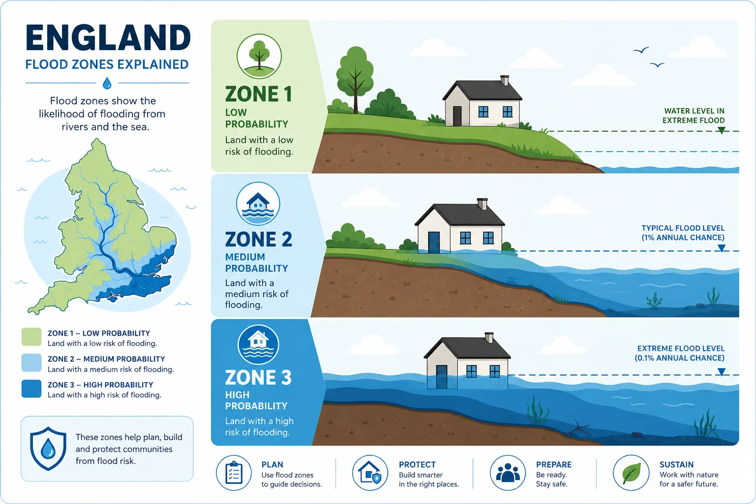
The Environment Agency divides flood risk in England into three zones based on annual probability of flooding from rivers or the sea.
| Flood Zone | Annual Flood Probability | Typical Valuation Impact |
|---|---|---|
| Zone 1 | Less than 0.1% (1 in 1,000) | Minimal to none |
| Zone 2 | 0.1% to 1% (1 in 1,000 to 1 in 100) | 3% to 8% discount (estimate) |
| Zone 3a | Greater than 1% (1 in 100 for rivers) | 12% to 20% discount |
| Zone 3b (Functional Floodplain) | Greater than 5% or designed to flood | Significant; may be unmortgageable |
Zone 3 is the most consequential for valuation purposes. Within Zone 3, a further distinction exists: Zone 3b (functional floodplain) is land that floods frequently and is generally unsuitable for most built development. Properties already built in Zone 3b face the most severe valuation discounts and the greatest difficulty securing standard mortgage finance.
Common mistake: Assuming Flood Zone 1 means zero risk. The May 2026 update demonstrated that surface water flooding can affect Zone 1 properties during extreme rainfall events. The AI model flagging 1.2 million undefended buildings found that the vast majority sit outside traditional flood zone classifications entirely.
How Much Does Flood Risk Reduce a Property's Value?
For properties in Flood Zone 3 without resilience measures, valuation reductions of 12% to 20% are now standard compared to equivalent properties outside flood-prone areas. This figure has increased from pre-2026 benchmarks, driven by the spring 2026 flood events and tighter lender requirements.
The discount narrows significantly when flood resilience measures are in place. Properties with documented features such as flood doors, raised electrical sockets, water-resistant ground-floor finishes, and non-return valves on drains typically see discounts of only 5% to 10%. This makes investing in resilience measures financially rational for owners in high-risk zones.
Factors that influence the size of the adjustment:
- Flood history: A property with a recorded flood event in the last five years attracts a larger discount than one that has never flooded despite its zone classification.
- Insurance availability: If standard buildings insurance is unavailable or priced prohibitively, the discount increases.
- Lender appetite: Some lenders refuse to mortgage properties in Zone 3b entirely, which suppresses demand and therefore value.
- Resilience investment: Documented, professionally installed flood resilience measures reduce the discount materially.
- Recovery trajectory: Values in areas that flooded in spring 2026 are currently depressed but are expected to recover within three years, assuming no repeat events.
What Do Building Surveyors Look For in Flood Risk Assessments?
A building surveyor conducting a flood risk assessment examines both the documentary evidence and the physical condition of the property. The goal is to establish not just whether a property is at risk, but how well it is protected and what the financial consequences of that risk are.
During a Level 3 building survey, a surveyor will typically:
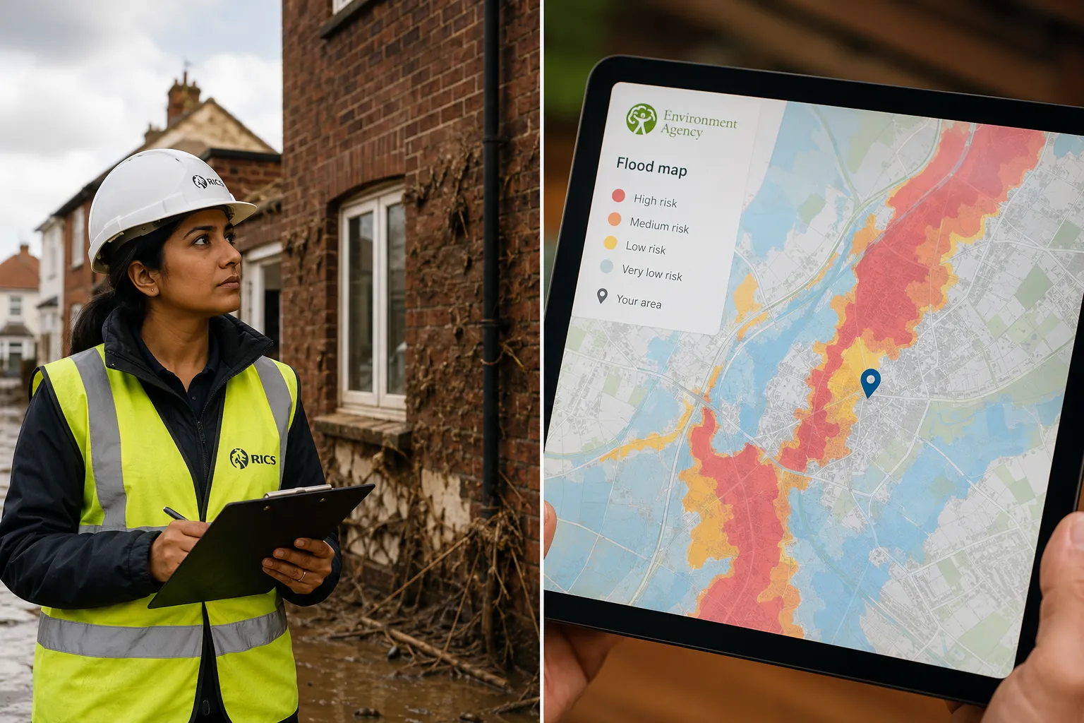
- Cross-reference the property's address against the updated EA Flood Map for Planning to confirm its flood zone.
- Check the surface water flood risk layer introduced in the May 2026 update.
- Inspect ground-floor construction for evidence of previous flood damage (tide marks, salt crystallisation on walls, replaced floor finishes).
- Assess existing flood resilience measures and their condition.
- Review drainage infrastructure, including the condition of gullies, inspection chambers, and any pumping equipment.
- Note the property's finished floor level relative to the adjacent watercourse or road level.
- Consider the environmental issues section of the survey report, which now routinely flags surface water risk.
For properties near the coast or tidal rivers, surveyors have adopted updated protocols following the spring 2026 events, placing greater emphasis on sea defence condition and long-term coastal change projections.
How Often Does the Environment Agency Update Its Flood Maps?
The Environment Agency updates its flood mapping on a rolling basis, but significant revisions tend to occur in response to new modelling data, climate projections, or major flood events. The January 2026 surface water dataset update and the May 2026 Flood Map for Planning consolidation represent two of the most substantive changes in recent years.
There is no fixed annual update cycle. Surveyors and property professionals should check the EA's Flood Map for Planning directly before any transaction rather than relying on a previous search result. Maps can change between instruction and exchange, particularly in areas where new modelling is underway.
Practical rule: Always run a fresh EA flood map check within 30 days of exchange. If a property has been re-zoned since the original survey was commissioned, the surveyor should be notified so the valuation can be reviewed.
How Do Surveyors Calculate Flood Risk Valuation Adjustments in 2026?
Surveyors use a comparable evidence approach combined with RICS guidance on ESG factors. The April 2026 RICS update formally embedded flood risk and climate resilience into the global valuation standards, meaning surveyors are now obliged to consider and document flood risk as part of any Red Book valuation.
The calculation process works as follows:
- Identify comparables in both the subject flood zone and lower-risk zones nearby.
- Quantify the price differential between matched pairs (same property type, condition, and location, differing only in flood zone).
- Adjust for resilience measures present at the subject property, reducing the raw zone differential accordingly.
- Factor in insurance costs where these are materially higher than market norms.
- Apply a lender risk overlay if the property's zone classification restricts the pool of available mortgage products.
- Document the adjustment explicitly in the valuation report, referencing the EA flood zone and the surface water risk classification.
For property development valuations, the calculation also includes the cost of any flood resilience works required to satisfy planning conditions, which are deducted from residual land value.
What Properties Are Most Affected by the New Environment Agency Maps?
The May 2026 update has had the greatest impact on three categories of property:
1. Urban properties previously outside flood zones. The integration of surface water data has brought thousands of urban properties into scope for the first time. These are often terraced or semi-detached homes on flat ground in areas with ageing drainage infrastructure.
2. Properties near smaller watercourses. Improved modelling of ordinary watercourses (ditches, streams, and culverted channels) has reclassified properties that were previously mapped as Zone 1.
3. Coastal and estuarial properties. Updated sea level rise projections have extended Zone 3 boundaries along several stretches of the English coast, particularly in the south and east.
Properties that were already in Zone 3 before 2026 are less directly affected by the map update itself, but they face increased scrutiny from lenders following the spring 2026 flood events.
Can You Get Flood Insurance If You Are in a High-Risk Area?
Yes, in most cases, but the cost and terms vary significantly. The Flood Re scheme, a joint initiative between the government and the insurance industry, allows insurers to pass the flood risk element of home insurance policies to a central reinsurance pool. This keeps premiums affordable for most high-risk residential properties built before 2009.
However, Flood Re does not cover:
- Properties built after 1 January 2009 (these were excluded to avoid incentivising development in flood plains).
- Leasehold flats (the building policy, not the contents, is what matters here).
- Commercial properties.
- Buy-to-let properties in some configurations.
Where Flood Re applies, insurance is generally obtainable. Where it does not, premiums can be prohibitively expensive or cover may be declined entirely. This directly affects valuation: a property that cannot obtain affordable buildings insurance faces a larger valuation discount because the financial risk to the buyer is materially higher. For landlords, insurance reinstatement cost valuations become especially important in flood-risk areas to ensure the sum insured is accurate.
Is Flood Risk Pricing Different for Commercial vs Residential Properties?
Yes. Commercial properties do not benefit from Flood Re, so flood insurance is priced entirely at market rates. This means the insurance cost differential between a commercial property in Zone 3 and one in Zone 1 can be substantial, and it feeds directly into yield calculations and therefore capital value.
For residential properties, Flood Re provides a degree of price smoothing that limits the insurance-driven component of the valuation discount. For commercial properties, surveyors must model the full insurance cost differential and factor it into the income capitalisation or comparable approach.
Additionally, commercial properties face business interruption risk that residential properties do not. A flooded retail unit or warehouse loses trading income during the recovery period, which is a separate valuation consideration from the physical damage to the building.
How Do I Check If My Property Is on the Updated Flood Maps?
The Environment Agency's Flood Map for Planning is publicly available at no cost. To check a property:
- Go to the EA's official flood risk mapping tool (search "Check your long term flood risk" on GOV.UK).
- Enter the property's postcode.
- Review the flood zone classification and, following the May 2026 update, the surface water flood risk layer.
- Note the flood risk from rivers and sea separately from surface water risk, as these are now displayed in the same interface.
For a more detailed analysis, particularly before a transaction, a specialist flood risk search from a conveyancing search provider will include historical flood data, proximity to watercourses, and drainage authority information that the EA's public tool does not show.
Edge case: If a property straddles two flood zones (common with larger plots), the valuation adjustment applies to the portion of the building footprint within the higher-risk zone, not necessarily the whole property.
What Should Homeowners Do If Their Property Is in a New Flood Zone?
Being reclassified into a higher flood zone does not automatically mean a property is unsellable or uninsurable. The appropriate response depends on the specific zone and the property's physical characteristics.
Immediate steps for affected homeowners:
- Obtain a formal flood risk assessment from a qualified surveyor to understand the practical implications for the specific property.
- Contact your current insurer to confirm whether your policy terms change following reclassification.
- Investigate Flood Re eligibility if you are not already covered under the scheme.
- Commission a building survey if you have not had one recently, to identify any existing flood vulnerability in the building fabric.
- Consider a flood resilience survey to identify cost-effective measures that could reduce both physical risk and the valuation discount.
- If selling, disclose the flood zone classification accurately and provide evidence of any resilience measures installed, as this will support the valuation.
For homeowners considering whether to sell, the three-year recovery timeline for post-flood values suggests that waiting, where financially possible, may yield a better outcome than selling immediately after a flood event.
What Are Common Mistakes When Assessing Flood Valuation Adjustments?
Several errors recur in flood risk valuations, and they can be costly in either direction.
Relying on outdated maps. Using a flood map search from six or twelve months ago misses the January and May 2026 updates. Always use a current search.
Ignoring surface water risk. Before May 2026, many valuations focused solely on fluvial and tidal risk. Surface water flooding now accounts for a significant proportion of total flood risk, particularly in urban areas.
Failing to credit resilience measures. A surveyor who applies the full Zone 3 discount without accounting for documented flood doors and raised electrics will undervalue the property. Equally, a surveyor who accepts a seller's verbal claim of resilience measures without physical verification will overvalue it.
Treating all Zone 3 properties identically. Zone 3a and Zone 3b carry very different risk profiles. Zone 3b properties may be unmortgageable with most high-street lenders.
Overlooking insurance availability. A property that falls outside Flood Re eligibility (post-2009 construction, for example) faces a structurally different insurance market and a larger valuation discount than an otherwise identical pre-2009 property.
Should I Still Buy a Property in a Flood Risk Area?
Flood risk does not automatically make a property a bad purchase. The decision depends on the zone, the price, the resilience measures in place, and the buyer's risk tolerance and long-term plans.
Buy if:
- The property is in Zone 2 or the lower end of Zone 3a, the price reflects the flood risk discount, and resilience measures are in place or budgeted.
- The property has never flooded despite its zone classification and has demonstrable natural or engineered protection.
- You are a cash buyer or have access to a lender comfortable with the zone.
- The location's long-term value drivers (transport, schools, employment) are strong enough to absorb the flood risk discount.
Proceed with caution if:
- The property is in Zone 3b or has flooded more than once in the last decade.
- Insurance is unavailable or unaffordable.
- The seller cannot provide evidence of resilience measures they have claimed.
- The asking price does not reflect the flood zone classification.
Getting an independent property valuation before committing to a purchase in any flood-affected area is the single most effective way to ensure you are paying a price that accurately reflects the risk.
FAQ
Q: Does a flood zone classification affect my mortgage application?
A: Yes. Lenders assess flood zone classification as part of their security valuation. Properties in Zone 3a may require a specialist lender, and Zone 3b properties are often declined by high-street banks entirely. Always check lender appetite before making an offer.
Q: How long does a flood risk assessment take as part of a building survey?
A: The flood risk element of a Level 3 building survey does not significantly extend the survey duration. The on-site inspection typically takes half a day to a full day depending on property size, with the flood risk analysis completed as part of the report preparation.
Q: Can flood resilience measures be added after purchase to recover value?
A: Yes. Installing professionally specified and documented resilience measures after purchase can reduce the valuation discount from the 12-20% range to 5-10%. The key is professional installation and a clear paper trail, as surveyors and lenders will want evidence of the work.
Q: Does the EA flood map update affect properties that have never flooded?
A: Yes. The map reflects modelled risk based on topography, watercourse proximity, and drainage capacity, not just historical flood events. A property can be reclassified into a higher zone without ever having experienced flooding.
Q: Are leasehold flats treated differently for flood risk valuations?
A: The flood zone classification applies to the building, not individual flats. However, the insurance implications differ because the building policy is typically held by the freeholder or management company. Leaseholders should confirm that the building's insurance covers flood risk and that the sum insured is adequate. See leasehold extension and enfranchisement valuations for related considerations.
Q: What is the difference between a flood risk assessment and a flood survey?
A: A flood risk assessment is a desk-based review of flood zone data, historical records, and drainage information, often produced by a specialist environmental consultant for planning purposes. A flood survey, as conducted by a building surveyor, combines that data with a physical inspection of the property to assess resilience, vulnerability, and valuation impact.
Conclusion
Valuation adjustments for flood risk in 2026 are no longer a niche concern reserved for riverside cottages. The Environment Agency's updated maps, the spring 2026 flood events, and the revised RICS ESG standards have placed flood risk at the centre of mainstream property transactions across England. Whether you are buying, selling, remortgaging, or managing a portfolio, understanding how flood zone classifications translate into price adjustments is now a core part of informed property decision-making.
Actionable next steps:
- Run a current EA flood map check on any property you are considering buying or selling.
- Commission a Level 3 building survey that explicitly addresses the updated surface water risk data.
- If your property has been reclassified, obtain a professional valuation that accounts for resilience measures before agreeing a sale price.
- Confirm your insurance position, particularly if your property was built after 2009 or falls outside Flood Re eligibility.
- If you are a landlord or developer, factor flood zone classification into yield calculations and development appraisals from the outset.
For expert guidance on flood risk valuations, building surveys, and property assessments across London and the South East, contact Prince Chartered Surveyors for a no-obligation consultation.
.cg-calc{font-family:Arial,sans-serif;max-width:480px;background:#f0f5fb;border:1px solid #b0c8e8;border-radius:8px;padding:20px;margin:24px auto}
.cg-calc h3{margin:0 0 14px;color:#1a3a5c;font-size:1.1rem}
.cg-calc label{display:block;font-size:.85rem;color:#2c4a6e;margin-bottom:4px;font-weight:600}
.cg-calc select,.cg-calc input{width:100%;padding:7px 10px;border:1px solid #90afd4;border-radius:5px;font-size:.9rem;margin-bottom:12px;box-sizing:border-box}
.cg-calc button{background:#1a3a5c;color:#fff;border:none;padding:9px 20px;border-radius:5px;cursor:pointer;font-size:.9rem;width:100%}
.cg-result{margin-top:14px;background:#fff;border:1px solid #b0c8e8;border-radius:6px;padding:14px;display:none}
.cg-result p{margin:4px 0;font-size:.88rem;color:#1a3a5c}
.cg-result .cg-big{font-size:1.2rem;font-weight:700;color:#c0392b}
.cg-result .cg-range{font-size:.82rem;color:#555}
Flood Risk Valuation Impact Estimator
Estimated valuation discount:
Estimated adjusted value:
function cgCalc(){
var z=document.getElementById(‘cg-zone’).value;
var p=parseFloat(document.getElementById(‘cg-price’).value);
var r=document.getElementById(‘cg-resilience’).value;
if(!p||p<10000){alert('Please enter a valid property value.');return;}
var lo,hi;
if(z==='1'){lo=0;hi=0;}
else if(z==='2'){lo=3;hi=8;}
else if(z==='3a'){lo=r==='yes'?5:12;hi=r==='yes'?10:20;}
else{lo=r==='yes'?15:25;hi=r==='yes'?22:35;}
var mid=(lo+hi)/2;
var adj=p*(1-mid/100);
document.getElementById('cg-pct').textContent=lo===hi?lo+'%':lo+'%,'+hi+'%';
document.getElementById('cg-adj').textContent='£'+Math.round(adj).toLocaleString('en-GB');
document.getElementById('cg-note').textContent='Estimate based on 2026 RICS guidance. Actual adjustment depends on comparables, insurance availability, and flood history. Not a formal valuation.';
document.getElementById('cg-result').style.display='block';
}
Tags: flood risk valuation, Environment Agency flood maps, building surveyor, flood zone 3, valuation adjustments, RICS flood risk, surface water flooding, flood resilience measures, property valuation 2026, flood insurance UK, Level 3 building survey, chartered surveyor