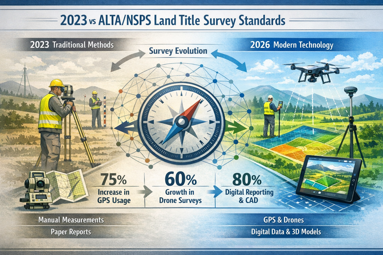
The landscape of land title surveying is about to undergo its most significant transformation in years. As the calendar approaches February 23, 2026, surveyors, title professionals, and real estate stakeholders face a critical deadline that will fundamentally reshape how land title surveys are conducted, documented, and certified across the United States. The newly adopted 2026 ALTA/NSPS Land Title Survey Standards represent more than routine updates—they embody a strategic shift toward enhanced clarity, transparency, and modern technological integration that will impact every survey commenced on or after this pivotal date.
Navigating the 2026 ALTA/NSPS Land Title Survey Standards: Key Changes and Compliance Essentials requires understanding not only what has changed but why these modifications matter for daily surveying practice. After more than three years of collaborative development by the Joint ALTA/NSPS Work Group, these standards introduce refined precision requirements, eliminate outdated documentation burdens, expand acceptance of aerial imagery, and establish new transparency mechanisms through enhanced encroachment reporting.[4] For surveying professionals, title insurers, lenders, and property developers, mastering these changes isn't optional—it's essential for compliance, risk management, and maintaining professional credibility in an increasingly complex regulatory environment.
Key Takeaways
✅ Mandatory Compliance Date: All land title surveys begun on or after February 23, 2026 must comply with the new standards, replacing 2021 requirements entirely.[1][3][4]
✅ Surveyor Responsibility Shift: The 2026 standards eliminate the requirement for title insurers to provide adjoining property deeds, placing documentation responsibility directly on surveyors.[2][4][5]
✅ Enhanced Transparency Tools: New Table A Item 20 provides a structured format for comprehensive encroachment reporting, replacing generalized notes with specific, transparent documentation.[1][2]
✅ Aerial Imagery Expansion: Standards now explicitly permit aerial or satellite imagery for certain survey features, requiring written client agreement and careful limitation review.[2][4][5]
✅ Clarified Documentation Standards: Revised language for possession evidence, monument documentation, and utility proximity requirements eliminates previous ambiguities and standardizes surveying practices.[4]
Understanding the 2026 ALTA/NSPS Standards: Timeline and Development Context
The February 2026 Effective Date and Transition Provisions
The February 23, 2026 effective date serves as the definitive compliance deadline for all surveying professionals conducting land title surveys.[1][3][4][5] This date represents the culmination of extensive collaborative work that began over three years ago, when the Joint ALTA/NSPS Work Group convened to address evolving industry needs, technological capabilities, and practical challenges identified in the 2021 standards.
Understanding the transition provisions is crucial for surveying firms managing projects that span this deadline. Surveys contracted before February 23, 2026, but completed after may operate under specific transition provisions, though the standards strongly encourage adoption of the new requirements regardless of contract date.[4] This flexibility acknowledges the realities of long-duration surveying projects while maintaining the integrity of the updated standards.
For professionals seeking comprehensive guidance on building regulation compliance testing, understanding how regulatory changes impact surveying standards provides essential context for broader compliance strategies.
The Development Process: Collaboration Between Surveyors and Title Professionals
The 2026 standards emerged from a uniquely collaborative process that distinguished this update from previous revisions. The Joint ALTA/NSPS Work Group, chaired by Todd D'Amico, PS of Oklahoma, comprised roughly equal numbers of professional surveyors and title insurance professionals who met semi-annually both in person and virtually.[4] This balanced composition ensured that the standards addressed practical concerns from both surveying and title insurance perspectives.
The committee officially adopted the standards in October 2025, providing a four-month implementation window before the mandatory compliance date.[4] This timeline allows surveying firms to:
- Update internal procedures and quality control protocols
- Train staff on new requirements and documentation standards
- Modify software and reporting templates
- Communicate changes to existing and prospective clients
- Revise engagement agreements and fee structures
The development timeline reflects a deliberate approach to standards modernization, balancing innovation with practical implementation considerations that respect the operational realities of surveying practices nationwide.
Core Strategic Objectives: Clarity, Accuracy, and Communication
The 2026 standards prioritize clearer documentation, enhanced transparency, improved communication between clients and surveyors, and refined precision requirements.[1] These strategic objectives respond directly to feedback from surveyors, title professionals, lenders, and property owners who identified ambiguities and practical challenges in previous standards.
Clarity manifests through revised language that eliminates previous interpretive uncertainties, particularly regarding possession evidence, monument documentation, and utility proximity requirements. Accuracy receives enhanced focus through refined Relative Positional Precision (RPP) definitions that align with contemporary measurement practices while remaining accessible to non-technical stakeholders. Communication improvements appear throughout the standards, from mandatory written agreements on aerial imagery use to structured encroachment reporting formats that facilitate transparent client understanding.
These strategic priorities reflect broader trends in professional surveying toward client-centered service delivery, risk transparency, and technological integration. For professionals exploring what measured surveys entail, these same principles of clarity and precision apply across surveying disciplines.
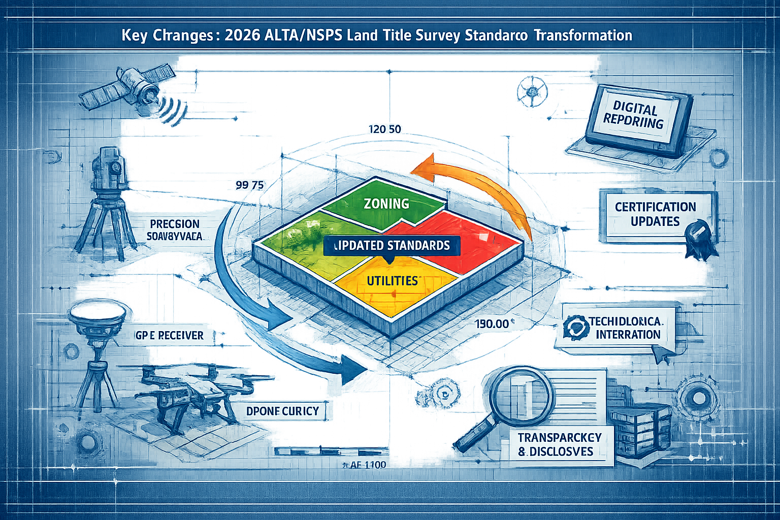
Key Changes in Navigating the 2026 ALTA/NSPS Land Title Survey Standards
Revised Relative Positional Precision (RPP) Definition
Among the most technically significant changes, the revised RPP definition continues aligning with accepted measurement practices while substantially clarifying explanations for stakeholders unfamiliar with statistical measurement concepts.[1] RPP represents a statistical measurement of how accurately surveyors locate property boundaries relative to one another, functioning as a critical quality metric for survey precision.
The 2026 definition maintains technical rigor while improving accessibility through:
- Simplified explanatory language that avoids unnecessary jargon
- Clearer relationship to practical boundary determination
- Enhanced transparency about measurement uncertainty
- Improved alignment with contemporary surveying technology capabilities
For surveyors, understanding RPP requirements remains essential for proper equipment selection, field methodology, and quality assurance procedures. The revised definition doesn't fundamentally alter technical requirements but does improve client understanding and reduce potential disputes arising from measurement uncertainty misunderstandings.
Elimination of Title Insurer Deed Requirements
Perhaps the most practically impactful change, the 2026 standards eliminated the requirement that title insurers provide copies of adjoining property deeds, shifting this documentation burden directly to surveyors.[2][4][5] This modification addresses a longstanding practical challenge identified by surveyors nationwide: in many markets, title insurers simply couldn't reliably provide adjoining property deeds within reasonable timeframes or at all.
The previous requirement created several problems:
📌 Delays in survey completion while waiting for deed documentation
📌 Inconsistent availability across different jurisdictions and title companies
📌 Unclear responsibility when deeds couldn't be obtained
📌 Increased project costs from extended timelines
By placing deed research responsibility directly on surveyors, the 2026 standards acknowledge surveying professionals' existing expertise in property research and eliminate an impractical intermediary step. Surveyors already possess the skills, resources, and access to conduct thorough deed research, making this responsibility shift both logical and efficient.
This change requires surveyors to:
✓ Develop or enhance deed research capabilities
✓ Budget appropriate time and resources for adjoining property research
✓ Establish reliable access to county recorder offices and online databases
✓ Incorporate deed research costs into fee structures
Enhanced Title Evidence Requirements
Complementing the deed requirement elimination, the 2026 standards now explicitly require that surveyors be provided a copy of the most recent title commitment or other title evidence satisfactory to the insurer, clearly stated in reformatted Section 4.[2][4] This clarification ensures surveyors receive essential title information while eliminating confusion about what constitutes adequate title evidence.
The reformatted Section 4 provides:
- Explicit language about title commitment requirements
- Clear timing expectations (most recent commitment)
- Flexibility for alternative title evidence when appropriate
- Improved coordination between surveyors and title professionals
This requirement ensures surveyors have access to critical information about easements, encumbrances, covenants, and restrictions that must appear on the final survey. Without proper title evidence, surveyors cannot adequately fulfill their documentation obligations or identify potential conflicts between physical conditions and recorded interests.
For professionals interested in broader property market legislation changes, these title evidence requirements reflect ongoing evolution in real estate documentation standards.
Refined Utility and Easement Documentation Standards
The 2026 standards introduce important refinements to utility and easement documentation proximity requirements. Evidence of utilities must now appear on and within five feet of the surveyed property, while utility poles remain on and within ten feet.[2] This represents a clarification of previous requirements and establishes clear, measurable standards for utility documentation scope.
Section 5.E.iv refinements address:
| Feature Type | Documentation Distance | Rationale |
|---|---|---|
| Underground utilities | On property + 5 feet | Immediate impact zone for excavation and development |
| Utility poles | On property + 10 feet | Greater visibility and structural clearance needs |
| Easements | As recorded | Legal documentation requirements |
| Overhead lines | On property + 10 feet | Safety and clearance considerations |
These refined proximity requirements provide surveyors with clear, defensible standards for determining which utilities require documentation. The distinction between general utilities (5 feet) and utility poles (10 feet) acknowledges practical differences in how these features impact property use and development.
Surveyors should note that these requirements establish minimum documentation standards—professional judgment may dictate documenting utilities beyond these distances when relevant to the survey's purpose or when requested by clients through Table A optional items.
Monument and Boundary Documentation Enhancement
Section 5.B.iii underwent significant revision to standardize language across the standards and eliminate a previously higher evidentiary burden. The 2026 standards replace the phrase "visible evidence" with "evidence observed in the process of conducting fieldwork".[4] This seemingly subtle language change carries substantial practical implications.
The previous "visible evidence" language created interpretive challenges:
❌ Did it require monuments to be currently visible, or evidence that they once existed?
❌ What constituted sufficient "visibility" in challenging field conditions?
❌ How should surveyors document monuments that were found but not readily visible?
The revised "evidence observed in the process of conducting fieldwork" language:
✅ Clarifies that surveyors document what they actually observe during fieldwork
✅ Eliminates ambiguity about visibility standards
✅ Aligns with professional surveying practice
✅ Provides clearer defensibility for documentation decisions
Additionally, Section 5.B.iii now explicitly requires that "vehicular access" must be specifically included in documentation.[4] This addition ensures surveys clearly indicate how properties can be accessed by vehicles, information critical for property development, emergency services, and property valuation.
Possession and Occupation Evidence Clarification
Among the most significant clarifications, Section 5.C.i now explicitly states "Regardless of proximity to perimeter boundary lines" when describing possession and occupation evidence requirements.[4] This language eliminates previous confusion that such evidence needed to appear only within five feet of property boundaries—a misinterpretation that contradicted the standards' original intent.
The clarification restores the comprehensive documentation scope originally intended:
🏠 All buildings and structures on the property, regardless of location
🚗 Parking areas, driveways, and paved surfaces throughout the property
🌳 Landscaping, fencing, and improvements anywhere on the surveyed parcel
📦 Storage facilities, sheds, and outbuildings in all locations
This "regardless of proximity" language prevents surveyors from inadvertently omitting significant improvements located in property interiors, away from boundary lines. For large parcels, this requirement ensures comprehensive documentation of all physical conditions that might affect property use, value, or title insurability.
The clarification particularly benefits:
- Commercial property surveys with extensive interior improvements
- Large residential parcels with multiple structures
- Industrial sites with widespread facilities
- Agricultural properties with distributed improvements
For professionals conducting construction and condition surveys, this comprehensive documentation approach aligns with thorough property assessment methodologies.
Technological Integration: Aerial Imagery and Modern Survey Methods
Expanded Acceptance of Aerial and Satellite Imagery
The 2026 standards embrace technological advancement through enhanced acceptance of aerial or satellite imagery as a basis for showing certain features on surveys.[2][4][5] This represents a significant modernization acknowledging that high-resolution imagery often provides accurate, cost-effective documentation for specific survey elements.
Table A Item 15 has been reverted to its original intent of permitting imagery rather than requiring ground surveying for certain features.[4] This reversion acknowledges that previous interpretations had inadvertently created overly restrictive requirements that didn't align with the item's purpose or with efficient surveying practice.
The imagery provisions allow surveyors to:
📸 Utilize current aerial photography for topographic features
🛰️ Incorporate satellite imagery for large-scale property contexts
🚁 Employ drone-captured imagery for comprehensive site documentation
🗺️ Integrate publicly available imagery when appropriate and accurate
However, the standards impose critical requirements to ensure imagery use maintains survey accuracy and reliability.
Mandatory Written Agreement on Imagery Utilization
Crucially, surveyors must now "agree with the client in writing on imagery to utilize" and carefully review limitations and recording requirements.[2][4][5] This written agreement requirement serves multiple purposes:
- Ensures client understanding of imagery sources and limitations
- Documents mutual agreement on acceptable imagery types and vintage
- Clarifies responsibility for imagery accuracy and currency
- Establishes expectations about ground-truthing requirements
- Provides legal protection for both surveyor and client
The written agreement should address:
✍️ Specific imagery sources (provider, date captured, resolution)
✍️ Intended uses (which survey features will rely on imagery)
✍️ Accuracy limitations (resolution constraints, seasonal factors)
✍️ Ground verification requirements (which features require field confirmation)
✍️ Update provisions (how outdated imagery will be addressed)
Limitations and Quality Control for Imagery-Based Surveys
While the 2026 standards expand imagery acceptance, surveyors must exercise professional judgment about appropriate applications and limitations. Imagery works well for:
✅ General topographic context and terrain visualization
✅ Large-scale property relationship documentation
✅ Preliminary site assessment and planning
✅ Verification of certain visible improvements
Imagery remains inappropriate for:
❌ Precise boundary determination and monumentation
❌ Subsurface utility location
❌ Detailed elevation measurements
❌ Legal boundary establishment
Surveyors should implement quality control procedures ensuring imagery-based documentation meets accuracy standards and doesn't compromise survey reliability. This includes verifying imagery currency, confirming resolution adequacy, and conducting selective ground-truthing to validate imagery accuracy.
For professionals exploring what measured building surveys involve, similar principles of technological integration balanced with professional verification apply across surveying specialties.
Enhanced Transparency: Table A Item 20 and Encroachment Reporting
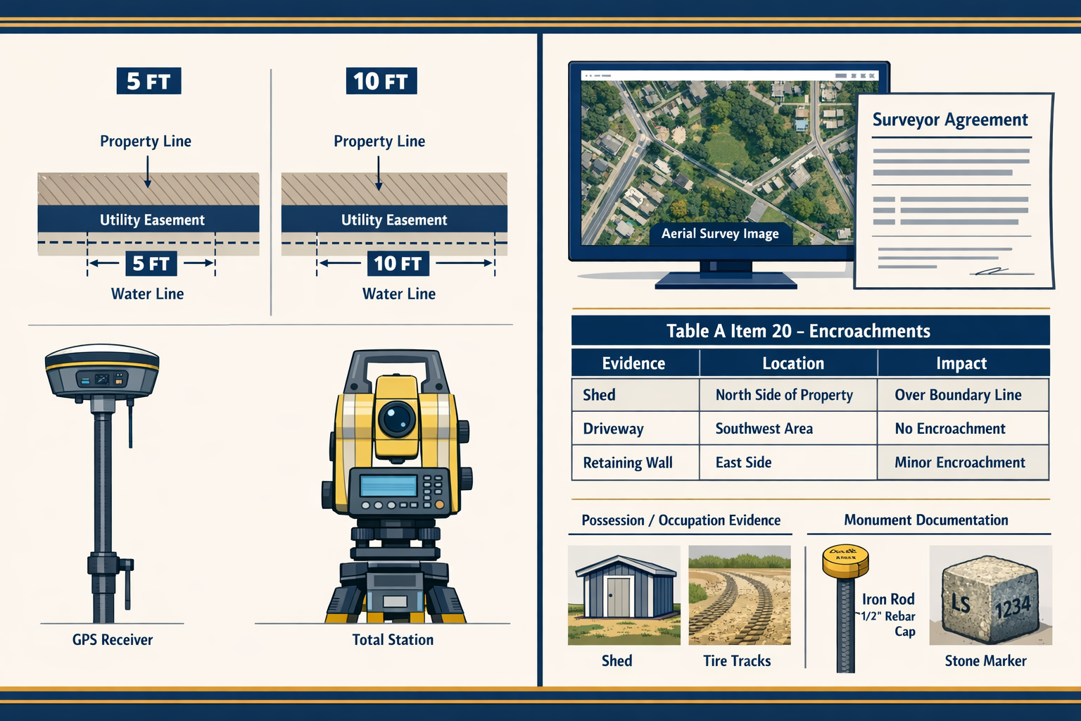
Introduction of Optional Table A Item 20
Among the most innovative additions, the 2026 standards introduce Optional Table A Item 20, which provides a dedicated table on the survey face for comprehensive encroachment reporting.[1][2] This structured format replaces generalized notes with specific, transparent documentation that clearly identifies:
- Observed evidence of potential encroachments
- Precise locations of concerning conditions
- Potential impacts on property use and title
- Survey references linking to detailed documentation
The table format promotes transparency by presenting potentially complex information in an accessible, structured manner that clients, lenders, and title professionals can readily understand and evaluate.
Structure and Content of Enhanced Encroachment Documentation
Table A Item 20 typically includes columns for:
| Item | Description | Location | Potential Impact | Survey Reference |
|---|---|---|---|---|
| 1 | Fence 0.3' onto adjacent parcel | Northwest corner | Possible boundary dispute | Detail A, Sheet 2 |
| 2 | Driveway extends 1.2' beyond easement | East property line | Easement violation | Station 12+45 |
| 3 | Building eave projects over setback | South elevation | Zoning non-compliance | Detail B, Sheet 3 |
This structured approach offers several advantages over traditional narrative notes:
🎯 Clarity: Each item receives dedicated documentation
🎯 Completeness: Standardized format ensures consistent coverage
🎯 Accessibility: Non-technical stakeholders can understand implications
🎯 Actionability: Clear identification facilitates resolution planning
Benefits for Stakeholders and Risk Management
The enhanced encroachment reporting benefits multiple stakeholders:
For Surveyors:
- Demonstrates thorough professional analysis
- Provides clear documentation of observed conditions
- Reduces liability through transparent disclosure
- Facilitates client communication about complex issues
For Title Insurers:
- Enables informed underwriting decisions
- Identifies potential title exceptions
- Supports risk assessment and pricing
- Reduces post-closing disputes
For Lenders:
- Clarifies collateral condition and value
- Identifies potential lending risks
- Supports informed loan decisions
- Facilitates borrower disclosure
For Property Owners:
- Provides clear understanding of property conditions
- Identifies issues requiring resolution before closing
- Supports negotiation with sellers
- Enables informed purchase decisions
This transparency-focused approach aligns with broader industry trends toward comprehensive disclosure and informed decision-making in real estate transactions.
Certification Updates: Successors and Assigns Provisions
Administrative Recording Requirements
The 2026 standards acknowledge that administrative rules in some jurisdictions may require plat or map recording, creating situations where survey certification needs to extend beyond the original client.[1][4] This practical recognition addresses real-world scenarios where:
- Lenders transfer loans to other institutions
- Title insurance policies are assigned
- Properties change hands shortly after survey completion
- Regulatory requirements mandate recorded plats
Certification Extension to Successors and Assigns
The standards now include an explicit allowance for certification of the plat or map to be extended to successors and assigns of the lender if requested.[1][4] This provision provides flexibility for lender transition scenarios while maintaining professional standards and surveyor accountability.
The certification extension:
📋 Must be explicitly requested (not automatically included)
📋 Applies specifically to lender successors and assigns
📋 Maintains surveyor professional responsibility
📋 Facilitates loan transfer and servicing transitions
Surveyors should clearly understand:
- When extension is appropriate (lender requests, regulatory requirements)
- How to properly document the extended certification
- Liability implications of certifying to successors
- Time limitations on certification validity
- Conditions under which certification should not be extended
This provision balances practical business needs with professional responsibility, ensuring surveys remain useful instruments while protecting surveyor liability exposure.
Practical Implementation: Navigating the 2026 ALTA/NSPS Land Title Survey Standards in Your Practice
Immediate Action Steps for Surveying Firms
As the February 23, 2026 deadline approaches, surveying firms should implement a systematic compliance strategy:
1. Comprehensive Staff Training 🎓
- Conduct detailed training sessions on all standard changes
- Develop internal reference materials and quick guides
- Assign responsibility for ongoing standards monitoring
- Create quality control checklists incorporating new requirements
2. Software and Template Updates 💻
- Modify survey templates to reflect new documentation requirements
- Update CAD standards and symbol libraries
- Revise report formats to include Table A Item 20 structure
- Implement aerial imagery agreement templates
3. Client Communication Protocols 📞
- Develop clear explanations of standard changes for clients
- Create FAQ documents addressing common questions
- Revise engagement letters to reflect new requirements
- Establish written agreement procedures for aerial imagery use
4. Fee Structure Review 💰
- Assess cost implications of new requirements (deed research, enhanced documentation)
- Revise fee schedules to reflect additional responsibilities
- Develop transparent pricing for optional Table A items
- Consider efficiency gains from aerial imagery acceptance
5. Vendor and Partner Coordination 🤝
- Communicate with title companies about title evidence requirements
- Establish deed research resources and procedures
- Coordinate with aerial imagery providers
- Update agreements with subconsultants and field crews
6. Quality Assurance Enhancement ✅
- Develop specific review procedures for new requirements
- Create compliance checklists for project managers
- Implement peer review for initial 2026-compliant surveys
- Establish feedback mechanisms for continuous improvement
7. Documentation and Record-Keeping 📁
- Maintain clear records of survey commencement dates
- Document compliance with transition provisions
- Preserve written agreements for aerial imagery use
- Archive training materials and staff certifications
For firms seeking comprehensive guidance on building inspection and survey methodologies, these systematic implementation approaches apply across surveying disciplines.
Common Pitfalls to Avoid
Surveyors should be particularly vigilant about these potential compliance challenges:
⚠️ Misunderstanding Effective Date Application
- Remember: surveys begun on or after February 23, 2026 require compliance
- Contract date alone doesn't determine applicable standards
- Fieldwork commencement triggers the requirement
⚠️ Inadequate Aerial Imagery Agreements
- Verbal agreements don't satisfy written agreement requirements
- Generic authorization insufficient—must specify imagery sources and uses
- Failing to document limitations creates liability exposure
⚠️ Incomplete Possession Evidence Documentation
- "Regardless of proximity" means exactly that—all improvements everywhere
- Don't limit documentation to boundary-adjacent features
- Interior improvements require the same thorough documentation
⚠️ Overlooking Utility Proximity Distinctions
- Five feet for general utilities, ten feet for utility poles
- Different distances serve different purposes—don't conflate them
- Professional judgment may require documentation beyond minimums
⚠️ Insufficient Deed Research Capabilities
- Title insurers no longer provide adjoining deeds—surveyors must obtain them
- Budget adequate time and resources for thorough research
- Establish reliable access to recording offices and databases
⚠️ Neglecting Table A Item 20 Structure
- When requested, use the structured table format—not narrative notes
- Include all required columns: description, location, impact, reference
- Maintain consistency across all documented items
Continuing Education and Professional Development
The 2026 standards emphasize the ongoing importance of professional development in surveying practice. Surveyors should:
📚 Attend standards-focused seminars and webinars
📚 Participate in professional association training programs
📚 Review official ALTA/NSPS guidance documents and FAQs
📚 Engage with peer discussions about implementation challenges
📚 Monitor developments and interpretive guidance
Professional organizations including ALTA (American Land Title Association) and NSPS (National Society of Professional Surveyors) offer valuable resources, training materials, and networking opportunities supporting successful standards implementation.
For professionals exploring various types of building surveys, this commitment to continuing education and professional development represents a universal principle across surveying specialties.
Industry Impact and Stakeholder Perspectives
Benefits for Title Insurance Professionals
Title insurance professionals gain significant advantages from the 2026 standards:
✨ Enhanced Risk Assessment: Table A Item 20's structured encroachment reporting provides clearer information for underwriting decisions
✨ Reduced Ambiguity: Clarified documentation requirements minimize interpretive disputes
✨ Improved Efficiency: Eliminating deed provision requirements streamlines workflows
✨ Better Communication: Standardized formats facilitate clearer surveyor-insurer coordination
The standards' emphasis on transparency and clarity directly supports title insurers' core mission of identifying and managing title risks before policy issuance.
Advantages for Lenders and Financial Institutions
Lenders benefit from improvements that enhance collateral assessment and risk management:
🏦 Clearer Collateral Evaluation: Comprehensive documentation supports accurate property valuation
🏦 Risk Transparency: Enhanced encroachment reporting identifies potential issues affecting collateral value
🏦 Successor Certification: Flexibility for loan transfer scenarios reduces administrative burdens
🏦 Standardization: Consistent documentation across jurisdictions facilitates portfolio management
These benefits contribute to more informed lending decisions and reduced post-closing disputes that can impact loan performance.
Value for Property Owners and Developers
Property owners and developers gain practical advantages from the updated standards:
🏗️ Comprehensive Property Understanding: "Regardless of proximity" documentation provides complete property condition information
🏗️ Development Planning: Accurate utility and easement documentation supports informed development decisions
🏗️ Risk Identification: Enhanced encroachment reporting reveals potential issues before purchase
🏗️ Cost Efficiency: Aerial imagery acceptance can reduce survey costs for appropriate applications
The standards' client-focused improvements facilitate more informed real estate decisions and reduce post-purchase surprises.
Professional Surveying Community Perspectives
For the surveying profession, the 2026 standards represent both opportunities and challenges:
Opportunities:
- Technological integration (aerial imagery) modernizes practice
- Clarified requirements reduce interpretive disputes
- Enhanced transparency demonstrates professional value
- Standardization supports consistent quality across the profession
Challenges:
- Additional responsibilities (deed research) require resource allocation
- Training and implementation require time and investment
- Written agreement requirements increase administrative burden
- Enhanced documentation standards demand greater attention to detail
Overall, the surveying community views the 2026 standards as a positive evolution that balances modernization with professional rigor, supporting the profession's continued relevance in an evolving real estate landscape.
Future Outlook: Evolution of Land Title Survey Standards
Anticipated Trends in Survey Technology
The 2026 standards' embrace of aerial imagery signals broader technological integration trends likely to continue:
🚀 Advanced Remote Sensing: LiDAR, photogrammetry, and other technologies will increasingly supplement traditional surveying
🚀 Artificial Intelligence: AI-assisted feature recognition and documentation may streamline survey production
🚀 Real-Time Data Integration: Cloud-based platforms enabling immediate data sharing and collaboration
🚀 Mobile Technology: Enhanced field data collection through sophisticated mobile devices and applications
Future standards revisions will likely continue balancing technological innovation with professional judgment requirements and accuracy standards.
Regulatory and Market Drivers
Several factors will influence future standards evolution:
- Climate Change Impacts: Increased focus on flood zones, environmental risks, and sustainability considerations
- Urbanization Pressures: Growing complexity in dense urban environments requiring enhanced documentation
- Cybersecurity Concerns: Digital data protection and survey information security requirements
- Cross-Border Transactions: Harmonization pressures from international real estate investment
- Consumer Protection: Enhanced disclosure requirements driven by regulatory and market demands
Ongoing Collaboration Between Surveyors and Title Professionals
The successful collaborative development process for the 2026 standards establishes a model for future updates. The Joint ALTA/NSPS Work Group's balanced composition and systematic approach demonstrates the value of multi-stakeholder engagement in standards development.
Future revisions will likely continue this collaborative approach, ensuring standards remain:
- Practically implementable for surveying professionals
- Relevant to title insurance underwriting needs
- Responsive to lender requirements and concerns
- Valuable for property owners and real estate professionals
- Aligned with technological capabilities and limitations
This ongoing dialogue between surveyors and title professionals supports standards that serve all stakeholders while maintaining professional rigor and public protection.
Conclusion: Embracing Change and Ensuring Compliance
Navigating the 2026 ALTA/NSPS Land Title Survey Standards: Key Changes and Compliance Essentials represents more than a regulatory compliance exercise—it's an opportunity for surveying professionals to demonstrate adaptability, embrace technological advancement, and enhance the value they provide to clients and stakeholders. The February 23, 2026 effective date rapidly approaches, making immediate action essential for firms committed to seamless compliance and continued professional excellence.
The standards' core improvements—refined precision definitions, eliminated impractical requirements, expanded aerial imagery acceptance, enhanced transparency mechanisms, and clarified documentation standards—collectively advance the surveying profession toward greater clarity, efficiency, and client service. While implementation requires investment in training, software updates, and procedural modifications, these changes ultimately strengthen professional practice and reduce ambiguity that has historically generated disputes and inefficiencies.
Your Action Plan for Successful Implementation
To ensure successful compliance with the 2026 standards, surveying firms should:
Immediate Actions (Before February 23, 2026):
- ✅ Complete comprehensive staff training on all standard changes
- ✅ Update all survey templates, software, and documentation systems
- ✅ Establish deed research capabilities and resources
- ✅ Develop aerial imagery agreement templates and procedures
- ✅ Revise engagement letters and fee structures
- ✅ Create quality control checklists incorporating new requirements
Ongoing Commitments:
- 🔄 Monitor ALTA/NSPS guidance and interpretive resources
- 🔄 Participate in professional development and continuing education
- 🔄 Maintain open communication with title insurance partners
- 🔄 Regularly review and refine implementation procedures
- 🔄 Share lessons learned within the professional community
- 🔄 Stay informed about technological developments and best practices
The Path Forward
The 2026 ALTA/NSPS Land Title Survey Standards represent a thoughtful evolution of professional practice, balancing tradition with innovation, precision with practicality, and professional judgment with standardization. For surveying professionals committed to excellence, these standards provide a clear framework for delivering value, managing risk, and maintaining the profession's essential role in real estate transactions.
Success requires more than passive compliance—it demands active engagement with the standards' underlying principles, thoughtful implementation of new requirements, and ongoing commitment to professional development. Firms that embrace these changes as opportunities rather than burdens will position themselves for continued success in an evolving marketplace.
The surveying profession's collaborative development of these standards demonstrates the value of multi-stakeholder engagement and the profession's commitment to continuous improvement. As the February 23, 2026 deadline approaches, the surveying community stands ready to implement these enhanced standards, ensuring land title surveys continue serving their critical function in protecting property rights, facilitating real estate transactions, and supporting economic development across the United States.
For additional guidance on comprehensive property assessment methodologies, explore our resources on building survey levels and professional surveying services. The principles of thorough documentation, professional rigor, and client-focused service that underpin the 2026 ALTA/NSPS standards apply across all surveying disciplines, supporting excellence in property assessment and real estate decision-making.
References
[1] New 2026 Minimum Standard Detail Requirements For Land Title Surveys – https://www.harrisbeachmurtha.com/insights/new-2026-minimum-standard-detail-requirements-for-land-title-surveys/
[2] Five Key Updates 2026 Altansps Land Title Survey Standards – https://westwoodps.com/recent-blog-posts/five-key-updates-2026-altansps-land-title-survey-standards
[3] 20260126 Alta Insights Understanding The 2026 Altansps Land Title Survey Standards – https://www.alta.org/news-and-publications/news/20260126-ALTA-Insights-Understanding-the-2026-ALTANSPS-Land-Title-Survey-Standards
[4] The 2026 Minimum Standard Detail Requirements For Alta Nsps Land Title Surveys – https://amerisurv.com/2026/02/01/the-2026-minimum-standard-detail-requirements-for-alta-nsps-land-title-surveys/
[5] Nsps Land Title – https://www.parkerpoe.com/news/2026/02/key-takeaways-from-the-2026-alta/nsps-land-title