

Boundary disputes in England and Wales now take an average of 18 months to resolve through litigation — and that figure climbs sharply when physical evidence is contested. Integrating drone surveys in boundary expert witness reports: RICS compliance for 2026 Land Registry challenges is no longer an emerging practice; it is rapidly becoming the expected standard for surveyors who want their evidence to stand up to judicial scrutiny. With RICS having introduced its global AI standard effective March 2026 and its Boundaries professional standard firmly in place, the technical and procedural bar for expert witness work has never been higher [1][3].
Key Takeaways
- Drone surveys using RTK GPS can achieve orthomosaic accuracy of ±2cm, making them highly reliable for boundary evidence
- RICS-compliant expert witness reports must document equipment calibration, ground control points, and an unbroken chain of custody for all drone data
- UK Civil Aviation Authority (CAA) regulations must be satisfied before any drone survey data can be considered admissible
- The RICS Boundaries professional standard (reissued October 2022) and the 2026 AI standard together define the compliance framework for modern boundary reports
- Drone data integrated correctly into expert witness reports can significantly reduce dispute resolution timelines and litigation costs
Why Drone Technology Is Reshaping Boundary Evidence
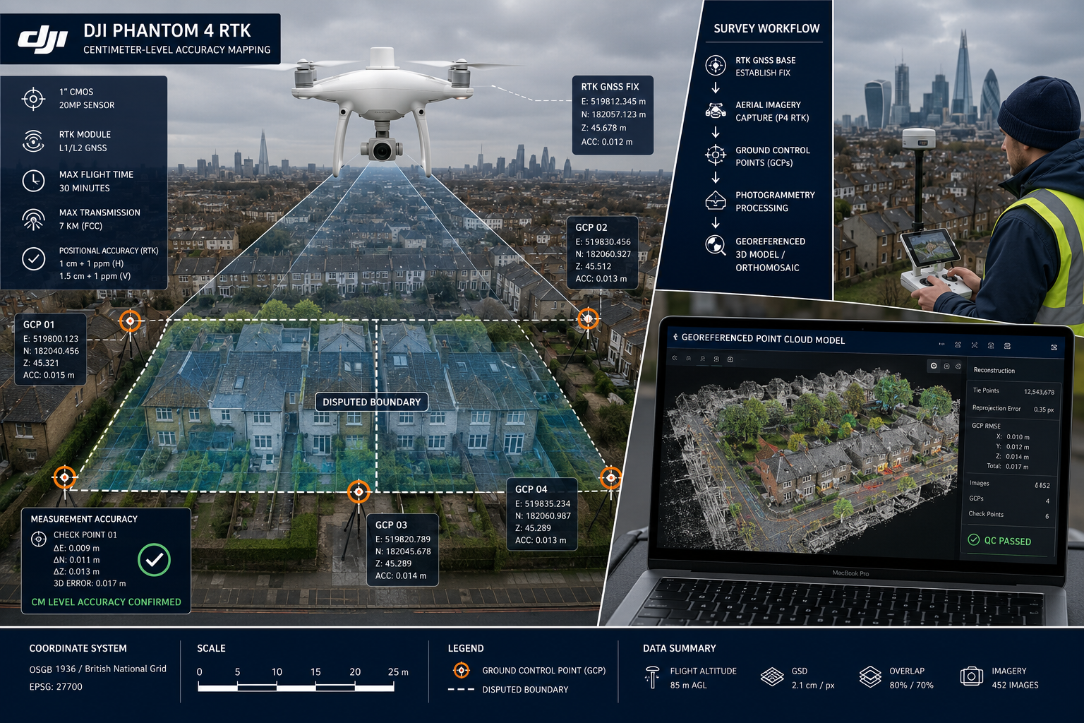
Traditional boundary surveys relied on tape measures, theodolites, and manual sketches — methods that introduce human error and are difficult to defend under cross-examination. The shift toward Unmanned Aerial Vehicle (UAV) surveys has been driven by a single, compelling advantage: centimeter-level accuracy that is independently verifiable.
Modern drones equipped with Real-Time Kinematic (RTK) GPS can produce orthomosaic maps accurate to ±2cm, and 3D point cloud models that give measurable, three-dimensional representations of every boundary feature — fences, walls, hedges, and encroachments alike [2]. For a boundary survey in London involving a disputed garden wall or a misaligned fence line, this level of precision is transformative.
Key advantages of drone surveys for boundary evidence:
| Feature | Traditional Survey | Drone (RTK/PPK) Survey |
|---|---|---|
| Positional accuracy | ±50–100mm | ±20mm or better |
| Area coverage speed | Hours per hectare | Minutes per hectare |
| Vegetation penetration | Limited | LiDAR capable |
| Reproducibility | Moderate | High (georeferenced) |
| Court admissibility | Established | Conditional on compliance |
The adoption of UAV surveys in boundary dispute evidence has become mainstream over the past three years, with courts increasingly expecting georeferenced aerial imagery as part of a robust expert witness submission [2]. However, technical capability alone does not guarantee admissibility. The data must be gathered, processed, and presented within a strict compliance framework.
RICS Standards Governing Expert Witness Reports in 2026
Understanding the regulatory landscape is essential before any drone is launched over a disputed boundary. Two RICS frameworks are directly relevant to integrating drone surveys in boundary expert witness reports for 2026 Land Registry challenges.
The RICS Boundaries Professional Standard
RICS published "Boundaries: procedures for boundary identification, demarcation and dispute resolution" — a professional standard reissued in October 2022 — which remains the primary guidance document for boundary surveyors in 2026 [3]. This standard emphasizes:
- Accurate identification of the legal boundary versus the physical boundary
- Clear, comprehensible presentation of evidence to minimize misunderstandings
- Structured dispute resolution pathways, including the RICS Boundary Disputes Mediation Service (BDMS), launched in collaboration with the Property Litigation Association and endorsed by the Civil Justice Council [3]
For surveyors preparing expert witness reports, this standard is not optional guidance — it is a professional obligation. Departing from it without documented justification exposes the surveyor to disciplinary risk and weakens the evidential weight of the report.
The 2026 RICS AI Standard
Effective from 9 March 2026, RICS introduced a global professional standard for the responsible use of artificial intelligence in surveying [1]. This is directly relevant to drone surveys because photogrammetry software — the tool that converts raw drone imagery into orthomosaic maps and point clouds — increasingly incorporates AI-driven processing algorithms.
The standard mandates:
- Clear policies on data use — how drone imagery is stored, processed, and shared
- AI system governance — documentation of the software version and algorithm settings used
- Risk documentation — identification of potential processing errors and how they were mitigated [1][6]
Surveyors who use AI-assisted photogrammetry tools without documenting these elements risk having their data challenged as non-compliant. The RICS AI standard is not a future consideration — it is a current obligation for any expert witness report filed in 2026 or beyond.
Expert Witness Duties Under RICS
RICS members offering expert witness services carry significant responsibilities: competence, independence, and full awareness of the complexities involved, including the possibility of cross-examination in court [4]. An expert witness's primary duty is to the court, not to the instructing party. Drone data, however impressive technically, must be presented with objectivity and without advocacy.
Surveyors should also be familiar with the comprehensive guide to boundary dispute and party wall surveyors in London to understand how expert witness work intersects with party wall matters — a common overlap in urban boundary disputes.
Building a RICS-Compliant Drone Survey Workflow
The practical workflow for integrating drone surveys into boundary expert witness reports has several non-negotiable stages. Each stage generates documentation that forms part of the evidential chain.
Stage 1: Equipment Selection and Pre-Flight Documentation
For RICS-compliant boundary surveys in 2026, drone specifications should meet the following minimum requirements [5]:
- RTK/PPK GPS capability for centimeter-level positioning without reliance on post-processing corrections alone
- LiDAR sensors where dense tree canopies or vegetation may obscure boundary features
- High-resolution RGB cameras (minimum 20MP) for orthomosaic production
- Automated flight logging with timestamped records of every flight path
- Encrypted data storage to support chain of custody requirements
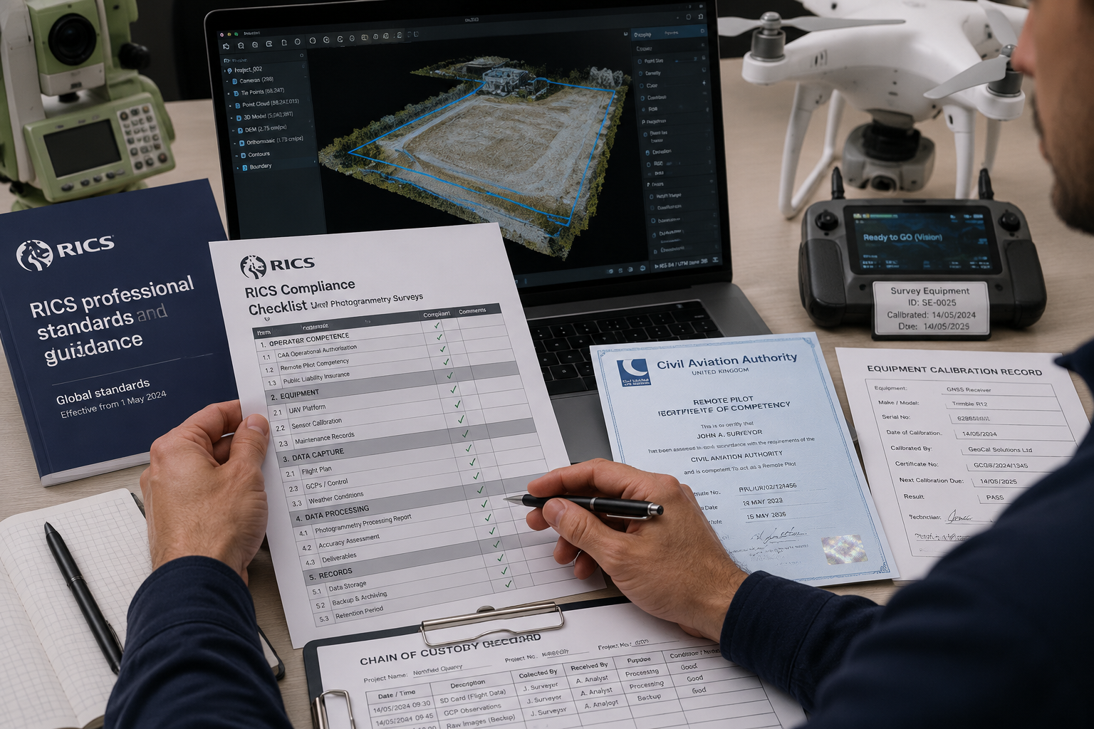
Equipment calibration records must be current and included in the appendices of the expert witness report. A drone that has not been calibrated within the manufacturer's recommended interval introduces a source of error that opposing counsel will exploit.
Stage 2: Ground Control Points and Georeferencing
Ground control points (GCPs) are physical markers placed at known coordinates across the survey area before the drone flight. They serve as reference anchors that validate the accuracy of the resulting orthomosaic map [2].
Best practice for GCPs in boundary surveys:
- Use a minimum of five GCPs distributed across the survey area
- Establish GCP coordinates using a total station or GNSS receiver with known accuracy
- Photograph each GCP in situ before and after the drone flight
- Record GCP coordinates in the report alongside the resulting positional error statistics
Without documented GCPs, a drone survey's accuracy claims are unverifiable. Courts and opposing experts will treat unverified accuracy claims with skepticism.
Stage 3: CAA Regulatory Compliance
All commercial drone operations in the UK must comply with Civil Aviation Authority regulations. For boundary survey work, this typically requires:
- A valid CAA Operational Authorisation (or compliance with the Open Category A2 rules for lighter drones)
- Pre-flight airspace checks using NATS or equivalent services
- Notification to relevant parties where flights occur near congested areas
Failure to demonstrate CAA compliance is a straightforward ground for challenging the admissibility of drone evidence [2]. The CAA authorisation documentation should be appended to every expert witness report that includes drone survey data.
Stage 4: Data Processing and Chain of Custody
Photogrammetry software converts raw drone imagery into the deliverables used in court: orthomosaic maps, digital elevation models, and 3D point clouds. The report must clearly state [2][5]:
- The software name and version number
- The processing parameters applied
- The resulting accuracy statistics (root mean square error at GCPs)
- Who processed the data and when
An unbroken chain of custody — from raw image files through to the final deliverables — must be documented. Raw files should be retained in their original, unedited state and stored securely. Any editing or enhancement of imagery must be disclosed and justified.
Presenting Drone Evidence in the Expert Witness Report
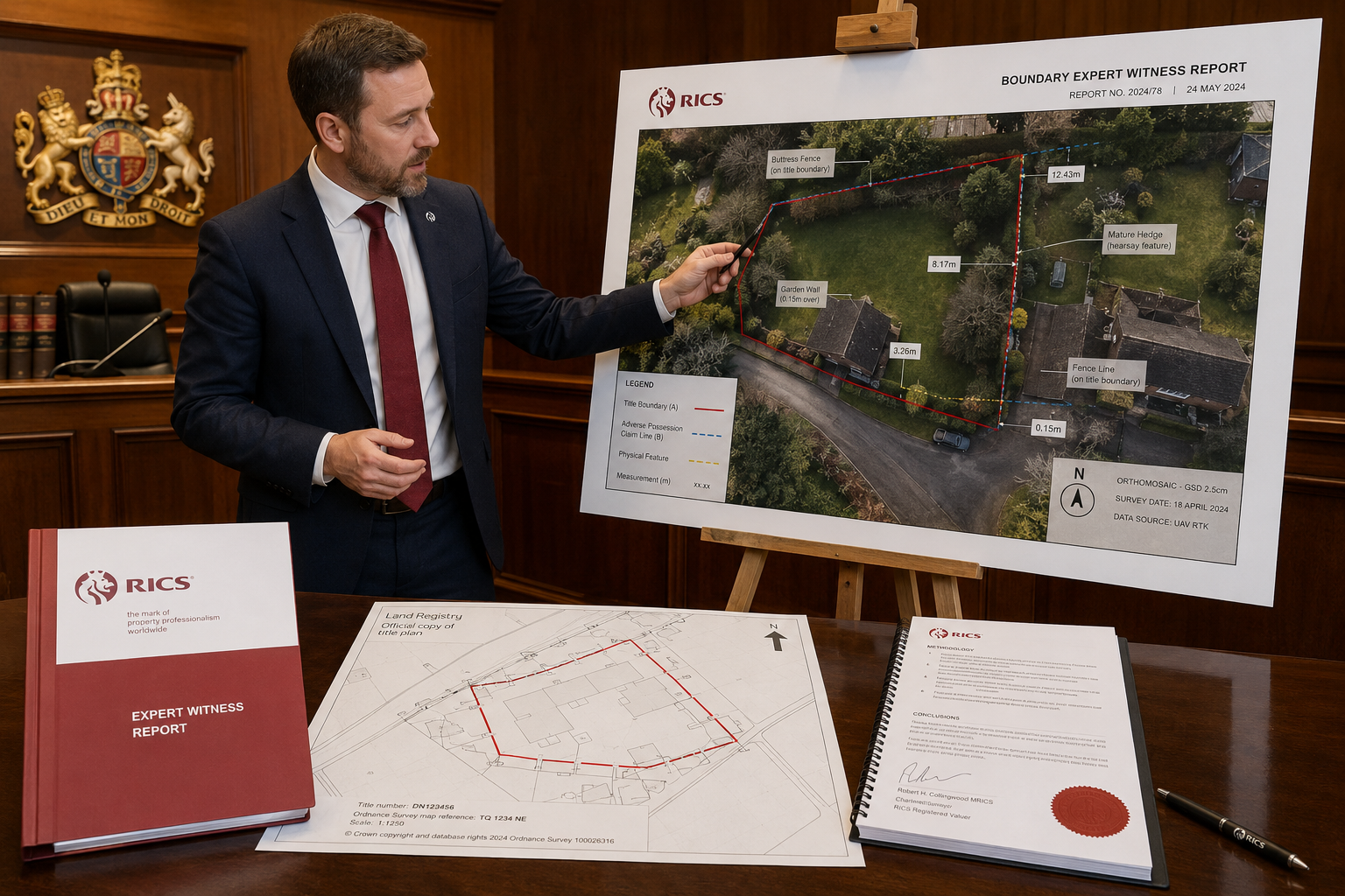
A technically excellent drone survey can still fail in court if the expert witness report does not present the data clearly and compliantly. The following structure is recommended for the drone evidence section of any RICS-compliant boundary expert witness report.
Recommended report structure for drone evidence:
- Survey methodology statement — equipment used, flight date, weather conditions, CAA compliance confirmation
- GCP data table — coordinates, accuracy statistics, and photographs
- Orthomosaic map — georeferenced, scaled, with boundary features annotated
- Point cloud extracts — where relevant to contested features (wall heights, encroachment distances)
- Accuracy statement — confirmed positional accuracy with supporting statistics
- Limitations section — any areas where canopy obstruction, weather, or flight restrictions affected data quality
- Software and AI disclosure — in line with the 2026 RICS AI standard [1][6]
"The expert's duty is to provide independent, objective evidence to assist the court — not to act as an advocate for the instructing party. Drone data must be presented with the same objectivity as any other form of survey evidence." [4]
The limitations section deserves particular attention. Dense tree coverage can obstruct LiDAR returns, adverse weather affects image quality, and CAA flight restrictions may prevent coverage of certain areas [2]. Acknowledging these limitations proactively strengthens the report's credibility; concealing them invites damaging cross-examination.
Surveyors handling urban disputes should also consider whether a drone roof survey might supplement boundary evidence — for example, where a disputed structure encroaches on a neighbouring property's airspace or affects shared roof elements.
Integrating Drone Surveys in Boundary Expert Witness Reports: RICS Compliance for 2026 Land Registry Challenges in Practice
Land Registry challenges in 2026 increasingly involve complex urban plots where historical title plans — often based on Ordnance Survey maps with a nominal accuracy of ±1 metre — fail to resolve disputes at the centimetre level. Drone surveys bridge this gap with precision that Land Registry adjudicators and First-tier Tribunal judges can rely upon.
Common Scenarios Where Drone Evidence Is Decisive
Encroachment disputes: A drone orthomosaic can measure the exact distance an extension, fence, or wall encroaches beyond the paper boundary, with accuracy that withstands cross-examination.
Adverse possession claims: Historical aerial imagery combined with current drone surveys can demonstrate continuous occupation of land over the required period, supporting or rebutting adverse possession arguments.
Boundary feature identification: Where a boundary runs along a hedge, ditch, or natural feature, a 3D point cloud model can establish the precise centreline of the feature — a question that traditional surveys often cannot answer definitively.
Party wall and boundary overlap: Where a boundary dispute intersects with party wall matters, drone evidence can clarify the exact position of shared structures. Surveyors involved in such cases should be aware of the implications of neighbour boundary wall works and how drone evidence supports the schedule of condition process.
Avoiding the Most Common Compliance Failures
Based on current RICS guidance and emerging case law, the most frequent compliance failures in drone-based boundary reports are:
- Missing or inadequate GCP documentation
- No CAA compliance evidence appended
- Photogrammetry software not identified or version number absent
- Accuracy statistics not reported or not explained in plain language
- Limitations section absent or superficial
- AI processing tools used but not disclosed under the 2026 RICS AI standard [1][5]
Surveyors who commission drone surveys from third-party operators must ensure they receive all underlying documentation — not just the finished map. The expert witness remains responsible for the completeness and accuracy of the report regardless of who conducted the flight.
For surveyors seeking broader context on the range of professional reports available in complex property matters, the chartered surveyors London resource provides a useful overview of service types and professional obligations.
The Role of Mediation Alongside Expert Evidence
Not every boundary dispute needs to reach the First-tier Tribunal or the courts. The RICS Boundary Disputes Mediation Service offers a faster, less expensive alternative, and a well-prepared drone survey report can facilitate mediation just as effectively as it supports litigation [3]. Presenting objective, georeferenced evidence at an early stage often prompts parties to reach agreement without the cost and delay of a full hearing.
Surveyors should also be aware that where a specific defect related to a boundary structure — such as a failing retaining wall or a subsiding boundary feature — is part of the dispute, supplementary structural evidence may be needed alongside the drone survey data.
Conclusion
Integrating drone surveys in boundary expert witness reports: RICS compliance for 2026 Land Registry challenges requires surveyors to combine technical precision with rigorous procedural discipline. The technology is available and proven; the compliance framework is clearly defined. What determines whether drone evidence advances or undermines a case is the quality of the workflow behind it.
Actionable next steps for surveyors and legal teams:
- Audit current equipment against the 2026 RICS-recommended drone specifications, including RTK/PPK GPS and encrypted data storage
- Review AI disclosure obligations under the RICS global AI standard effective March 2026 and update report templates accordingly
- Establish a GCP protocol for every boundary survey, with minimum five control points and documented accuracy statistics
- Append all compliance documentation — CAA authorisation, calibration records, and chain of custody logs — to every expert witness report
- Consider mediation early using drone evidence as a neutral, objective foundation for settlement discussions
- Engage a RICS-regulated chartered surveyor with demonstrable experience in both drone survey operations and expert witness work for any dispute heading toward the First-tier Tribunal
The convergence of UAV technology, RICS professional standards, and Land Registry adjudication processes in 2026 creates both an obligation and an opportunity. Surveyors who master this integration will produce reports that resolve disputes faster, at lower cost, and with greater authority than any traditional survey method can achieve.
References
[1] Rics Launches Landmark Global Standard On Responsible Use Of Ai In Surveying – rics.org
[2] Expert Witness Valuations In Neighbour Boundary Disputes Rics Standards And Drone Survey Integration For 2026 Cases – wimbledonsurveyors.com
[3] Boundaries Procedures For Boundary Identification Demarcation And Dispute Resolution Rics Guidance Note 4th Edition – rics.org
[4] Expert Witness Duties Responsibilities – ww3.rics.org
[5] Drones In Boundary Dispute Surveys Rics Evidence Standards For Expert Witness Site Documentation 2026 – nottinghillsurveyors.com
[6] Responsible Use Of Ai – rics.org
[7] Land Standards – rics.org
How Prince Surveyors can help: explore our expert witness surveyors or learn about our RICS valuations.