

Last updated: July 24, 2026
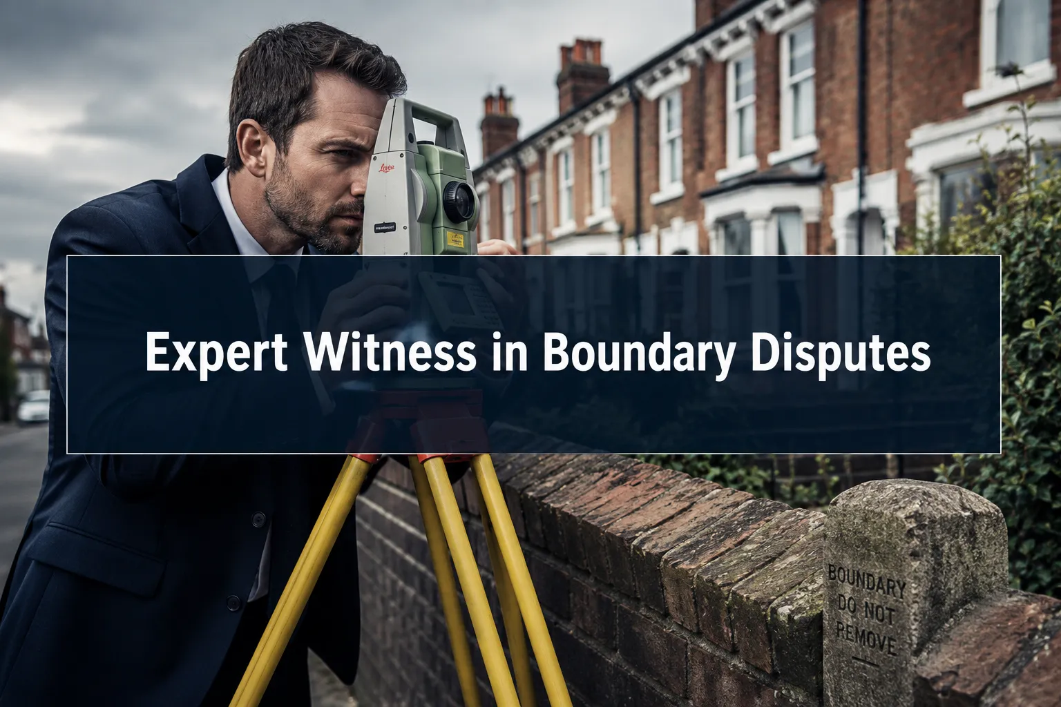
Quick Answer: In 2026, an expert witness in a boundary dispute is a qualified chartered surveyor who prepares a Civil Procedure Rules (CPR) Part 35-compliant report that courts, mediators, and solicitors can rely upon. RICS digital reporting standards now require that evidence be supported by georeferenced data, drone surveys, and 3D models, raising the bar for what counts as credible boundary evidence in England and Wales.
Key Takeaways
- An expert witness in a boundary dispute must hold relevant RICS qualifications and owe their primary duty to the court, not the client who instructed them.
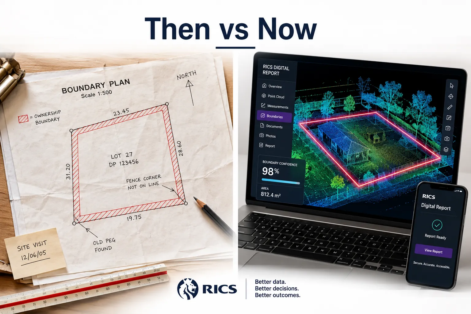
- RICS digital reporting standards in 2026 require georeferenced measurements, structured data outputs, and audit-ready documentation, going well beyond traditional hand-drawn plans.
- Drone surveys and 3D point-cloud models are now admissible as expert evidence when properly certified and tied to a CPR Part 35 report.
- The cost of an expert witness boundary report in the UK typically ranges from approximately £1,500 to £5,000 or more, depending on complexity and whether court attendance is required.
- A surveyor who measures a boundary and an expert witness who gives evidence about it are not always the same person, understanding the distinction matters.
- Common expert witness mistakes include failing to declare limitations, overstating certainty, and producing reports that do not comply with CPR Part 35.
- Most straightforward neighbour boundary disputes can be resolved without court, but an expert witness report strengthens any negotiation or mediation position significantly.
- Digital 3D models complement traditional surveys but do not replace the legal analysis and professional opinion that only a qualified expert witness can provide.
What Is an Expert Witness in Boundary Disputes?
An expert witness in a boundary dispute is a suitably qualified professional, almost always a chartered surveyor, appointed to provide independent, impartial opinion evidence to assist a court or tribunal in resolving a disagreement about where a legal boundary lies. Their duty runs to the court first, not to the party that pays their fee.
In practice, this means the expert witness:
- Reviews title deeds, Land Registry plans, historic OS maps, and physical site evidence
- Prepares a written report compliant with Civil Procedure Rules Part 35 (CPR 35)
- States clearly the limits of their expertise and the assumptions underpinning their conclusions
- May attend court hearings or First-tier Tribunal (Property Chamber) proceedings to give oral evidence
In 2026, expert witness roles in boundary disputes have expanded to include the interpretation of digital datasets, drone-captured imagery, LiDAR point clouds, and georeferenced measured surveys, alongside traditional documentary evidence.
For homeowners or landlords facing a contested boundary, commissioning a professional expert witness report early in the process can prevent a dispute from escalating to costly litigation.
What Is the Difference Between a Surveyor and an Expert Witness?
A surveyor measures and records; an expert witness interprets that evidence and gives a professional opinion that a court can act upon. The two roles are related but legally distinct.
| Role | Primary Function | Duty Owed To | CPR 35 Required? |
|---|---|---|---|
| Boundary Surveyor | Measures and maps the boundary | Client | No |
| Expert Witness | Gives independent opinion evidence | The Court | Yes |
| Single Joint Expert | Agreed by both parties | The Court | Yes |
| Party-Appointed Expert | Instructed by one side | The Court (not the client) | Yes |
A surveyor can produce a measured survey that an expert witness then relies upon as source data. In many cases, the same chartered surveyor performs both functions, but they must keep the roles conceptually separate in their report.
Common mistake: Some homeowners assume their regular surveyor's report is automatically expert witness evidence. It is not, unless it is structured to meet CPR Part 35 requirements and includes the mandatory expert's declaration.
What Qualifications Do Expert Witnesses Need for Property Disputes?
Expert witnesses in UK property boundary disputes should hold MRICS or FRICS status with the Royal Institution of Chartered Surveyors and have demonstrable experience in boundary surveying and dispute resolution. Courts expect a clear statement of qualifications in every report.
Additional qualifications that strengthen credibility include:
- Membership of the Expert Witness Institute (EWI) or the Academy of Experts
- Completion of CPD training in expert witness practice and CPR 35 compliance
- Experience giving evidence at the First-tier Tribunal (Property Chamber) or County Court
- Specialist knowledge of Land Registration Act 2002 provisions and adverse possession rules
In 2026, RICS also expects members producing digital evidence to demonstrate competence in the specific technology used, whether that is drone photogrammetry, total station surveys, or 3D scanning. An expert who cannot explain the methodology behind their digital data in cross-examination will lose credibility quickly.
How Do RICS Digital Reporting Standards Work in 2026?
RICS digital reporting standards require that boundary surveys submitted as expert evidence in 2026 include georeferenced, structured, and auditable data, not just a PDF plan. The standards aim to make survey evidence reproducible, comparable, and transparent.
Key requirements under current RICS guidance include:
- Georeferencing: All measured points must be tied to a recognised coordinate system (typically OSGB36 or ETRS89) so that another surveyor can independently verify the measurements.
- Metadata and audit trails: Digital files must carry timestamps, instrument calibration records, and operator details.
- Structured outputs: Reports should include machine-readable data alongside the narrative, enabling solicitors and courts to interrogate the underlying measurements.
- Methodology statements: The expert must explain which instruments were used, their stated accuracy, and how measurements were quality-checked.
These standards directly support the role of expert witness roles in 2026 boundary disputes by making evidence harder to challenge on technical grounds. A report backed by a georeferenced point-cloud dataset and a certified drone survey is substantially more persuasive than one based solely on a tape measure and a sketch.
For context on how building surveys more broadly have evolved under RICS standards, the RICS building survey guide for home buyers provides useful background on what RICS-compliant reporting looks like in practice.
Can Drone Surveys Be Used as Expert Witness Evidence?
Yes, drone surveys are admissible as expert witness evidence in boundary disputes, provided they are collected, processed, and presented in accordance with RICS digital reporting standards and referenced within a CPR Part 35-compliant report.
For drone evidence to hold up in court or at the First-tier Tribunal, the expert witness must demonstrate:
- The drone operator held a valid CAA operational authorisation for the survey area.
- Ground control points (GCPs) were used to achieve sub-10cm positional accuracy.
- The photogrammetric or LiDAR processing methodology is clearly documented.
- The resulting orthomosaic or point cloud is georeferenced and can be independently verified.
- The expert can explain and defend the methodology under cross-examination.
Drone surveys are particularly valuable in disputes involving large plots, overgrown boundaries, or cases where physical access is contested. They produce a time-stamped, objective record of the boundary features as they existed on a specific date, which can be decisive when one party claims encroachment occurred recently.
Edge case: Drone evidence alone does not determine the legal boundary. It shows physical features on the ground. The expert witness must then correlate those features with the title deeds and conveyancing history to give a legal boundary opinion.

What Makes Evidence Admissible in Boundary Dispute Court Cases?
Evidence in a boundary dispute court case is admissible when it is relevant, reliable, and properly presented. For expert evidence specifically, CPR Part 35 sets the framework: the report must contain a statement of truth, a declaration of the expert's duty to the court, and a clear distinction between fact and opinion.
Checklist for admissible expert boundary evidence:
- Written report signed with the CPR 35 expert declaration
- Clear statement of the expert's qualifications and experience
- Methodology explained in sufficient detail for another expert to replicate
- All assumptions and limitations stated explicitly
- Georeferenced survey data with calibration records attached
- No advocacy for the instructing party's position
Courts will exclude or heavily discount expert evidence that reads as a partisan argument rather than an independent professional opinion. Judges at the First-tier Tribunal (Property Chamber) are experienced at identifying reports that cross this line.
Understanding the average cost of a boundary dispute is also relevant here, the cost of inadmissible or weak evidence can multiply the overall dispute cost significantly.
How Has Expert Witness Testimony Changed in 2026?
Expert witness testimony in boundary disputes has changed in three meaningful ways by 2026: the evidence base is more digital, the reporting standards are more structured, and courts expect greater transparency about methodology.
What has changed:
- Digital-first evidence: Georeferenced datasets, drone orthomosaics, and 3D point-cloud models are now standard submissions in complex boundary cases, not exceptional ones.
- CPR 35 compliance scrutiny: Courts and tribunals are applying closer scrutiny to whether reports genuinely comply with CPR Part 35, particularly the expert's declaration and the separation of fact from opinion.
- Single joint expert appointments: There is a continuing trend toward courts appointing a single joint expert (SJE) rather than allowing each party to field their own expert, which reduces costs and adversarial posturing.
- Remote evidence: Video link evidence from expert witnesses, normalised after 2020, remains common in lower-value disputes, reducing the cost of expert attendance.
The core function of expert witness roles in 2026 boundary disputes, providing independent, court-directed professional opinion, has not changed. What has changed is the technical sophistication expected of the evidence underpinning that opinion.
Do I Need an Expert Witness for a Boundary Dispute With My Neighbour?
Not always, but an expert witness report significantly strengthens your position whether the dispute goes to court or not. For disputes involving encroachments of more than a few centimetres, title ambiguities, or any prospect of litigation, commissioning a CPR 35-compliant report is strongly advisable.
Choose an expert witness report if:
- The disputed land has material financial value (a strip affecting a driveway, extension plans, or garden access)
- Your solicitor has indicated the dispute may proceed to the First-tier Tribunal or County Court
- The other party has already instructed their own surveyor or expert
- Mediation is planned and you need an objective evidence base
You may not need a full expert witness report if:
- The boundary is clearly shown in both parties' title deeds with no ambiguity
- The dispute is genuinely about a fence that has moved a few centimetres and both parties are willing to negotiate informally
- A measured boundary survey (without the CPR 35 expert declaration) is sufficient to resolve the matter
Party wall disputes that arise alongside boundary disagreements add another layer of complexity, the guide to party wall disputes explains how the two processes interact and when you may need separate professionals for each.
How Much Does an Expert Witness Cost for a Boundary Dispute?
Expert witness fees for boundary disputes in the UK vary based on the complexity of the case, the technology required, and whether the expert attends court. As a general guide for 2026:
- Written CPR 35 report only: approximately £1,500 to £3,000 for a standard residential boundary dispute
- Report plus drone or 3D survey: approximately £2,500 to £5,000 depending on site size and data processing requirements
- Court or tribunal attendance: typically charged at a daily or half-day rate, often £800 to £1,500 per day on top of report fees
- Single joint expert appointments: costs are shared between parties, which can reduce individual outlay
These are estimates based on current market rates and will vary by region, firm, and case complexity. London and South East rates tend to be higher than the national average.
It is worth noting that expert witness fees are often recoverable as litigation costs if you win your case, though this is at the court's discretion and not guaranteed. Getting a clear fee agreement in writing before instructing an expert is essential.
For a broader picture of dispute-related costs, the average cost of a boundary dispute article breaks down the full range of expenses involved.
How Long Does It Take to Get an Expert Witness Report for a Boundary Case?
A standard expert witness boundary report takes between four and eight weeks from instruction to delivery, assuming the expert has prompt access to the site and all relevant title documents. Complex cases involving historic mapping research, drone surveys, or multiple title registers can take ten to fourteen weeks.
Typical timeline:
- Week 1-2: Initial instruction, document review, site visit booking
- Week 2-3: Site survey (including drone flight if required)
- Week 3-5: Data processing, mapping, and historic research
- Week 5-8: Report drafting, peer review, and delivery
Delays most commonly occur when: the instructing solicitor is slow to provide title documents, the opposing party refuses site access, or the expert's diary is heavily committed. Instructing early, before a court deadline is imminent, avoids the premium fees that come with urgent turnaround requests.
What Are Common Mistakes Expert Witnesses Make in Boundary Cases?
The most damaging mistakes expert witnesses make in boundary cases fall into two categories: technical errors in the survey data and procedural failures in the report itself.
Technical mistakes:
- Relying on Land Registry title plan scales (typically 1:1250) for precise boundary measurement, these plans are indicative, not definitive
- Failing to account for the difference between the general boundary rule and a fixed boundary determination
- Overstating the precision of measurements without acknowledging instrument tolerances
Procedural mistakes:
- Omitting or incorrectly completing the CPR Part 35 expert declaration
- Expressing conclusions with more certainty than the evidence supports
- Allowing the instructing party's preferred outcome to influence the framing of the opinion
- Failing to address the opposing expert's report point by point when a joint statement is required
A well-structured report from a qualified expert avoids these pitfalls by clearly separating factual findings from professional opinion, stating all assumptions, and acknowledging where the evidence is genuinely ambiguous. For related professional standards, the building surveyor London review discusses how RICS members are expected to maintain professional standards across all report types.
Can Digital 3D Models Replace Traditional Boundary Surveys?
No, digital 3D models cannot replace traditional boundary surveys, but they significantly enhance them. A 3D point-cloud model or photogrammetric mesh shows physical features with high accuracy, but it does not interpret the legal boundary. That interpretation requires a qualified expert witness who can correlate physical evidence with title deeds, conveyancing history, and legal precedent.
What 3D models do well:
- Capture the precise location of physical boundary features (walls, fences, hedges) at a specific date
- Provide a permanent, verifiable record that can be revisited if the physical features are later altered
- Allow measurements to be taken remotely by solicitors, barristers, and opposing experts
- Visualise disputed areas in a way that non-technical judges and tribunal members can understand
What 3D models cannot do:
- Determine where the legal boundary lies under English land law
- Resolve ambiguities in title deeds or interpret conveyancing language
- Replace the professional opinion and court declaration of a qualified expert witness
The most effective approach in 2026 combines a georeferenced 3D survey as the evidentiary foundation with a CPR 35-compliant expert witness report as the interpretive layer on top.
What Happens If the Expert Witness and Surveyor Disagree on the Boundary?
When a party-appointed expert witness and the opposing surveyor disagree, the court or tribunal will typically order a joint statement identifying the areas of agreement and disagreement. This process, governed by CPR 35.12, narrows the issues before any hearing.
If the disagreement persists after the joint statement:
- Each expert may be called to give oral evidence and be cross-examined
- The tribunal will weigh the methodology, qualifications, and reasoning of each expert
- A single joint expert may be appointed to resolve the technical dispute if the parties agree
In practice, genuine disagreements between qualified experts in boundary cases often come down to the interpretation of ambiguous title deed language rather than measurement disputes. Where both experts have used rigorous digital survey methods, the factual measurement data is usually consistent, it is the legal conclusion drawn from that data that diverges.
What this means for property owners: If you receive an expert report that contradicts your own surveyor's findings, do not panic. The joint statement process often resolves apparent contradictions, and a well-reasoned CPR 35 report from a qualified expert will hold its ground under scrutiny.
What Is the Difference Between RICS Standards and Other Surveying Standards?
RICS standards are the primary professional framework for property surveying in England and Wales, and they carry specific legal and professional weight that other standards do not. For boundary disputes, RICS membership signals to courts that the expert is bound by a regulated code of conduct and subject to disciplinary proceedings if they breach it.
RICS vs other frameworks:
- RICS (Royal Institution of Chartered Surveyors): Regulated, globally recognised, mandatory CPD, enforceable conduct rules. The standard courts expect for expert witness boundary reports in England and Wales.
- CICES (Chartered Institution of Civil Engineering Surveyors): Relevant for infrastructure and engineering surveys, less commonly seen in residential boundary disputes.
- RICS Geomatics Professional Group standards: Specific guidance for measured surveys and geospatial data, directly relevant to digital boundary evidence.
- ISO 19152 (Land Administration Domain Model): An international standard for land administration data; increasingly referenced in digital cadastral work but not yet a primary court standard in England and Wales.
For residential boundary disputes in England and Wales in 2026, RICS membership and adherence to RICS professional standards remains the benchmark that courts, solicitors, and insurers expect.
Interactive Tool: Expert Witness Report Readiness Checker
.cg-ew-wrap{font-family:Arial,sans-serif;max-width:540px;margin:0 auto;background:#f4f7fb;border-radius:10px;padding:22px 24px;box-sizing:border-box}
.cg-ew-wrap h3{margin:0 0 6px;font-size:1.1rem;color:#1a2e4a}
.cg-ew-wrap p{margin:0 0 14px;font-size:.88rem;color:#444}
.cg-ew-item{display:flex;align-items:center;gap:10px;margin-bottom:9px;background:#fff;border-radius:6px;padding:9px 12px;cursor:pointer;border:1.5px solid #dde3ee;transition:border .2s}
.cg-ew-item.checked{border-color:#2563eb;background:#eef3ff}
.cg-ew-item input{width:17px;height:17px;accent-color:#2563eb;cursor:pointer}
.cg-ew-item label{font-size:.87rem;color:#222;cursor:pointer;line-height:1.35}
.cg-ew-result{margin-top:14px;padding:11px 14px;border-radius:7px;font-size:.9rem;font-weight:600;text-align:center}
.cg-ew-btn{display:block;width:100%;padding:10px;background:#2563eb;color:#fff;border:none;border-radius:7px;font-size:.95rem;font-weight:700;cursor:pointer;margin-top:12px}
.cg-ew-btn:hover{background:#1d4ed8}
CPR 35 Report Readiness Checker
Tick each element your boundary report includes. See if it meets the 2026 standard.
var items=[“CPR Part 35 expert declaration signed”,”Expert’s qualifications clearly stated”,”Georeferenced survey data included”,”Methodology and instruments documented”,”Assumptions and limitations stated”,”Fact and opinion clearly separated”,”Addresses opposing expert’s points”,”Audit trail for digital data attached”];
var el=document.getElementById(“cg-ew-list”);
items.forEach(function(t,i){el.innerHTML+=’
‘;});
function cgToggle(i){var cb=document.getElementById(“cg-cb-“+i);cb.checked=!cb.checked;document.getElementById(“cg-item-“+i).classList.toggle(“checked”,cb.checked);}
function cgEwCheck(){var score=0;items.forEach(function(_,i){if(document.getElementById(“cg-cb-“+i).checked)score++;});var r=document.getElementById(“cg-ew-result”);r.style.display=”block”;if(score===8){r.style.background=”#d1fae5″;r.style.color=”#065f46″;r.textContent=”Strong (“+score+”/8): Your report meets 2026 CPR 35 standards.”;}else if(score>=5){r.style.background=”#fef3c7″;r.style.color=”#92400e”;r.textContent=”Partial (“+score+”/8): Address the missing elements before submission.”;}else{r.style.background=”#fee2e2″;r.style.color=”#991b1b”;r.textContent=”Needs work (“+score+”/8): Consult a qualified expert witness before proceeding.”;}}
Frequently Asked Questions
What is the difference between a boundary survey and an expert witness report?
A boundary survey measures and records the physical position of boundary features. An expert witness report goes further: it interprets that evidence against title deeds and legal precedent, is structured to comply with CPR Part 35, and includes a declaration that the expert's duty is to the court. A boundary survey can be used as source data within an expert witness report, but it is not the same document.
Does an expert witness in a boundary dispute work for me or for the court?
The expert witness's primary duty is to the court, not to the party who instructs and pays them. This is a legal requirement under CPR Part 35. An expert who acts as an advocate for their instructing party risks having their evidence excluded and faces professional disciplinary consequences.
How do RICS digital reporting standards affect my boundary dispute case?
RICS digital reporting standards mean that any survey evidence submitted in 2026 should include georeferenced data, documented methodology, and an audit trail. This makes the evidence more credible, harder to challenge on technical grounds, and more useful to the court. It also means that cheap, non-georeferenced surveys are increasingly unlikely to withstand cross-examination.
Can I use a drone survey I commissioned myself as evidence?
A drone survey you commissioned yourself is unlikely to meet the standards required for expert witness evidence unless it was conducted by a suitably qualified surveyor using calibrated equipment and ground control points, and is presented within a CPR 35-compliant report. DIY drone footage has very limited evidential value in formal proceedings.
What happens if I cannot afford an expert witness?
If the cost of an expert witness is prohibitive, consider applying for a single joint expert appointment, where costs are shared between both parties. Mediation is also an option that requires less formal expert evidence than court proceedings. Some chartered surveying firms offer initial consultation services that can help you assess the strength of your position before committing to a full report.
Is an expert witness report useful even if my dispute does not go to court?
Yes, in many cases it is most useful precisely because the dispute does not go to court. A well-prepared CPR 35-compliant report from a credible RICS expert often prompts the other party to settle, because it demonstrates that your position is backed by independent professional opinion. Solicitors routinely use expert reports to support negotiation and mediation without ever filing court proceedings.
Conclusion
Expert witness roles in 2026 boundary disputes have become more technically demanding and more consequential than at any previous point. RICS digital reporting standards have raised the evidentiary bar: georeferenced surveys, drone data, and 3D models are now expected components of credible boundary evidence, not optional extras.
For UK homeowners, landlords, and property professionals, the practical takeaways are clear:
- Instruct a qualified RICS expert witness early, before positions harden and costs escalate.
- Ensure any survey evidence is georeferenced, documented, and CPR Part 35-compliant from the outset.
- Understand the distinction between a boundary surveyor and an expert witness, and confirm which role your appointed professional is fulfilling.
- Use the single joint expert route where possible to reduce costs and increase the likelihood of settlement.
- Do not rely on Land Registry title plans alone, their scale makes them unsuitable for precise boundary measurement.
If a boundary dispute is developing, the most cost-effective first step is a consultation with a chartered surveyor experienced in expert witness work. For disputes that also involve shared walls or structures, reviewing the party wall dispute guidance alongside boundary advice will ensure no related legal obligations are missed.
To explore professional expert witness and boundary survey services, visit the expert witness reports service page for further detail on how a CPR-compliant report is structured and what to expect from the process.
Tags: expert witness boundary dispute, RICS digital reporting standards, boundary dispute evidence, CPR Part 35 expert report, chartered surveyor expert witness, drone survey boundary evidence, boundary dispute cost UK, RICS boundary survey, property boundary dispute 2026, expert witness qualifications, boundary dispute court evidence, single joint expert