

Last updated: July 24, 2026
Quick Answer: Expert witness boundary determinations using drone surveys must comply with RICS professional standards, particularly the October 2022 Boundaries Professional Standard and the updated Expert Witness Professional Statement currently under revision. For 2026 Land Registry disputes, drone survey evidence is admissible in court when produced by a suitably qualified RICS member, meets accuracy thresholds appropriate to the dispute, and is presented in a CPR Part 35-compliant report. A drone survey alone is rarely sufficient, it must be combined with deed analysis, historical evidence, and a written expert opinion.
Key Takeaways
- RICS formally recognises aerial imagery, including drone surveys, as a valid tool in boundary identification and dispute resolution under its October 2022 Boundaries Professional Standard.
- Expert witness drone surveys must be conducted by or under the supervision of an RICS-qualified surveyor with relevant competence in boundary determination.
- CPR Part 35 governs how expert evidence is presented to courts in England and Wales; non-compliance is the most common reason drone survey evidence is rejected.
- Land Registry title plans are indicative only and do not establish the legal boundary, expert analysis of deeds, historical maps, and measured surveys is required.
- A pre-action measured boundary report typically costs £500,£1,500; a full CPR Part 35 expert witness report starts around £5,000, with drone survey add-ons increasing this figure.
- Drone surveys offer significant advantages for long, overgrown, or inaccessible boundaries where traditional ground-based measurement is impractical.
- The RICS Expert Witness Professional Statement is under active revision following a public consultation in October 2025, with updated guidance expected to formalise drone survey methodology requirements.
- Early expert evidence is strongly recommended, boundary litigation frequently costs more than the value of the disputed land itself.
What Are RICS Standards for Drone Surveys in Boundary Disputes?
RICS standards for drone surveys in boundary disputes are set out primarily in the October 2022 Boundaries Professional Standard ("Boundaries: procedures for boundary identification, demarcation and dispute resolution") and the RICS Expert Witness Professional Statement. Together, these documents establish how surveyors must gather, analyse, and present boundary evidence, including aerial and drone imagery, in a legally defensible way.
The 2022 Boundaries Professional Standard explicitly acknowledges aerial photographs and drone imagery as valuable tools in boundary determination. Key requirements include:
- Methodology transparency: The surveyor must document how the drone data was collected, the equipment used, and how the imagery was processed and georeferenced.
- Integration with other evidence: Drone imagery must be considered alongside title deeds, conveyancing documents, historical Ordnance Survey maps, and physical features on the ground.
- Impartiality: The surveyor acts as an expert for the court, not for either party. This duty of independence overrides any instruction from the client.
- Accuracy reporting: The report must state the positional accuracy of the survey data and acknowledge any limitations.
Following a public consultation in October 2025, RICS is actively updating its Expert Witness Professional Statement to reflect modern technologies, including drone surveys. Until the revised edition is published, surveyors should follow the current statement alongside the 2022 Boundaries Professional Standard.
How Accurate Do Drone Surveys Need to Be for Expert Witness Testimony?
For expert witness testimony, drone survey accuracy must be fit for purpose relative to the scale of the boundary dispute. There is no single fixed tolerance mandated by RICS, but the accuracy must be sufficient to support the conclusions drawn in the report.
In practice, this means:
- Sub-5cm positional accuracy is generally expected for residential boundary disputes where a few centimetres can determine ownership of a strip of land.
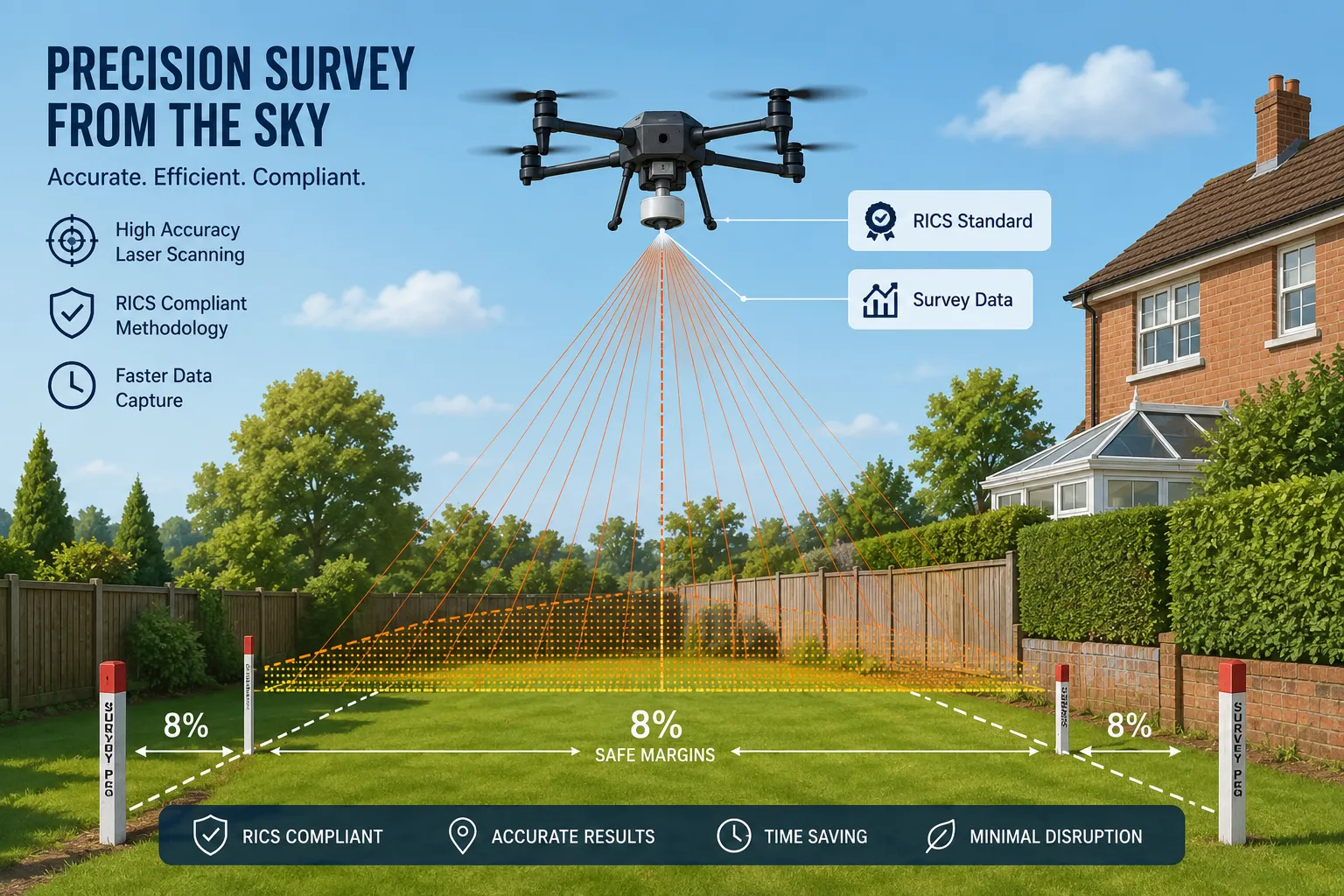
- RTK (Real-Time Kinematic) or PPK (Post-Processed Kinematic) GPS drone systems are preferred because they achieve ground sample distances (GSD) and positional accuracies in the 1-3cm range when ground control points (GCPs) are used correctly.
- Standard consumer drones without RTK typically achieve 5-15cm accuracy without GCPs, which may be insufficient for contested boundary lines in close-proximity disputes.
- The expert witness report must state the achieved accuracy, the number and placement of GCPs, and the software used for photogrammetric processing.
A common mistake is using drone imagery captured for general property marketing rather than commissioning a survey-grade flight. Courts and the Land Registration division of the First-tier Tribunal (Property Chamber) will scrutinise the methodology closely.
Can Drone Survey Evidence Be Used in Land Registry Disputes in 2026?
Yes, drone survey evidence is admissible in 2026 Land Registry disputes, provided it is presented correctly. The First-tier Tribunal (Property Chamber), which hears Land Registry boundary disputes referred under the Land Registration Act 2002, accepts expert evidence in the form of measured surveys, and drone-derived data qualifies when it meets the required standards.
For drone evidence to be accepted:
- It must form part of a CPR Part 35-compliant expert witness report.
- The expert must be suitably qualified (see qualifications section below).
- The report must clearly explain the methodology, equipment, accuracy, and how the drone data supports the boundary determination opinion.
- The drone operator must hold a valid UK CAA Flyer ID and, where required, an Operational Authorisation for the flight category.
Land Registry title plans, drawn at 1:1250 or 1:2500 scale, cannot resolve disputes about lines measured in centimetres. This is precisely where a professional expert witness report supported by drone survey data adds genuine evidential weight.
What Qualifications Does an Expert Witness Need for Boundary Determinations?
An expert witness in boundary determinations should be a chartered surveyor holding MRICS or FRICS designation with demonstrable competence in boundary surveying. Qualification alone is not sufficient, the surveyor must also have relevant experience in boundary dispute work.
Specific requirements include:
- RICS membership (MRICS or FRICS) with competence in boundary identification and dispute resolution.
- Familiarity with CPR Part 35, Practice Direction 35, and the RICS Expert Witness Professional Statement.
- Drone survey competence: Either personal qualification as a drone operator (UK CAA Flyer ID) or the ability to supervise and critically interpret data from a qualified operator.
- No conflict of interest: The expert must be independent and able to certify compliance with the expert's overriding duty to the court.
It is worth noting that being a competent surveyor and being a competent expert witness are distinct skills. RICS recommends that members undertaking expert witness work complete specific CPD in the role. Firms providing drone survey services for boundary disputes should be able to demonstrate both technical survey capability and expert witness experience.
What Is the Difference Between Drone Surveys and Traditional Boundary Surveys?
Traditional boundary surveys rely on ground-based total stations, GPS equipment, and physical measurement of features such as fence posts, walls, and hedges. Drone surveys capture the same area from above using photogrammetry or LiDAR, producing orthomosaic images, point clouds, and 3D models.
| Feature | Traditional Survey | Drone Survey |
|---|---|---|
| Access required | Direct physical access | Airspace access only |
| Best for | Urban, small plots | Large, overgrown, or inaccessible land |
| Accuracy (with GCPs) | 1-3cm | 1-5cm |
| Time on site | Half day to full day | 1-3 hours flight + processing |
| Evidence type | Measured drawings | Ortho imagery + point cloud |
| Cost | Moderate | Moderate to higher (processing included) |
Drone surveys are particularly valuable for long rural boundaries, sites with dense vegetation, or cases where a neighbour refuses access. They also provide a visual record that is easier for non-technical tribunal members and judges to interpret. However, they do not replace deed analysis or ground-truthing of physical features, they complement it.
For context on how survey methodology affects property decisions more broadly, the cost of a measured building survey article provides useful background on survey pricing and scope.
How Much Does a Drone Boundary Survey Cost for Legal Disputes?
Costs vary depending on the size of the site, complexity of the boundary, and the level of report required. Based on current market rates in 2026:
- Pre-action measured boundary report (suitable for negotiation and mediation): £500,£1,500, typically without a drone element.
- Drone survey add-on to a boundary report: £300,£800 for the flight and data processing on a standard residential plot.
- Full CPR Part 35 expert witness report with drone survey: from £5,000, with larger or more complex cases reaching £10,000,£15,000 or more.
- Attendance at tribunal or court as an expert witness: charged additionally, often at day rates of £1,500,£3,000 for a chartered surveyor.
The average cost of a boundary dispute can run well into five figures when litigation proceeds to a full hearing. Early investment in a quality expert report frequently prevents that outcome.
"Boundary litigation often costs more than the disputed land is worth. A credible expert report produced early is the single most effective way to resolve a dispute without going to tribunal."
Why Would a Drone Survey Be Rejected as Expert Evidence?
Drone survey evidence is rejected most often because of procedural failures, not technical ones. The most common reasons include:
- Non-compliance with CPR Part 35: The report does not include the expert's declaration, does not address the duty to the court, or is not addressed to the court.
- Inadequate methodology disclosure: The report fails to state the drone model, sensor specifications, GCP placement, processing software, or achieved accuracy.
- Lack of qualification: The person who conducted the survey is not RICS-qualified or cannot demonstrate relevant competence in boundary work.
- Biased opinion: The report reads as advocacy for one party rather than an independent assessment. This is fatal to admissibility.
- Regulatory non-compliance: The drone operator did not hold the required CAA authorisation for the flight category, or the flight was conducted in a restricted zone without permission.
- Failure to integrate other evidence: The report relies solely on drone imagery without analysing title deeds, conveyancing history, or physical boundary features.
A well-prepared expert witness report anticipates these issues and addresses them systematically.
Who Can Legally Conduct Expert Witness Drone Surveys for Boundaries?
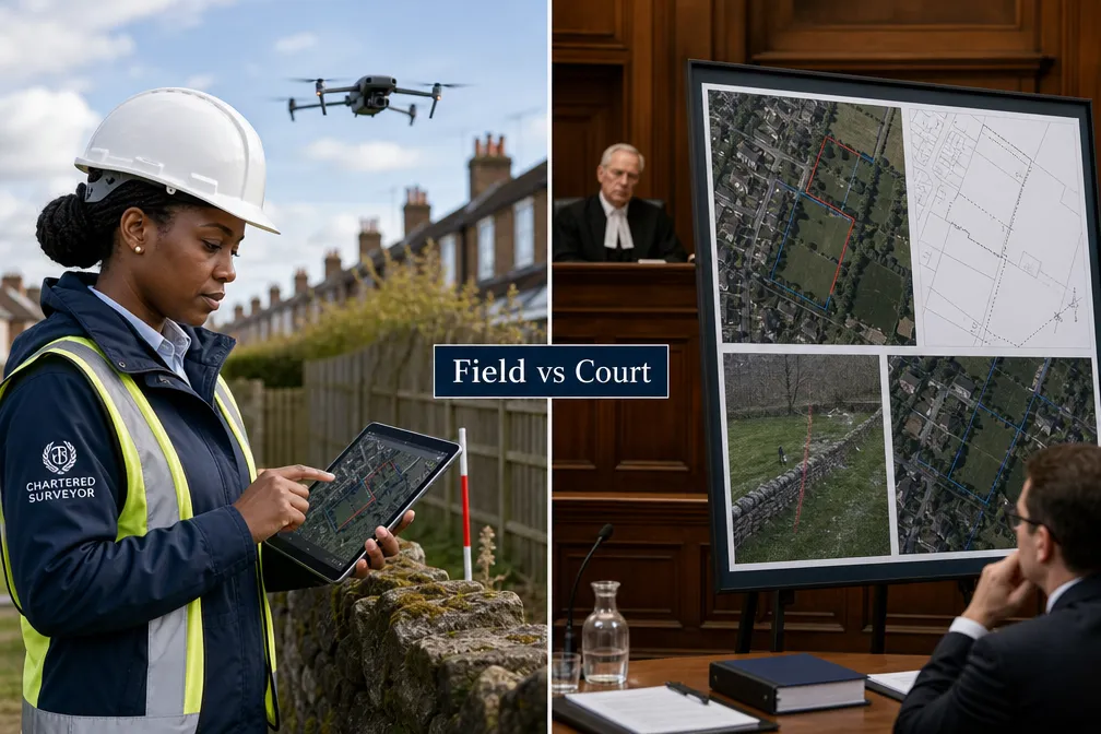
The legal and professional framework requires two overlapping competencies: drone operation and expert witness surveying. In practice, this means either a single RICS-qualified surveyor who also holds CAA drone authorisation, or a team where an RICS expert supervises a qualified drone operator and takes professional responsibility for the data.
Under UK CAA regulations (as updated post-Brexit), anyone flying a drone commercially for survey purposes must hold:
- A GVC (General Visual Line of Sight Certificate) for most professional survey operations, or a Specific Category Operational Authorisation for more complex flights.
- A valid Flyer ID and, where the drone exceeds 250g, an Operator ID.
The RICS-qualified surveyor must be able to critically evaluate the drone data, not merely receive it from a third party. Courts have questioned expert evidence where the named expert had no direct involvement in data collection and could not speak to its reliability.
For property professionals seeking to understand how surveying expertise applies across different dispute types, the party wall disputes resource is a useful related reference.
Common Mistakes People Make with Drone Boundary Evidence
Several avoidable errors consistently undermine drone boundary evidence in disputes:
- Commissioning a drone survey too late. Evidence gathered after a boundary has been altered (new fence erected, vegetation cleared) loses the contemporaneous record that makes drone imagery so valuable.
- Using marketing-grade drone footage. Video or low-resolution imagery captured for estate agent listings is not survey-grade and will not withstand scrutiny.
- Not using ground control points. Without GCPs, positional accuracy cannot be verified and the data may be challenged successfully.
- Assuming the drone survey determines the legal boundary. The legal boundary is determined by the title deeds and conveyancing history. The drone survey measures the physical boundary, these are often different things.
- Selecting an expert based on price alone. A report that fails CPR Part 35 requirements is worthless regardless of cost.
- Ignoring neighbour access issues. Flying over a neighbour's land requires careful consideration of the Air Navigation Order and potential trespass claims, even though airspace rules differ from ground trespass law.
How Long Does a Drone Survey Take for Land Registry Disputes?
The drone flight itself typically takes one to three hours for a standard residential boundary. However, the full process from instruction to completed report takes considerably longer:
- Site preparation and GCP placement: Half a day on site prior to or during the flight.
- Flight and data capture: One to three hours depending on site size and complexity.
- Photogrammetric processing: One to three days using specialist software (e.g., Agisoft Metashape, DJI Terra, Pix4D).
- Deed and document analysis: Variable, often the most time-consuming element, particularly for older properties with complex conveyancing histories.
- Report writing and peer review: One to two weeks for a full CPR Part 35 report.
Total elapsed time from instruction to completed expert witness report is typically four to eight weeks. Parties should factor this into any pre-action protocol timetable or tribunal directions.
Are Drone Surveys Admissible in Court for Boundary Cases?
Drone surveys are admissible in court for boundary cases in England and Wales when presented as part of a properly constituted expert witness report under CPR Part 35. The technology itself is not the issue, courts and tribunals have accepted aerial and photogrammetric evidence for many years. What matters is how the evidence is prepared and presented.
The First-tier Tribunal (Property Chamber) and the County Court both accept drone-derived boundary evidence routinely in 2026, provided:
- The expert is independent and RICS-qualified.
- The report complies with CPR Part 35 and Practice Direction 35.
- The methodology is transparent and reproducible.
- The conclusions are clearly distinguished from the factual data.
Drone evidence has proven particularly persuasive in cases involving disputed hedge or tree boundaries, encroachments, and adverse possession claims, where the visual record from above provides clarity that ground-level photographs cannot.
FAQ
Q: Can I use my own drone footage as evidence in a boundary dispute?
A: Self-collected drone footage is unlikely to be accepted as expert evidence because it lacks independence and professional methodology. It may have limited value as factual evidence (showing the state of a boundary at a point in time), but it cannot substitute for an expert witness report from an RICS-qualified surveyor.
Q: Does a drone survey replace the need to examine title deeds?
A: No. A drone survey measures the physical boundary as it exists on the ground. The legal boundary is determined by the title deeds and conveyancing documents. Expert witness boundary determinations using drone surveys must integrate both sources, the drone data alone cannot establish legal ownership.
Q: What happens if my neighbour refuses to allow the drone to fly over their land?
A: Under UK law, landowners have rights over the airspace above their property to a reasonable height. For low-altitude survey flights, the drone operator should seek permission or ensure the flight plan avoids the neighbour's airspace where possible. A skilled operator can often capture sufficient boundary data from the client's side or from public airspace.
Q: Is RICS membership mandatory for an expert witness in a boundary dispute?
A: It is not a strict legal requirement, but RICS membership (MRICS or FRICS) is the recognised professional standard for boundary surveying expert witnesses in England and Wales. Tribunals and courts place significantly more weight on evidence from RICS members, and non-RICS experts face greater scrutiny of their qualifications and methodology.
Q: How does the 2026 update to the RICS Expert Witness Professional Statement affect drone surveys?
A: The revision, following the October 2025 public consultation, is expected to provide more explicit guidance on the use of modern technologies including drones. Until the updated statement is published, surveyors should apply the current Expert Witness Professional Statement alongside the 2022 Boundaries Professional Standard, documenting their drone methodology carefully.
Q: Can drone surveys resolve a boundary dispute without going to tribunal?
A: Yes, and this is the preferred outcome. A well-prepared expert report supported by drone survey data frequently provides sufficient clarity for parties to reach a negotiated settlement or for the Land Registry to determine a boundary application without a full tribunal hearing. Early expert evidence is consistently more cost-effective than litigation.
Conclusion
Expert witness boundary determinations using drone surveys represent one of the most significant developments in UK property dispute resolution in recent years. When conducted by a suitably qualified RICS member, using survey-grade equipment and proper methodology, drone surveys provide accurate, visually compelling evidence that can resolve disputes that would otherwise require costly and protracted tribunal proceedings.
The framework governing this work in 2026 is clear: the RICS Boundaries Professional Standard, the Expert Witness Professional Statement (currently under revision), and CPR Part 35 together set the standards that any drone-based boundary report must meet. Compliance with all three is non-negotiable for evidence that will withstand scrutiny.
Actionable next steps for property owners and professionals:
- If you are involved in a boundary dispute, instruct an RICS-qualified surveyor with specific experience in expert witness work and drone survey methodology as early as possible.
- Request sight of the surveyor's CPR Part 35 declaration template and drone operator credentials before commissioning a report.
- Do not rely on Land Registry title plans to resolve a boundary dispute, obtain a measured survey that integrates deed analysis with physical measurement.
- Consider mediation supported by a joint expert report before committing to tribunal proceedings.
- For properties with complex or inaccessible boundaries, ask specifically whether a drone survey is appropriate and what accuracy it will achieve.
For professional expert witness and drone survey services from RICS-qualified chartered surveyors, explore Prince Surveyors' expert witness reports and premium drone survey services.
.cg-checker{font-family:Arial,sans-serif;max-width:560px;margin:2em auto;background:#f4f7fb;border:1px solid #c8d6e8;border-radius:8px;padding:24px}
.cg-checker h3{margin:0 0 16px;color:#1a3a5c;font-size:1.1rem}
.cg-q{margin-bottom:14px}
.cg-q label{display:block;font-size:.92rem;color:#2c3e50;margin-bottom:6px;font-weight:600}
.cg-q select{width:100%;padding:7px 10px;border:1px solid #b0bec5;border-radius:5px;font-size:.9rem;background:#fff}
.cg-btn{background:#1a3a5c;color:#fff;border:none;padding:10px 24px;border-radius:5px;cursor:pointer;font-size:.95rem;margin-top:8px}
.cg-btn:hover{background:#2563a8}
.cg-result{margin-top:16px;padding:14px;border-radius:6px;font-size:.92rem;display:none}
.cg-yes{background:#e6f4ea;border:1px solid #81c784;color:#1b5e20}
.cg-maybe{background:#fff8e1;border:1px solid #ffd54f;color:#5d4037}
.cg-no{background:#fdecea;border:1px solid #ef9a9a;color:#7f0000}
Is a Drone Survey Right for Your Boundary Dispute?
function cgCheck(){
var sz=document.getElementById(‘cg-size’).value;
var ac=document.getElementById(‘cg-access’).value;
var st=document.getElementById(‘cg-stage’).value;
var el=document.getElementById(‘cg-result’);
if(!sz||!ac||!st){el.className=’cg-result cg-maybe’;el.style.display=’block’;el.textContent=’Please answer all three questions.’;return;}
var score=0;
if(sz===’large’)score+=2; else if(sz===’medium’)score+=1;
if(ac===’hard’)score+=2;
if(st===’tribunal’)score+=1;
el.style.display=’block’;
if(score>=3){el.className=’cg-result cg-yes’;el.textContent=’A drone survey is strongly recommended. The site size and access challenges make aerial data collection the most practical and accurate approach for your dispute.’;}
else if(score>=1){el.className=’cg-result cg-maybe’;el.textContent=’A drone survey may add value alongside traditional ground measurement. Discuss with your RICS surveyor whether the additional cost is justified for your specific boundary.’;}
else{el.className=’cg-result cg-no’;el.textContent=’A traditional ground-based survey is likely sufficient for this dispute. A drone survey is unlikely to provide significant additional benefit for a small, accessible urban plot.’;}
}
Tags: boundary disputes, expert witness, drone surveys, RICS standards, Land Registry, boundary determination, CPR Part 35, chartered surveyor, property disputes, aerial survey, boundary evidence, land registration