

Last updated: July 24, 2026
Quick Answer: A boundary dispute expert witness using drone surveys provides courts and tribunals with precise, independently verified aerial evidence of property lines. In 2026, RICS standards require such evidence to meet strict accuracy, methodology, and impartiality benchmarks. Drone surveys now offer sub-5cm positional accuracy, making them one of the most reliable tools available for property line litigation in England and Wales.
Key Takeaways
- Boundary disputes are among the most litigated property matters in England and Wales, and drone surveys have become a recognised evidential tool in 2026 proceedings.
- RICS guidance (4th edition) explicitly endorses contemporary field survey techniques, including drones, for boundary identification and dispute resolution.
- A qualified expert witness must hold RICS membership, demonstrate impartiality, and comply with Civil Procedure Rules Part 35 when presenting drone evidence in court.
- Drone surveys typically achieve positional accuracy of 2-5cm using RTK (Real-Time Kinematic) GPS, far exceeding the precision of traditional tape-and-offset methods.
- Costs for a drone boundary survey in the UK range from approximately £500 to £2,500 depending on site complexity, with full expert witness reports adding further professional fees.
- RICS now places explicit emphasis on mediation before litigation, and drone survey data can support early settlement as much as it supports court proceedings.
- Drone evidence is admissible in UK courts provided it is collected lawfully, follows a documented methodology, and is presented by a suitably qualified expert.
- Market caution in 2026 means many property owners are reluctant to commit to expensive litigation; drone surveys offer a cost-proportionate route to resolution.
What Is a Boundary Dispute Expert Witness and What Do They Do?
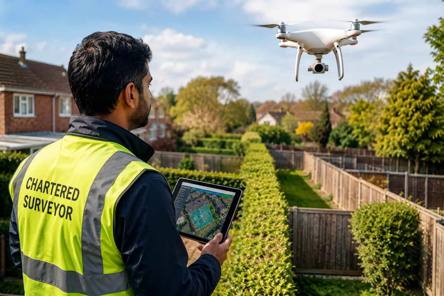
A boundary dispute expert witness is a qualified surveyor, typically RICS-chartered, appointed to provide independent, impartial technical evidence about the location of a property boundary. They do not advocate for either party; their duty is to the court.
In practice, the expert witness will:
- Examine title deeds, Land Registry plans, and historical mapping
- Conduct or commission a physical boundary survey, increasingly using drone technology
- Produce a written expert report setting out findings, methodology, and conclusions
- Attend court or tribunal hearings to give oral evidence and be cross-examined
The role is governed by Civil Procedure Rules Part 35 in England and Wales, which sets out the expert's overriding duty to assist the court. RICS members acting as expert witnesses must also comply with the RICS Surveyors Acting as Expert Witnesses professional statement, which requires objectivity, competence, and transparency of methodology.
For a detailed overview of what this service involves, see expert witness reports from Prince Surveyors.
How Do Drone Surveys Help Resolve Property Line Disputes?
Drone surveys help resolve property line disputes by capturing high-resolution aerial imagery and geospatial data that can precisely map boundary features, including fences, walls, hedges, and physical markers, across an entire site in a single flight.
Key advantages over ground-based methods include:
- Comprehensive coverage: A drone can survey an entire residential plot and its neighbours in under an hour, capturing features that are difficult to access on foot.
- Orthomosaic mapping: Drone software stitches hundreds of overlapping images into a single scaled, georeferenced plan that can be measured digitally.
- Photographic evidence: High-resolution images capture the current physical state of boundaries, which is particularly valuable when a party claims encroachment has occurred.
- Repeatability: Surveys can be repeated at different dates to demonstrate changes over time, relevant in adverse possession cases.
The Prince Chartered Surveyors premium drone survey service uses RTK-enabled drones that achieve ground sample distances of under 2cm per pixel, producing evidence-grade data suitable for litigation.
What Are RICS Standards for Drone Surveys in 2026 Property Line Litigation?
RICS standards for drone surveys in 2026 require that boundary surveys using unmanned aerial vehicles (UAVs) follow documented methodology, achieve verifiable positional accuracy, and are conducted by a suitably qualified and CAA-authorised operator.
The RICS professional standard Boundaries: procedures for boundary identification, demarcation and dispute resolution (4th edition) sets the framework. Key requirements include:
| Requirement | Detail |
|---|---|
| Operator authorisation | CAA Operational Authorisation (OA) required for most survey operations |
| Ground control points | Minimum of 4-6 GCPs to achieve sub-5cm accuracy |
| Methodology documentation | Full flight log, equipment specification, and processing report |
| Impartiality | Expert must have no financial interest in the outcome |
| Report format | Must comply with CPR Part 35 and RICS expert witness PS |
The 4th edition also introduces a stronger emphasis on mediation as a first step before litigation. Drone survey data can support this process too: presenting objective aerial evidence often accelerates settlement discussions by removing factual disagreement about the physical position of boundary features.
For context on how legislation and standards are evolving in 2026, the property market legislation changes overview provides useful background.
How Accurate Are Drone Surveys for Property Boundaries, and How Do They Compare to Traditional Methods?
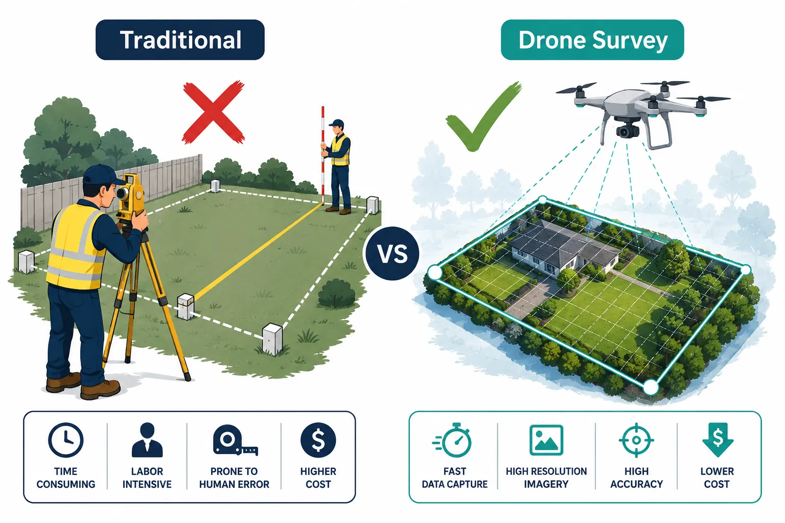
Drone surveys using RTK GPS achieve positional accuracy of 2-5cm, which is sufficient for resolving most residential boundary disputes where the disagreement is typically measured in tens of centimetres to a few metres.
Comparison: Drone vs Traditional Boundary Survey
Traditional boundary surveys using total stations and EDM (Electronic Distance Measurement) equipment can achieve similar or slightly better accuracy at specific measured points. However, they are point-based rather than continuous, meaning features between measured points may be interpolated rather than directly observed.
Drone surveys capture continuous photographic coverage, so every visible boundary feature is recorded. The trade-off is that drones cannot easily measure features hidden under dense vegetation or below ground level, such as buried boundary markers.
Choose drone surveys if:
- The dispute involves a large or complex site
- Visual evidence of encroachment is needed
- Cost and speed are important factors
- The boundary features are visible from the air
Choose traditional ground survey if:
- Sub-centimetre accuracy is required at specific points
- Vegetation or structures obstruct aerial coverage
- The dispute hinges on a single precise measurement
For more on what measured surveys involve, see this guide to measured building surveys.
How Much Does a Drone Survey Cost for Property Boundary Disputes?
A drone boundary survey in the UK typically costs between £500 and £2,500 for the survey itself, with full expert witness reports adding £1,500 to £5,000 or more depending on complexity and the likelihood of court attendance.
Cost factors include:
- Site size and complexity: Larger or more complex sites require longer flight times and more processing.
- Accuracy specification: RTK surveys with ground control points cost more than basic aerial photography.
- Expert witness report: A CPR Part 35-compliant report requires significantly more professional time than a standard survey report.
- Court attendance: If the expert is required to give oral evidence, daily rates typically range from £1,500 to £3,000.
For a broader picture of what boundary disputes cost overall, the average cost of a boundary dispute guide sets out the full financial picture, including legal fees and mediation costs.
Can Drone Survey Evidence Be Used in Court for Property Line Cases?
Yes, drone survey evidence is admissible in UK courts provided it is collected lawfully, follows a documented and reproducible methodology, and is presented by a suitably qualified expert witness.
For drone evidence to be accepted, the following conditions must be met:
- Legal flight authority: The operator must hold CAA authorisation and comply with the UK Drone and Model Aircraft Code.
- Data integrity: The survey must include a documented chain of custody for all raw data and processed outputs.
- Expert qualification: The presenting expert must be RICS-chartered (or hold equivalent recognised qualifications) and comply with CPR Part 35.
- Methodology transparency: The court must be able to understand and scrutinise how the data was collected and processed.
- Independence: The expert must not have a prior relationship with either party that could compromise impartiality.
Courts in England and Wales have accepted drone-derived orthomosaic plans and photographic evidence in boundary and encroachment cases. The key test is whether the evidence is reliable and whether the expert can defend their methodology under cross-examination.
Do I Need an Expert Witness for My Property Line Dispute?
Not every boundary dispute requires a formal expert witness. However, if the matter is likely to proceed to the First-tier Tribunal (Property Chamber) or the County Court, independent expert evidence is strongly advisable and may be required by the court.
You likely need an expert witness if:
- Negotiations with your neighbour have broken down
- The dispute involves a significant financial value (typically over £10,000 in land or property value)
- You are considering or facing litigation
- The boundary location is genuinely ambiguous from title documents alone
You may not need a formal expert witness if:
- The dispute can be resolved through mediation with a jointly instructed surveyor
- The boundary position is clearly defined in title documents and both parties agree on interpretation
- The matter is minor and both parties are willing to negotiate directly
RICS guidance encourages joint instruction of a single expert where possible, as this reduces costs and avoids the adversarial dynamic of competing expert reports.
What Happens When Neighbours Disagree on Property Lines?
When neighbours disagree on property lines, the first step should be to obtain the title deeds and Land Registry filed plans for both properties and compare them. If the documents do not resolve the dispute, a surveyor should be instructed to carry out a boundary identification survey.
The typical escalation path is:
- Review title documents and Land Registry plans
- Instruct a chartered surveyor for a boundary identification survey (drone surveys are increasingly used at this stage)
- Attempt mediation, supported by the survey findings
- If mediation fails, apply to the Land Registry for a determined boundary or issue proceedings in the First-tier Tribunal or County Court
- Expert witness evidence is presented at tribunal or court
The RICS 4th edition standard strongly encourages mediation at step 3, noting that most boundary disputes can be resolved without litigation when both parties have access to objective survey data. Party wall matters that arise alongside boundary disputes may also need separate attention; the party wall agreement guide covers the relevant procedures.
What Qualifications Should a Boundary Dispute Expert Witness Have?
A boundary dispute expert witness should hold RICS membership (MRICS or FRICS), have demonstrable experience in boundary surveying, and hold or work within a firm that holds CAA Operational Authorisation if drone surveys are to be used.
Specific qualifications to look for:
- RICS membership: MRICS or FRICS designation confirms adherence to professional standards and a code of conduct.
- Specialist experience: Look for surveyors who regularly handle boundary identification work, not just general building surveys.
- CPR Part 35 training: The expert should be familiar with the duties and format requirements for court-compliant expert reports.
- CAA authorisation: If drone surveys form part of the evidence, the operator must hold appropriate CAA authorisation.
- Professional indemnity insurance: Adequate PI cover is essential for expert witness work.
Avoid instructing a surveyor who has previously advised either party on the same dispute, as this creates a conflict of interest that could undermine the admissibility of their evidence.
What Are Common Mistakes in Drone Boundary Surveys?
The most common mistakes in drone boundary surveys are insufficient ground control points, failure to document the methodology, and using consumer-grade drones without RTK capability, all of which can undermine the evidential value of the data.
Mistakes to avoid:
- Too few GCPs: Using fewer than four ground control points reduces accuracy and makes the survey difficult to defend in cross-examination.
- No independent check points: GCPs used in processing should be supplemented by independent check points to verify accuracy.
- Poor flight planning: Flying too high reduces resolution; flying in poor light or wind conditions introduces blur and positional error.
- Inadequate metadata: Failing to record equipment specifications, flight parameters, and weather conditions weakens the chain of evidence.
- Unqualified operator: Using a drone operator without CAA authorisation may render the survey inadmissible and could expose the instructing party to legal risk.
- Ignoring vegetation: Dense tree canopies can obscure boundary features; surveyors should note limitations clearly in their report.
Why Are Property Owners Cautious About Boundary Disputes in 2026?
Property owners in 2026 are cautious about boundary disputes primarily because of cost, market uncertainty, and the risk that litigation could delay or derail a property sale. The UK property market has experienced sustained caution since 2023, with buyers and sellers both wary of complications that could affect transaction timelines.
Specific concerns include:
- Legal costs: A contested boundary dispute taken to tribunal can cost £20,000 to £50,000 or more in legal and surveying fees (estimate based on typical reported ranges in property litigation; individual cases vary significantly).
- Transaction risk: A live boundary dispute must be disclosed to buyers and can cause sales to fall through or prices to be renegotiated.
- Time: Court proceedings can take 12 to 24 months; even mediation-based resolution typically takes 3 to 6 months.
- Neighbour relations: Many property owners are reluctant to escalate disputes that could permanently damage relationships with adjoining owners.
Drone surveys address some of these concerns by providing fast, cost-proportionate evidence that can support early mediation rather than requiring full litigation. The average cost of a boundary dispute article explores how costs accumulate and where drone surveys can reduce overall expenditure.
How Long Does a Drone Survey Take for Boundary Disputes?
A drone survey for a residential boundary dispute typically takes half a day to one full day on site, with processed data and a draft plan available within 3 to 5 working days. A full expert witness report takes longer, typically 2 to 4 weeks depending on the complexity of the case.
Timeline breakdown:
- Pre-flight planning and permissions: 1 to 3 days
- Site survey: 2 to 6 hours depending on site size
- Data processing (orthomosaic, point cloud): 1 to 3 days
- Expert witness report preparation: 1 to 3 weeks
- Review and finalisation: 3 to 5 working days
This compares favourably to traditional ground surveys for large or complex sites, where data collection alone can take multiple days.
Boundary Dispute Expert Witness Using Drone Surveys: A Practical Decision Guide
Before instructing an expert witness for drone-based boundary evidence, work through these steps:
- Obtain your title documents from Land Registry and review the filed plan.
- Identify the specific point of disagreement, is it the line itself, or the ownership of a boundary feature (fence, wall, hedge)?
- Assess proportionality, is the value of the disputed land proportionate to the cost of a full expert witness report?
- Consider joint instruction, instructing a single expert jointly with your neighbour reduces costs and is encouraged by RICS.
- Check the surveyor's qualifications, RICS membership, CPR Part 35 experience, and CAA authorisation where drones are used.
- Explore mediation first, RICS guidance and the Civil Procedure Rules both encourage alternative dispute resolution before litigation.
Frequently Asked Questions
What is the difference between a boundary survey and an expert witness report?
A boundary survey identifies and maps the physical position of boundary features. An expert witness report goes further, interpreting that data in the context of title documents, legal principles, and the specific dispute, and is formatted to comply with Civil Procedure Rules Part 35 for use in court.
Can I use drone footage I have taken myself as evidence in a boundary dispute?
Consumer drone footage taken by a homeowner is unlikely to be accepted as expert evidence because it lacks the accuracy specification, methodology documentation, and independent impartiality required by courts. It may, however, be useful as supporting factual evidence if collected lawfully.
Does a drone survey replace the need to examine title deeds?
No. A drone survey establishes the physical position of boundary features on the ground. Title deeds and Land Registry plans establish the legal boundary. Both are needed; the expert witness's role is to reconcile the two.
Are drone surveys only useful for large properties?
No. Drone surveys are cost-effective for residential properties of all sizes. For smaller plots, the speed of data collection and the comprehensive photographic record often justify the cost even where the disputed area is small.
What is a determined boundary and how does drone evidence support it?
A determined boundary is a legally fixed boundary registered at Land Registry following an application under the Land Registration Act 2002. Drone survey data, when presented as part of an expert witness report, can form part of the evidence package submitted to support a determined boundary application.
How do RICS standards differ for drone surveys versus traditional surveys in boundary disputes?
RICS standards apply equally to both methods in terms of accuracy, impartiality, and report format. Drone surveys have additional requirements around CAA authorisation, flight methodology documentation, and ground control point specification that do not apply to ground-based surveys.
Conclusion
Boundary disputes remain one of the most stressful and financially significant challenges a property owner can face. In 2026, the combination of drone survey technology and RICS-compliant expert witness practice offers a faster, more cost-proportionate route to resolution than traditional methods alone.
Actionable next steps:
- If a dispute is emerging, obtain your Land Registry title documents and compare them with your neighbour's before instructing anyone.
- Instruct a RICS-chartered surveyor with specific boundary identification experience and CAA authorisation for drone operations.
- Explore mediation before committing to litigation; drone survey data is as useful at the negotiating table as it is in court.
- Ensure any expert witness report is CPR Part 35-compliant from the outset, even if you hope to settle before a hearing.
- Check the expert witness report service to understand what a professionally prepared report includes and how it is structured for court use.
For property professionals and landlords who want to understand the broader context of boundary and property disputes, the building inspections and surveys guide for homeowners provides a useful starting point.
.cg-tool{font-family:Arial,sans-serif;max-width:540px;margin:2em auto;background:#f4f7fb;border:1px solid #c8d6e5;border-radius:8px;padding:24px}
.cg-tool h3{margin:0 0 6px;font-size:1.1rem;color:#1a2e4a}
.cg-tool p{font-size:.85rem;color:#555;margin:0 0 16px}
.cg-tool label{display:block;font-size:.88rem;color:#1a2e4a;margin-bottom:4px;font-weight:600}
.cg-tool select,.cg-tool input{width:100%;padding:8px 10px;border:1px solid #b0c4d8;border-radius:5px;font-size:.9rem;margin-bottom:14px;box-sizing:border-box;background:#fff}
.cg-btn{background:#1a2e4a;color:#fff;border:none;padding:10px 22px;border-radius:5px;font-size:.95rem;cursor:pointer;width:100%}
.cg-btn:hover{background:#2c4a6e}
.cg-result{margin-top:16px;background:#fff;border-left:4px solid #1a2e4a;padding:12px 14px;border-radius:4px;font-size:.88rem;color:#1a2e4a;display:none}
.cg-result strong{display:block;margin-bottom:4px;font-size:.95rem}
Drone Survey Suitability Checker
Answer three quick questions to see whether a drone survey is suitable for your boundary dispute.
function cgCheck(){
var s=document.getElementById(‘cg-size’).value,
v=document.getElementById(‘cg-veg’).value,
c=document.getElementById(‘cg-court’).value,
r=document.getElementById(‘cg-result’),msg=”;
if(!s||!v||!c){r.style.display=’block’;r.innerHTML=’Please answer all three questions.‘;return;}
if(v===’dense’){msg=’Drone survey: use with caution. Dense vegetation may obscure boundary features. A combined drone and ground survey is recommended. Ensure the expert notes coverage limitations clearly in their report.’;}
else if(s===’large’&&c===’yes’){msg=’Drone survey: strongly recommended. Large sites with litigation risk benefit most from drone orthomosaic mapping. Instruct a RICS-chartered surveyor with CAA authorisation and request a CPR Part 35-compliant report.’;}
else if(c===’no’&&v!==’dense’){msg=’Drone survey: suitable for mediation support. Aerial evidence can accelerate settlement. A standard drone survey report (without full CPR Part 35 format) may be sufficient and more cost-effective.’;}
else{msg=’Drone survey: suitable. Your scenario is well-suited to a drone boundary survey. Confirm the surveyor holds RICS membership and CAA Operational Authorisation before instructing.’;}
r.style.display=’block’;r.innerHTML=msg;
}
Tags: boundary dispute expert witness, drone surveys property, RICS standards 2026, property line litigation, boundary survey UK, expert witness report, drone survey cost, property boundary evidence, chartered surveyor expert witness, boundary identification, property dispute resolution, RICS drone guidance