What are Measured Surveys: A Comprehensive Guide to Professional Land Measurement

Imagine purchasing your dream property only to discover that your neighbor’s fence sits three feet inside your boundary line, or planning a major construction project without knowing the exact elevation changes across your land. These scenarios highlight why measured surveys remain one of the most critical—yet often misunderstood—services in real estate, construction, and land development. In 2025, as property values continue to climb and land disputes become increasingly costly, understanding what measured surveys are and why they matter has never been more important.
What are measured surveys? At their core, measured surveys are precise, professional assessments of land boundaries, features, and characteristics conducted by licensed surveyors using specialized equipment and techniques. These surveys create accurate representations of property dimensions, elevations, improvements, and legal boundaries that serve as the foundation for countless real estate transactions, construction projects, and legal proceedings.
Key Takeaways
- Measured surveys are professional land assessments that establish precise property boundaries, dimensions, and features using advanced surveying equipment and mathematical calculations
- Multiple survey types exist including boundary surveys, topographic surveys, ALTA/NSPS surveys, and construction surveys, each serving specific purposes for different projects
- Licensed surveyors are required to conduct measured surveys, ensuring accuracy, legal compliance, and professional standards that protect property owners and stakeholders
- Surveys prevent costly disputes by providing legally defensible documentation of property lines, easements, encroachments, and improvements
- Technology has transformed surveying with GPS, laser scanning, and drone technology improving accuracy and efficiency while reducing costs and timeframes
Understanding What Measured Surveys Are and Their Purpose
Measured surveys represent the scientific and legal process of determining the three-dimensional positions of points and the distances and angles between them. These surveys establish terrestrial or three-dimensional positions of points as well as the distances and angles between them [1]. The practice combines elements of mathematics, physics, engineering, and law to create accurate representations of land parcels and their characteristics.
The Foundation of Property Rights
At the heart of what measured surveys accomplish is the establishment and verification of property rights. Without accurate surveys, property ownership would remain ambiguous, leading to endless disputes and uncertainty. Measured surveys provide:
- Legal boundary determination based on deed descriptions and historical records
- Physical evidence through monuments, markers, and corner stakes
- Documentary proof via certified plat maps and survey reports
- Protection against encroachment from neighboring properties
- Foundation for title insurance and real estate transactions
Historical Context and Modern Evolution
Land surveying ranks among humanity’s oldest professions, dating back to ancient Egypt where surveyors re-established property boundaries after Nile River floods [2]. Today’s measured surveys build upon centuries of refinement while incorporating cutting-edge technology that would astound early practitioners.
Types of Measured Surveys: What Are Measured Surveys Used For?
Understanding what measured surveys encompass requires familiarity with the various types, each designed for specific applications and stakeholder needs.
Boundary Surveys (Property Surveys)
Boundary surveys represent the most common type of measured survey, focusing on establishing or verifying property lines. These surveys:
✅ Identify exact property corners and boundaries
✅ Locate existing improvements relative to property lines
✅ Discover potential encroachments or easements
✅ Provide foundation for fence installation or property disputes
✅ Required for most real estate transactions and refinancing
A typical boundary survey includes field measurements, research of historical records and deeds, monument placement at property corners, and a final plat or map showing findings [3].
Topographic Surveys
Topographic surveys map the natural and man-made features of land, including elevation changes, contours, trees, buildings, utilities, and water features. Engineers and architects rely on these surveys for:
- Site development and grading plans
- Drainage and erosion control design
- Building placement and foundation planning
- Environmental impact assessments
- Infrastructure projects like roads and utilities
ALTA/NSPS Land Title Surveys
The ALTA/NSPS survey (American Land Title Association/National Society of Professional Surveyors) represents the most comprehensive measured survey type, meeting stringent national standards. Commercial real estate transactions typically require ALTA surveys, which include:
| ALTA Survey Component | Purpose |
|---|---|
| Boundary determination | Establishes legal property limits |
| Improvements location | Maps all buildings and structures |
| Easement identification | Documents access and utility rights |
| Encroachment detection | Identifies boundary violations |
| Zoning compliance | Verifies setback requirements |
| Title commitment items | Addresses title company concerns |
Construction Surveys (Site Layout)
Construction surveys translate architectural and engineering plans into physical reality on construction sites. Surveyors establish precise reference points that guide:
- Building foundation placement
- Utility line installation
- Road and parking lot layout
- Grading and excavation work
- Vertical elevation control
Subdivision Surveys
When developers divide large parcels into multiple lots, subdivision surveys create the legal framework. These complex surveys establish individual lot boundaries, dedicate streets and easements, and comply with local planning regulations.
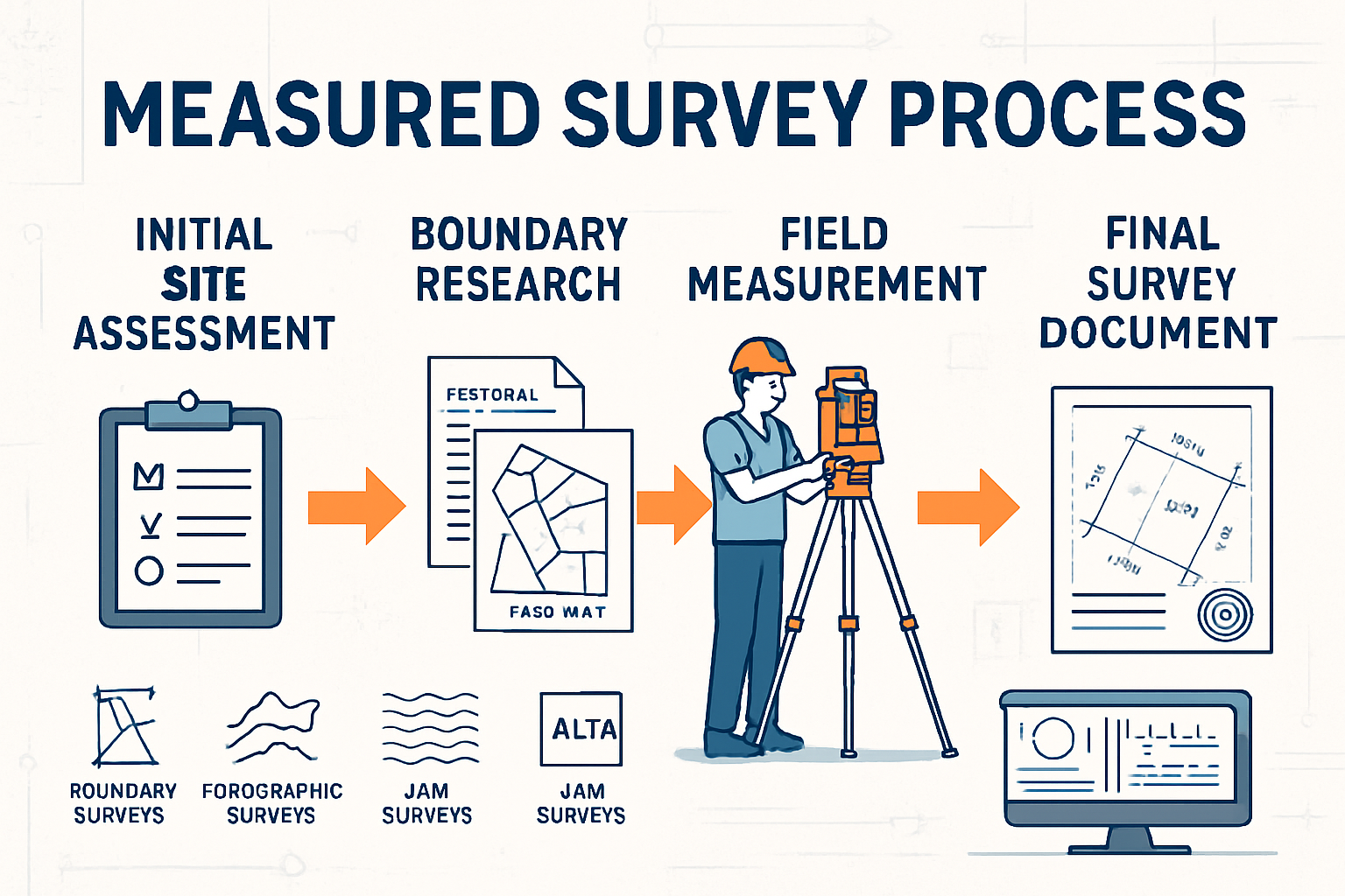
The Measured Survey Process: How Professionals Conduct Surveys
Understanding what measured surveys involve requires examining the systematic process surveyors follow to ensure accuracy and legal validity.
Step 1: Research and Records Review 📋
Before setting foot on property, surveyors conduct extensive research including:
- Deed examination to understand legal descriptions
- Previous survey review to identify historical boundaries
- County records search for easements, rights-of-way, and restrictions
- Adjacent property research to understand neighboring boundaries
- Historical documentation including original government surveys
This research phase proves critical, as modern surveys must reconcile with historical property descriptions that may date back centuries.
Step 2: Field Reconnaissance
Surveyors visit the site to:
- Locate existing survey monuments and markers
- Assess site conditions and access
- Identify potential obstacles or challenges
- Determine optimal equipment and methodology
- Establish control points for measurements
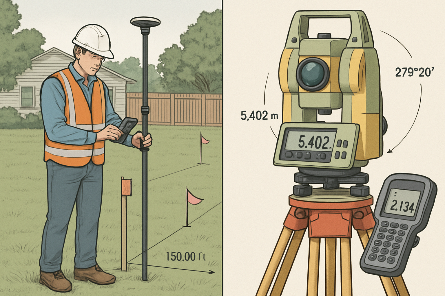
Step 3: Field Measurements and Data Collection
Using sophisticated equipment, surveyors collect precise measurements through:
Traditional Equipment:
- Total stations combining electronic distance measurement with angle measurement
- GPS receivers utilizing satellite positioning for coordinate determination
- Levels for elevation measurements
- Measuring tapes and chains for verification
Advanced Technology (2025):
- 3D laser scanners capturing millions of data points
- Drone photogrammetry for aerial mapping and modeling
- Mobile LiDAR systems for corridor and infrastructure surveys
- Real-Time Kinematic (RTK) GPS for centimeter-level accuracy
Step 4: Data Processing and Analysis
Raw field data undergoes rigorous processing where surveyors:
- Apply mathematical adjustments and error corrections
- Reconcile field measurements with deed descriptions
- Resolve discrepancies between evidence and records
- Calculate coordinates, bearings, and distances
- Create digital models and CAD drawings
Step 5: Monument Placement
Surveyors set permanent monuments at property corners, typically:
- Iron rods or pipes
- Concrete monuments
- Brass caps or disks
- Tagged markers for identification
Step 6: Plat Preparation and Certification
The final deliverable includes a certified survey plat showing:
- Property boundaries with bearings and distances
- Monument locations and descriptions
- Improvements and their relationship to boundaries
- Easements, rights-of-way, and encroachments
- Surveyor’s certification and professional seal
- Legal description of the property
Who Needs Measured Surveys? Common Applications and Scenarios
What are measured surveys necessary for? The applications span virtually every aspect of land ownership and development.
Real Estate Transactions 🏡
Buyers, sellers, and lenders rely on measured surveys to:
- Verify property boundaries match deed descriptions
- Identify encroachments before closing
- Satisfy title insurance requirements
- Confirm zoning compliance
- Protect investment through accurate documentation
Construction and Development Projects
Developers and builders require surveys for:
- Site planning and optimal building placement
- Permit applications demonstrating code compliance
- Foundation layout ensuring accurate construction
- As-built surveys documenting completed work
- Volume calculations for earthwork and materials
Legal Disputes and Litigation
When property conflicts arise, measured surveys provide:
- Expert evidence in boundary disputes
- Documentation for adverse possession claims
- Support for easement and right-of-way cases
- Basis for expert witness testimony
- Objective third-party assessment
Mortgage Refinancing and Lending
Financial institutions often require surveys to:
- Confirm collateral property boundaries
- Identify potential title issues
- Assess property improvements
- Verify legal access
- Protect lender interests
Fence Installation and Property Improvements
Property owners need surveys before:
- Installing fences along boundary lines
- Building additions or outbuildings
- Planting trees near property lines
- Installing pools or outdoor structures
- Resolving neighbor disputes
The Legal and Professional Framework of Measured Surveys
What makes measured surveys legally valid and professionally reliable? A comprehensive regulatory framework ensures quality and accountability.
Licensing and Professional Requirements
Every state requires surveyors to obtain professional licensure through:
- Four-year degree in surveying or related field
- Extensive field experience (typically 4+ years)
- Passing the Fundamentals of Surveying (FS) exam
- Passing the Principles and Practice of Surveying (PS) exam
- Continuing education to maintain licensure
Only licensed Professional Land Surveyors (PLS) can certify surveys and affix their professional seal [4].
Professional Standards and Ethics
Surveyors must adhere to:
- State-specific minimum standards for survey accuracy and content
- Professional ethics codes governing conduct and practice
- Liability and insurance requirements protecting clients
- Record-keeping obligations maintaining survey documentation
Legal Weight and Evidentiary Value
Certified measured surveys carry significant legal authority because:
- Courts recognize them as expert professional opinions
- They establish rebuttable presumptions of boundary locations
- Licensed surveyors can provide expert testimony
- Professional standards ensure reliability and accuracy
- Certification creates accountability and liability
Technology and Innovation in Measured Surveys (2025)
The surveying profession has experienced dramatic technological advancement, transforming what measured surveys can accomplish.
GPS and GNSS Technology
Global Navigation Satellite Systems (GNSS) have revolutionized surveying by:
- Providing coordinate positions accurate to centimeters
- Eliminating need for line-of-sight between points
- Enabling rapid data collection over large areas
- Integrating with Geographic Information Systems (GIS)
- Reducing time and cost for many survey types
3D Laser Scanning and LiDAR
Light Detection and Ranging (LiDAR) technology captures:
- Millions of precise measurement points per second
- Complete 3D models of structures and terrain
- As-built documentation for existing conditions
- Detailed topographic information
- Data for Building Information Modeling (BIM)
Unmanned Aerial Systems (Drones)
Drone technology has expanded surveying capabilities through:
- Aerial photography and orthomosaic creation
- Topographic mapping of large or inaccessible areas
- Volume calculations for stockpiles and excavations
- Progress monitoring on construction sites
- Cost-effective data collection
Software and Data Processing
Advanced software enables:
- CAD integration for seamless design workflow
- Cloud-based collaboration among project teams
- Automated processing reducing human error
- 3D visualization for client understanding
- Mobile apps for field data collection
Cost Factors and Investment Considerations
Understanding what measured surveys cost helps property owners and developers budget appropriately.
Factors Affecting Survey Costs 💰
Survey pricing varies based on:
| Cost Factor | Impact on Price |
|---|---|
| Property size | Larger parcels require more time |
| Terrain difficulty | Dense vegetation, steep slopes increase effort |
| Research complexity | Unclear deed histories require extensive research |
| Survey type | ALTA surveys cost more than simple boundary surveys |
| Location | Urban vs. rural, regional cost variations |
| Accessibility | Remote locations increase mobilization costs |
| Required accuracy | Higher precision demands more time and equipment |
Typical Price Ranges (2025)
While costs vary significantly by location and circumstances:
- Residential boundary survey: $400-$2,000
- Topographic survey: $1,000-$5,000+
- ALTA/NSPS survey: $2,000-$10,000+
- Subdivision survey: $5,000-$50,000+
- Construction staking: $500-$3,000 per visit
Return on Investment
Despite upfront costs, measured surveys provide value through:
- Dispute prevention avoiding costly litigation
- Project efficiency reducing construction errors and delays
- Title insurance enabling property transfers
- Property value protection documenting boundaries and improvements
- Regulatory compliance satisfying permitting requirements
Common Misconceptions About What Measured Surveys Are
Several myths persist about measured surveys that deserve clarification:
❌ Myth 1: “The Tax Assessor’s Map Shows My Boundaries”
Reality: Tax maps serve assessment purposes only and explicitly state they’re not surveys. They lack the accuracy and legal standing of measured surveys [5].
❌ Myth 2: “My Fence Marks the Property Line”
Reality: Fences often sit inside property lines for setback compliance or were installed without surveys. Only a measured survey establishes true boundaries.
❌ Myth 3: “I Don’t Need a Survey If I’m Not Selling”
Reality: Surveys benefit current owners by preventing encroachment, guiding improvements, and resolving disputes before they escalate.
❌ Myth 4: “All Surveys Are the Same”
Reality: Different survey types serve distinct purposes with varying levels of detail, accuracy standards, and costs.
❌ Myth 5: “GPS Can Replace Professional Surveyors”
Reality: While GPS aids surveying, professional expertise in research, boundary law, evidence evaluation, and conflict resolution remains irreplaceable.
Selecting a Qualified Surveyor: Best Practices
Choosing the right professional ensures quality results and protects your investment.
Essential Qualifications to Verify ✓
- Current professional license in the state where property is located
- Errors and omissions insurance protecting against mistakes
- Experience with your survey type (boundary, ALTA, topographic, etc.)
- Local knowledge of area practices and regulations
- Professional references from recent clients
Questions to Ask Potential Surveyors
- How long have you been licensed in this state?
- What experience do you have with [specific survey type]?
- What is your estimated timeline for completion?
- What deliverables will I receive?
- Do you carry professional liability insurance?
- What is your total fee, and what does it include?
- Have you surveyed properties in this area before?
Red Flags to Avoid 🚩
- Unlicensed individuals offering “survey” services
- Quotes significantly below market rates
- Reluctance to provide references or credentials
- Promises of specific boundary locations before research
- Pressure to hire without time for due diligence
The Future of Measured Surveys: Trends and Developments
As we progress through 2025, several trends are reshaping what measured surveys encompass:
Artificial Intelligence and Machine Learning
AI applications are emerging in:
- Automated feature extraction from survey data
- Predictive analysis for boundary determination
- Quality control and error detection
- Historical record digitization and analysis
Digital Twin Technology
Integration of survey data into digital twins—virtual replicas of physical properties—enables:
- Real-time monitoring of property changes
- Predictive maintenance for infrastructure
- Enhanced visualization for stakeholders
- Integration with smart city initiatives
Blockchain for Survey Records
Blockchain technology promises:
- Immutable recording of survey monuments and boundaries
- Transparent chain of title and survey history
- Reduced fraud and disputes
- Streamlined property transfers
Sustainability and Environmental Surveying
Growing environmental awareness expands surveying into:
- Carbon sequestration measurement
- Wetland delineation and monitoring
- Renewable energy site assessment
- Climate change impact documentation
Conclusion: The Essential Role of Measured Surveys
Understanding what measured surveys are reveals their fundamental importance to property ownership, development, and protection. These professional assessments provide the precise, legally defensible documentation that underpins real estate transactions, construction projects, dispute resolution, and land management.
As technology continues advancing, measured surveys become increasingly accurate, efficient, and comprehensive. Yet the core principles remain unchanged: professional expertise, mathematical precision, legal knowledge, and ethical practice combine to establish and protect property rights.
“A measured survey is not an expense—it’s an investment in certainty, protection, and peace of mind.”
Actionable Next Steps
Whether you’re buying property, planning construction, resolving a boundary dispute, or simply want to know exactly what you own, consider these steps:
- Determine your survey needs based on your specific situation and goals
- Research licensed surveyors in your area with relevant experience
- Request quotes and compare services, timelines, and deliverables
- Verify credentials including licensure, insurance, and references
- Review the survey carefully upon completion and ask questions about findings
- Maintain survey records with your property documents for future reference
- Update surveys when making significant property changes or improvements
The investment in a professional measured survey pays dividends through avoided disputes, informed decision-making, and protected property rights. In an era where land values continue rising and development pressures intensify, knowing exactly what you own and where your boundaries lie has never been more valuable.
Don’t wait for a dispute or transaction deadline to discover boundary issues. Proactive surveying empowers property owners with knowledge, protects investments, and provides the foundation for confident property management and development decisions.
References
[1] American Congress on Surveying and Mapping (ACSM). “Definitions of Surveying and Associated Terms.” ACSM Standards, 2024.
[2] National Society of Professional Surveyors. “History of Surveying.” NSPS Educational Resources, 2023.
[3] American Land Title Association. “ALTA/NSPS Land Title Survey Standards.” Joint publication with National Society of Professional Surveyors, 2021.
[4] National Council of Examiners for Engineering and Surveying (NCEES). “Surveying Licensure Requirements by State.” NCEES Publications, 2024.
[5] International Property Tax Institute. “Understanding Tax Maps vs. Survey Plats.” IPTI Educational Series, 2023.
SEO Meta Title and Description
Meta Title: What are Measured Surveys? Complete Guide 2025
Meta Description: Discover what measured surveys are, types, costs, and why they’re essential for property owners. Expert guide to professional land surveys in 2025.