The property development landscape is experiencing a seismic shift. As environmental regulations tighten and client expectations evolve, advanced surveying techniques are no longer optional—they're essential for predicting environmental impacts like erosion, habitat disruption, and ecosystem degradation before the first shovel breaks ground. In 2026, Sustainability-Driven Ecological Forecasting in Property Surveys: Tools for 2026 Green Development Compliance represents the cutting edge of responsible development, combining artificial intelligence, satellite technology, and standardized assessment frameworks to align projects with rising regulatory demands and stakeholder expectations for eco-friendly site planning.
This transformation goes beyond simple compliance. Property developers, surveyors, and investors now face a reality where approximately 25% of total equity value in global portfolios is exposed to severe physical climate hazards[3]. The integration of ecological forecasting into property surveys offers a strategic advantage—identifying risks early, optimizing site design for minimal environmental impact, and demonstrating commitment to sustainability that attracts conscious investors and meets increasingly stringent regulatory requirements.
Key Takeaways
✅ AI-driven geospatial analytics now enable location-specific environmental risk assessment using satellite data, habitat metrics, and ecosystem service valuations previously unavailable to surveyors[2]
✅ ISO 17298:2025 establishes the first global standard for biodiversity impact assessment, creating a unified framework for property development ecological evaluations[1]
✅ Physical climate risk modeling must now integrate into real estate strategy, with infrastructure assets requiring robust scenario analysis to address exposure to environmental hazards[3]
✅ Nature-based solutions have transitioned from optional add-ons to strategic necessities, with biodiversity considerations becoming standard practice in development projects[1]
✅ Integrated sustainability reporting now requires carbon assessment paired with financial modeling, affecting property development approval and financing processes across all sectors[1]
Understanding Sustainability-Driven Ecological Forecasting in Property Surveys

What Is Ecological Forecasting in Property Development?
Ecological forecasting applies predictive modeling to anticipate environmental changes and impacts resulting from property development activities. Unlike traditional environmental assessments that document existing conditions, ecological forecasting uses historical data, current baseline measurements, and predictive algorithms to project future ecosystem states under different development scenarios.
For property surveys in 2026, this means surveyors can now:
- Predict erosion patterns before site disturbance occurs
- Model habitat connectivity impacts on local wildlife populations
- Forecast stormwater runoff changes and downstream effects
- Estimate carbon sequestration losses from vegetation removal
- Project biodiversity net gain outcomes from proposed mitigation strategies
This forward-looking approach transforms property surveys from static documentation exercises into dynamic planning tools that inform design decisions and regulatory compliance strategies.
The Regulatory Drivers Behind 2026 Compliance Requirements
The regulatory landscape governing property development has evolved dramatically. Several key frameworks now shape Sustainability-Driven Ecological Forecasting in Property Surveys: Tools for 2026 Green Development Compliance:
ISO 17298:2025 Biodiversity Impact Assessment Standard
This groundbreaking standard represents a "turning point" in how organizations measure and manage their relationship with nature[1]. For property developers, ISO 17298:2025 provides:
- Standardized methodologies for baseline biodiversity surveys
- Consistent impact prediction frameworks
- Comparable metrics across different project types
- Integration pathways with existing environmental management systems
Taskforce on Nature-related Financial Disclosures (TNFD)
The TNFD has released sector-specific guidance targeting industries including construction, real estate, and infrastructure development[1]. These frameworks enable property developers to:
- Identify nature-related financial risks at the project level
- Assess dependencies on ecosystem services
- Disclose environmental impacts to investors and stakeholders
- Integrate biodiversity considerations into financial planning
Enhanced Environmental Claims Enforcement
Regulators now enforce greater accuracy in environmental marketing and sustainability certifications, with enhanced powers including fines linked to organizational turnover[1]. This creates significant compliance pressure for developers making green building claims.
Understanding these regulatory drivers is essential for selecting appropriate survey tools and methodologies. For comprehensive guidance on regulatory compliance in building assessments, explore our building regulation compliance testing services.
The Business Case for Ecological Forecasting
Beyond regulatory compliance, ecological forecasting delivers tangible business benefits:
🌱 Risk Mitigation: Early identification of environmental constraints prevents costly project delays and redesigns
💰 Financial Performance: Properties demonstrating strong environmental credentials command premium valuations and attract ESG-focused investors
⚖️ Legal Protection: Comprehensive ecological assessments provide documentation supporting planning applications and defending against challenges
🏆 Competitive Advantage: Developers with robust sustainability credentials win contracts with environmentally conscious clients and public sector entities
📊 Data-Driven Decision Making: Quantified environmental impacts enable objective comparison of design alternatives
The convergence of climate and biodiversity disclosure frameworks creates unified assessment approaches[1], making ecological forecasting an increasingly streamlined component of property development planning rather than a separate compliance burden.
Tools and Technologies Enabling Sustainability-Driven Ecological Forecasting in Property Surveys
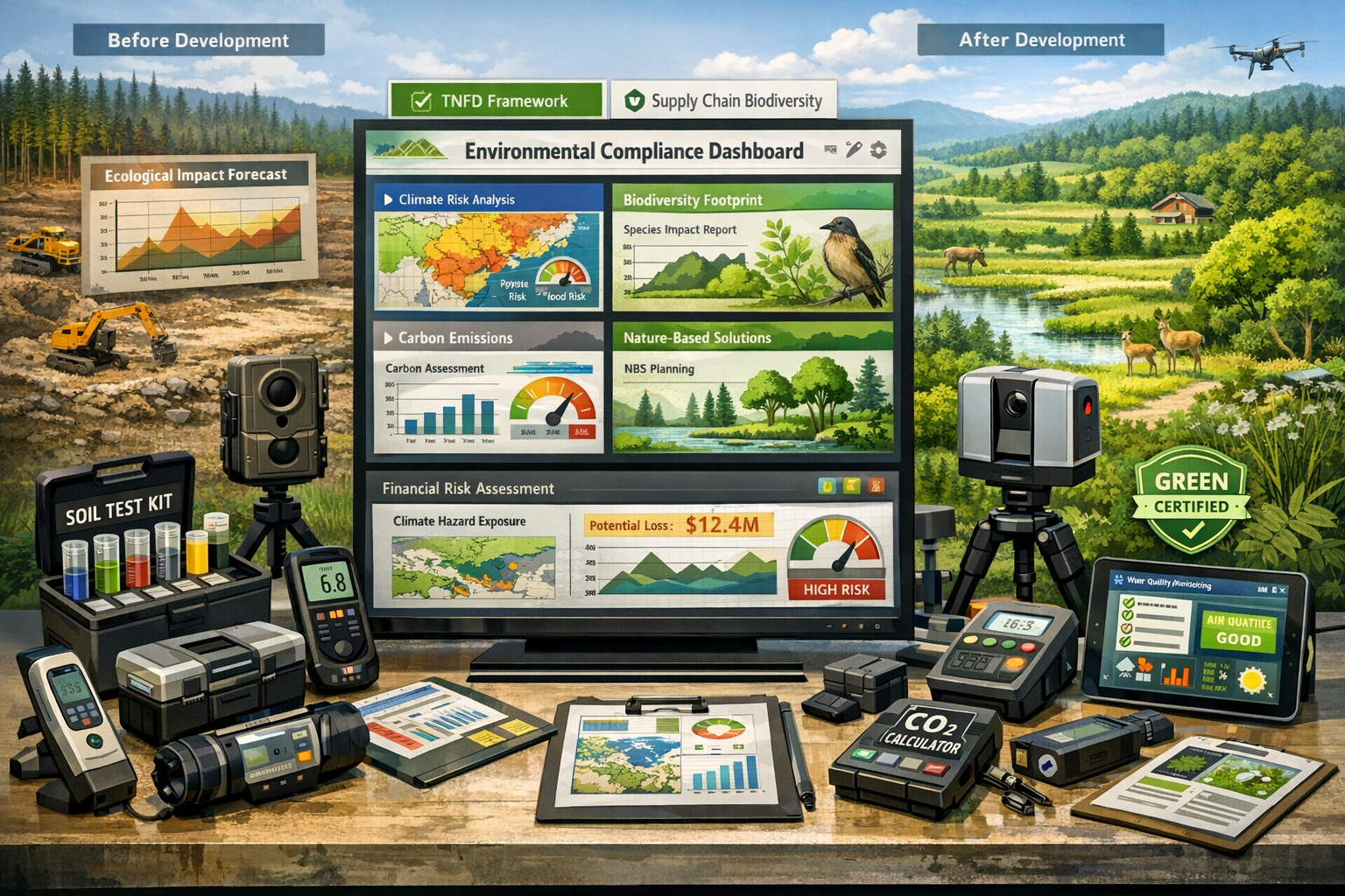
AI-Driven Geospatial Analytics Platforms
Organizations are increasingly using satellite-based location data and ecological metrics to estimate impacts and dependencies on ecosystems at the site level[2]. These AI-powered platforms represent the most significant technological advancement in property survey capabilities.
Key Features of Modern Geospatial Analytics Tools:
| Feature | Application in Property Surveys | Benefits |
|---|---|---|
| Satellite Imagery Analysis | Historical land use changes, vegetation cover tracking | Establishes baseline conditions without site access |
| Habitat Degradation Mapping | Identifies stressed ecosystems, fragmented habitats | Prioritizes conservation areas in site planning |
| Species Distribution Modeling | Predicts presence of protected species | Prevents regulatory violations and project delays |
| Ecosystem Service Valuation | Quantifies carbon storage, water filtration, pollination | Supports cost-benefit analysis of design alternatives |
| Change Detection Algorithms | Monitors environmental conditions over time | Validates mitigation effectiveness post-construction |
These platforms enable location-specific environmental risk assessment previously unavailable to surveyors, transforming how ecological considerations integrate into property development planning.
Leading Geospatial Analytics Solutions for 2026:
- Google Earth Engine: Provides access to decades of satellite imagery with built-in analysis tools for vegetation indices, land cover classification, and change detection
- Planet Labs: Offers daily satellite imagery at 3-5 meter resolution, enabling real-time monitoring of site conditions and surrounding ecosystems
- Esri ArcGIS: Comprehensive GIS platform with specialized ecology and conservation modules for habitat suitability modeling and biodiversity assessment
- Mapbox: Customizable mapping platform with APIs for integrating ecological data layers into project planning dashboards
When conducting environmental issues assessments, these geospatial tools provide the foundational data layer for comprehensive ecological forecasting.
Biodiversity Impact Assessment Software
The introduction of ISO 17298:2025 has catalyzed development of specialized software for standardized biodiversity impact assessment[1]. These tools translate complex ecological data into actionable development guidance.
Core Capabilities:
✨ Baseline Biodiversity Surveys: Digital field data collection with species identification support using AI-powered image recognition
✨ Impact Prediction Modeling: Quantifies expected biodiversity losses under different development scenarios using established ecological relationships
✨ Mitigation Hierarchy Application: Guides users through avoid-minimize-restore-offset sequence with quantified outcomes at each stage
✨ Net Gain Calculation: Computes biodiversity net gain/loss using standardized metrics aligned with regulatory requirements
✨ Monitoring Protocol Generation: Creates long-term monitoring plans with data collection schedules and success criteria
Recommended Biodiversity Assessment Platforms:
- iNaturalist: Community science platform for species identification and occurrence documentation, useful for baseline surveys
- IBAT (Integrated Biodiversity Assessment Tool): Provides access to global biodiversity databases including protected areas, threatened species, and key biodiversity areas
- Biodiversity Metric 4.0 Calculator: UK-specific tool for calculating biodiversity units and net gain, increasingly used as international model
- NatureServe Vista: Decision-support software for conservation planning and development siting to minimize ecological impacts
These specialized tools complement traditional property survey approaches. For developers seeking comprehensive assessments, combining biodiversity software with Level 3 full building surveys provides complete due diligence coverage.
Physical Climate Risk Modeling Systems
With 25% of global portfolio equity value exposed to severe physical hazards[3], infrastructure and real estate assets now require robust physical-risk modeling incorporating climate-scenario analysis.
Climate Risk Assessment Components:
🌊 Flood Risk Modeling: Projects future flood exposure under different climate scenarios, incorporating sea-level rise, increased precipitation, and storm surge
🔥 Wildfire Susceptibility Analysis: Evaluates vegetation types, topography, and climate projections to assess fire risk over property lifetime
🌡️ Heat Stress Mapping: Identifies urban heat island effects and projects temperature extremes affecting building performance and occupant comfort
💨 Wind Hazard Assessment: Models changing storm patterns and extreme wind events relevant to structural design requirements
🏜️ Drought and Water Stress: Evaluates long-term water availability for landscaping, operations, and ecosystem maintenance
Leading Climate Risk Platforms:
- Jupiter Intelligence: Provides hyperlocal climate risk analytics with asset-level resolution for real estate portfolios
- Four Twenty Seven (Moody's): Offers physical climate risk scores integrated with financial risk assessment frameworks
- Climate Engine: Open-source platform providing access to climate datasets and analysis tools for custom risk modeling
- RMS Climate Change Models: Catastrophe modeling specifically designed for insurance and real estate applications
Integrating climate risk modeling into property surveys ensures developments remain viable and valuable throughout their operational lifetime, protecting both developer and end-user investments.
Carbon Assessment and Financial Modeling Integration
Organizations are now required to differentiate between gross emissions reductions and residual emissions, with carbon pricing integrated into procurement and investment decisions[1]. This necessitates tools that seamlessly combine carbon accounting with financial analysis.
Integrated Carbon-Financial Assessment Tools:
Whole Life Carbon Calculators: These tools assess embodied carbon (materials, construction) and operational carbon (energy use, maintenance) across a building's entire lifecycle:
- One Click LCA: Building-specific life cycle assessment with material databases and carbon footprint calculations
- EC3 (Embodied Carbon in Construction Calculator): Open-source tool with extensive material carbon data
- RICS Whole Life Carbon Assessment: Framework aligned with professional surveying standards
Carbon Pricing Models: Assign financial values to carbon emissions, enabling direct comparison with other project costs:
- Internal carbon prices typically range from £50-£200 per tonne CO2e in 2026
- Shadow pricing helps evaluate long-term financial exposure to potential carbon taxes
- Scenario analysis tests project viability under different carbon price trajectories
Green Finance Eligibility Tools: Assess whether projects meet criteria for sustainable finance instruments:
- Green bond eligibility checkers aligned with Climate Bonds Initiative standards
- Sustainability-linked loan calculators with performance-based interest rates
- ESG scoring systems used by institutional investors
This financial integration transforms carbon assessment from a compliance exercise into a strategic planning tool that influences fundamental design decisions and funding strategies.
Supply Chain Biodiversity Footprinting Tools
Organizations are identifying upstream biodiversity risks through supply chain mapping and sourcing region analysis[1]. For property developers, this extends ecological responsibility beyond the immediate development site to encompass material sourcing and contractor selection.
Supply Chain Assessment Capabilities:
📦 Material Origin Tracing: Identifies geographic sources of construction materials and associated biodiversity impacts in extraction/production regions
🌍 Sourcing Region Risk Mapping: Evaluates biodiversity sensitivity of areas where materials originate, flagging high-risk sources
🔗 Supplier Environmental Performance: Assesses contractor and material supplier sustainability credentials and certifications
📊 Cumulative Impact Calculation: Aggregates biodiversity footprint across entire material supply chain for comprehensive project impact assessment
Practical Implementation:
- Supplier questionnaires requesting biodiversity policies and impact assessments
- Material databases with embedded environmental impact data (e.g., Environmental Product Declarations)
- Blockchain tracing systems for verified sustainable material sourcing
- Third-party certifications (FSC for timber, Responsible Steel, etc.) as screening criteria
This expanded scope of ecological forecasting ensures property developments minimize environmental harm throughout their entire value chain, not just at the construction site itself.
Implementing Sustainability-Driven Ecological Forecasting in Property Surveys: Practical Framework for 2026 Compliance
Phase 1: Pre-Survey Planning and Scope Definition
Successful implementation of Sustainability-Driven Ecological Forecasting in Property Surveys: Tools for 2026 Green Development Compliance begins before surveyors ever visit the site. Proper planning ensures comprehensive data collection and regulatory alignment.
Essential Pre-Survey Activities:
1. Regulatory Requirements Mapping
Identify all applicable environmental regulations, standards, and disclosure requirements:
- Local planning authority environmental policies
- National biodiversity net gain requirements
- ISO 17298:2025 compliance obligations
- TNFD disclosure expectations for project financing
- Sector-specific environmental standards
2. Stakeholder Consultation
Engage with parties who will use or be affected by the ecological forecasting results:
- Developers and investors: Understand risk tolerance and sustainability objectives
- Planning authorities: Clarify information requirements for application approval
- Local communities: Identify environmental concerns and priorities
- Conservation organizations: Gather existing ecological data and local knowledge
- Future occupants: Determine environmental performance expectations
3. Baseline Data Acquisition
Gather existing environmental information before field surveys:
- Historical satellite imagery and aerial photographs
- Previous ecological surveys and environmental impact assessments
- Protected species records from national databases
- Soil surveys and geological maps
- Climate data and flood risk maps
- Local biodiversity action plans
4. Survey Methodology Selection
Choose appropriate survey techniques based on site characteristics, development type, and regulatory requirements:
- Habitat surveys: Phase 1 habitat classification, National Vegetation Classification
- Species surveys: Protected species protocols (bats, great crested newts, birds, etc.)
- Soil and water testing: Contamination screening, nutrient analysis, pH testing
- Topographic surveys: LiDAR, drone photogrammetry, traditional total station
- Climate monitoring: Weather station installation for microclimate data
This planning phase establishes the foundation for comprehensive ecological forecasting. When combined with traditional RICS building surveys, developers gain complete understanding of both structural and environmental considerations.
Phase 2: Field Data Collection and Site Assessment
With planning complete, surveyors execute comprehensive field data collection using modern tools and standardized protocols.
Advanced Field Survey Techniques:
Drone-Based Remote Sensing
Unmanned aerial vehicles (UAVs) revolutionize ecological data collection:
- Multispectral imaging: Captures vegetation health indices (NDVI) revealing stressed or declining plant communities
- Thermal imaging: Identifies water seepage, microclimate variations, and potential wildlife habitat features
- 3D photogrammetry: Creates detailed terrain models for erosion risk assessment and drainage planning
- Repeat surveys: Tracks seasonal changes in vegetation and habitat use patterns
Environmental DNA (eDNA) Sampling
This cutting-edge technique detects species presence through DNA traces in soil and water:
- Non-invasive: Identifies species without direct observation or capture
- Comprehensive: Detects rare and cryptic species missed by traditional surveys
- Efficient: Single water sample can identify dozens of aquatic species
- Cost-effective: Reduces need for multiple season-specific surveys
IoT Environmental Monitoring
Internet-of-Things sensors provide continuous environmental data:
- Soil moisture sensors: Track drainage patterns and erosion risk factors
- Water quality monitors: Measure pH, dissolved oxygen, turbidity in real-time
- Acoustic recorders: Capture bird and bat calls for species identification
- Weather stations: Document microclimate conditions affecting habitat suitability
Mobile GIS Data Collection
Field surveyors use tablet-based GIS applications for standardized data capture:
- GPS-tagged observations: Precisely locate habitat features, species sightings, and environmental concerns
- Photo documentation: Georeferenced images with metadata for future reference
- Standardized forms: Ensure consistent data collection aligned with ISO 17298:2025 requirements
- Real-time validation: Immediate data quality checks prevent survey gaps
This modern field survey approach generates rich, georeferenced datasets that feed directly into ecological forecasting models, eliminating transcription errors and accelerating analysis timelines.
Phase 3: Predictive Modeling and Impact Forecasting
With comprehensive baseline data collected, surveyors apply predictive models to forecast environmental impacts under different development scenarios.
Core Modeling Approaches:
Habitat Suitability Modeling
Predicts which species can persist on-site post-development:
- MaxEnt (Maximum Entropy): Uses species occurrence records and environmental variables to predict habitat suitability across the site
- Species Distribution Models: Forecasts range shifts under climate change scenarios
- Connectivity Analysis: Evaluates whether developed site maintains wildlife movement corridors
Erosion and Sediment Transport Modeling
Projects soil loss and downstream impacts:
- RUSLE (Revised Universal Soil Loss Equation): Estimates annual soil loss based on rainfall, soil type, slope, and vegetation cover
- WEPP (Water Erosion Prediction Project): Simulates individual storm events and sediment delivery to waterways
- Scenario comparison: Evaluates effectiveness of erosion control measures (silt fencing, vegetation buffers, permeable surfaces)
Hydrological Impact Assessment
Forecasts changes to water quantity and quality:
- Stormwater runoff modeling: Predicts peak flows and volumes under different surface cover scenarios
- Groundwater recharge analysis: Evaluates impacts of impervious surfaces on aquifer replenishment
- Water quality modeling: Estimates pollutant loading to receiving waters from construction and operation
Biodiversity Net Gain Calculation
Quantifies net biodiversity outcome:
- Baseline biodiversity units: Calculates existing biodiversity value using habitat type, condition, and strategic significance
- Post-development units: Projects biodiversity value after development with proposed mitigation
- Net gain/loss: Determines whether project achieves required biodiversity net gain percentage (typically 10% in UK, varying elsewhere)
Carbon Sequestration Forecasting
Estimates changes in carbon storage:
- Vegetation carbon stock assessment: Quantifies carbon stored in trees, shrubs, and soil organic matter
- Development impact: Calculates carbon releases from vegetation removal and soil disturbance
- Mitigation potential: Evaluates carbon sequestration from proposed landscaping and green infrastructure
These models transform raw survey data into actionable forecasts that inform design decisions, regulatory submissions, and stakeholder communications. The predictive insights enable developers to optimize site layouts, minimize environmental harm, and demonstrate compliance with emerging standards.
Phase 4: Mitigation Strategy Development and Optimization
Ecological forecasting identifies potential impacts; mitigation strategies address them. The mitigation hierarchy—avoid, minimize, restore, offset—guides systematic approach to reducing environmental harm.
Avoidance Strategies
The most effective mitigation is avoiding impacts entirely:
- Site layout optimization: Position buildings, roads, and infrastructure to avoid sensitive habitats and species breeding areas
- Seasonal scheduling: Time construction activities to avoid critical periods (bird nesting, amphibian breeding, bat hibernation)
- Buffer zones: Establish development-free areas around watercourses, ancient woodlands, and protected habitats
Minimization Techniques
Where impacts cannot be avoided, minimize their extent and severity:
- Reduced footprint: Compact development design minimizing land take
- Permeable surfaces: Reduce runoff and maintain groundwater recharge
- Wildlife-friendly lighting: Minimize light pollution affecting nocturnal species
- Noise and vibration controls: Protect sensitive species during construction
- Pollution prevention: Silt fencing, spill containment, dust suppression
Restoration and Enhancement
Improve degraded habitats and create new ecological features:
- Habitat restoration: Rehabilitate degraded areas within the development site
- Green infrastructure: Living roofs, bioswales, rain gardens providing habitat and ecosystem services
- Native landscaping: Replace ornamental species with native plants supporting local wildlife
- Water features: Create ponds, wetlands, or restore natural watercourses
Biodiversity Offsetting
When residual impacts remain after avoidance, minimization, and restoration:
- Off-site habitat creation: Establish new habitats in locations identified through spatial prioritization
- Habitat banking: Purchase biodiversity credits from certified habitat banks
- Long-term management: Ensure offset habitats receive appropriate management for minimum 30 years
- Monitoring and adaptive management: Track offset performance and adjust management as needed
Nature-Based Solutions Integration
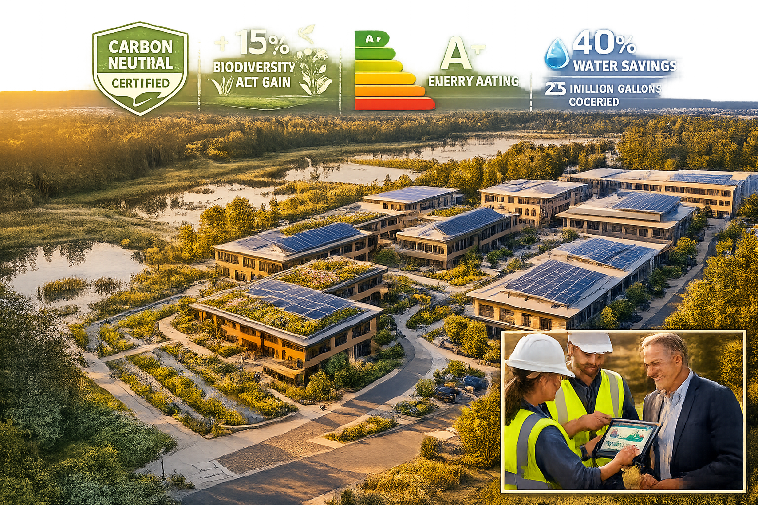
Nature-based solutions have transitioned from optional add-ons to strategic necessities[1], with biodiversity considerations becoming standard practice:
- Urban forests: Trees providing cooling, air quality improvement, carbon sequestration, and habitat
- Constructed wetlands: Treat stormwater while creating wildlife habitat
- Green walls: Vertical vegetation providing insulation, air quality benefits, and biodiversity support
- Soil bioengineering: Living plant materials for slope stabilization replacing concrete structures
These mitigation strategies, informed by ecological forecasting results, enable developers to achieve net positive environmental outcomes while meeting regulatory requirements and stakeholder expectations. For guidance on incorporating environmental considerations into broader property assessments, review our resources on building defects surveys.
Phase 5: Reporting, Disclosure, and Regulatory Submission
The final phase translates technical ecological forecasting results into clear, compliant documentation for regulators, investors, and stakeholders.
Comprehensive Reporting Framework:
Executive Summary
Concise overview for decision-makers:
- Project description and development parameters
- Key environmental constraints and opportunities
- Predicted impacts and proposed mitigation
- Biodiversity net gain calculation
- Regulatory compliance status
- Recommendations and next steps
Technical Assessment Documentation
Detailed methodology and findings:
- Baseline conditions description with supporting data
- Survey methodologies aligned with ISO 17298:2025 standards
- Predictive modeling approaches and assumptions
- Impact forecasts with uncertainty quantification
- Mitigation hierarchy application and residual impacts
- Monitoring and adaptive management plans
Regulatory Compliance Matrices
Systematic demonstration of compliance:
| Requirement | Standard/Regulation | Compliance Status | Evidence Location |
|---|---|---|---|
| Biodiversity Impact Assessment | ISO 17298:2025 | ✅ Compliant | Section 4.2 |
| Biodiversity Net Gain | Local Planning Policy | ✅ 12% net gain achieved | Appendix C |
| Protected Species | Wildlife & Countryside Act | ✅ Mitigation approved | Section 5.3 |
| Climate Risk Disclosure | TNFD Framework | ✅ Physical risks assessed | Section 6.1 |
| Carbon Assessment | Local Climate Policy | ✅ Net zero pathway | Appendix D |
Stakeholder Communication Materials
Accessible summaries for non-technical audiences:
- Visual impact assessments: Before/after renderings showing ecological features
- Infographics: Simplified biodiversity net gain calculations and carbon footprint
- Interactive maps: Web-based platforms showing habitat distributions and mitigation measures
- Plain language summaries: Non-technical explanations of environmental benefits
Financial Disclosure Integration
Mandatory integration of sustainability data into financial reporting[1]:
- Nature-related financial risks: Quantified exposure to ecosystem degradation
- Climate scenario analysis: Financial impacts under different climate futures
- Green finance eligibility: Documentation supporting sustainable financing applications
- ESG scoring: Environmental performance metrics for investor evaluation
Digital Data Delivery
Modern reporting increasingly uses digital platforms:
- GIS data packages: Georeferenced survey data in standard formats (shapefile, GeoJSON)
- Interactive dashboards: Real-time monitoring data accessible to stakeholders
- API integration: Automated data feeds to planning authority systems
- Blockchain verification: Immutable records of environmental commitments and performance
This comprehensive reporting approach ensures ecological forecasting results effectively inform decision-making across all stakeholder groups while meeting increasingly stringent disclosure requirements.
Industry-Specific Applications and Case Studies
Residential Development: Balancing Housing Needs with Ecological Protection
Residential developments face unique challenges balancing housing demand with environmental protection. Sustainability-Driven Ecological Forecasting in Property Surveys: Tools for 2026 Green Development Compliance enables developers to identify optimal solutions.
Typical Residential Development Challenges:
- Greenfield site conversion: Minimizing biodiversity loss when developing previously undeveloped land
- Urban densification: Creating green space and habitat within constrained urban sites
- Stormwater management: Preventing increased flood risk to surrounding properties
- Community expectations: Meeting resident demands for green amenities and environmental quality
Ecological Forecasting Solutions:
Habitat Connectivity Planning: Geospatial analysis identifies critical wildlife corridors, enabling site layouts that maintain connectivity between habitat patches. Development footprints avoid corridor areas, while landscaping creates stepping-stone habitats supporting species movement.
Green Infrastructure Integration: Hydrological modeling optimizes placement of bioswales, rain gardens, and permeable paving to manage stormwater while creating habitat. Forecasting demonstrates these features prevent downstream flooding while supporting biodiversity.
Tree Canopy Optimization: Climate modeling identifies optimal tree placement for cooling benefits, while species selection balances native habitat value with resident amenity preferences. Carbon sequestration forecasts quantify climate benefits over development lifetime.
Case Example: A 200-home development in Southeast England used ecological forecasting to achieve 15% biodiversity net gain while meeting housing density requirements. Geospatial analysis identified a degraded hedgerow as critical bat foraging corridor. The development design preserved and enhanced the hedgerow, while creating complementary habitat features (ponds, wildflower meadows) in areas forecasted as lower ecological value. The resulting development achieved planning approval in record time and commanded 8% price premium over comparable developments.
For developers considering residential projects, combining ecological forecasting with traditional property survey approaches ensures comprehensive due diligence.
Commercial and Industrial Development: Demonstrating Corporate Environmental Responsibility
Commercial and industrial developers face intense scrutiny from investors, regulators, and corporate tenants demanding verifiable environmental performance.
Commercial Development Priorities:
- ESG investor requirements: Demonstrating environmental credentials to access sustainable finance
- Tenant expectations: Meeting corporate occupier sustainability commitments
- Operational efficiency: Minimizing long-term environmental costs and climate risks
- Regulatory compliance: Satisfying increasingly stringent environmental disclosure requirements
Forecasting Applications:
Physical Climate Risk Assessment: Modeling evaluates site exposure to flooding, heat stress, and extreme weather under climate scenarios through 2050-2100. Results inform building design (flood resilience, cooling systems) and insurance risk assessment. Investors use this data to evaluate long-term asset value stability.
Supply Chain Biodiversity Footprinting: Assessment traces construction materials to source regions, identifying biodiversity risks in extraction areas. Developers use results to select lower-impact materials and suppliers with verified sustainability credentials, supporting corporate biodiversity commitments.
Net Zero Pathway Modeling: Integrated carbon and financial modeling demonstrates pathway to net zero emissions, including embodied carbon reduction strategies and operational efficiency measures. Forecasting quantifies carbon pricing exposure under different regulatory scenarios, informing design decisions and financial planning.
Case Example: A logistics facility development used climate risk modeling to identify significant flood exposure under 2°C warming scenario. Forecasting demonstrated that elevating the building floor by 1.2 meters would eliminate flood risk while adding only 3% to construction costs. This modification enabled the developer to secure green financing at 0.5% lower interest rate, generating £2.1 million in interest savings over the loan term—far exceeding the additional construction cost.
Infrastructure Projects: Long-Term Environmental Performance
Infrastructure developments—roads, utilities, renewable energy—require ecological forecasting addressing decades-long operational periods and extensive geographic footprints.
Infrastructure-Specific Considerations:
- Linear corridors: Roads, pipelines, and transmission lines fragmenting habitats
- Operational impacts: Ongoing noise, light, and collision risks affecting wildlife
- Long asset lifetimes: 50-100 year operational periods requiring climate change consideration
- Public interest: High stakeholder scrutiny and community engagement requirements
Forecasting Approaches:
Landscape-Scale Connectivity Analysis: Modeling evaluates how linear infrastructure affects wildlife movement across entire landscapes. Results identify optimal crossing locations (wildlife bridges, underpasses) and guide corridor routing to minimize fragmentation.
Operational Impact Modeling: Forecasting predicts long-term effects of noise, lighting, and collision risk on wildlife populations. Models test effectiveness of mitigation measures (acoustic barriers, wildlife-friendly lighting, crossing structures) over decades-long operational periods.
Climate Resilience Assessment: Infrastructure assets require climate scenario analysis addressing entire operational lifetime. Modeling evaluates performance under temperature extremes, changed precipitation patterns, and sea-level rise, informing design specifications and maintenance planning.
Case Example: A 45-kilometer highway project used ecological forecasting to optimize wildlife crossing locations. Habitat connectivity modeling identified three critical crossing zones where the road would sever important movement corridors. The project incorporated two wildlife overpasses and five underpasses at these locations. Post-construction monitoring confirmed the structures maintain connectivity, with camera traps documenting regular use by deer, badgers, and other species.
For infrastructure developers, ecological forecasting complements traditional engineering surveys, ensuring projects deliver long-term value while minimizing environmental harm. Learn more about comprehensive assessment approaches in our guide to community housing projects and sustainability.
Adaptive Reuse and Renovation: Environmental Considerations in Existing Buildings
Renovation and adaptive reuse projects present unique ecological forecasting challenges, balancing preservation of existing structures with modern environmental performance standards.
Renovation-Specific Challenges:
- Existing site disturbance: Properties often have established vegetation and wildlife use patterns
- Embodied carbon preservation: Retaining existing structures avoids embodied carbon of new construction
- Constrained improvement options: Physical limitations of existing buildings restrict environmental upgrades
- Heritage considerations: Listed buildings and conservation areas limiting modification options
Forecasting Applications:
Habitat Value Assessment: Surveys document ecological features associated with existing buildings—bat roosts in roof spaces, nesting birds in eaves, veteran trees in grounds. Forecasting predicts impacts of renovation activities and identifies timing restrictions and mitigation requirements.
Whole-Life Carbon Comparison: Modeling compares carbon footprint of renovation versus demolition and new construction. Analysis typically shows renovation generates 50-75% less embodied carbon, supporting sustainability case for adaptive reuse.
Energy Performance Forecasting: Building physics modeling predicts energy performance achievable through various retrofit measures, balancing heritage preservation with operational carbon reduction. Climate projections inform passive design improvements addressing future temperature extremes.
Case Example: A Victorian warehouse conversion to residential use incorporated ecological forecasting revealing the building supported a maternity bat roost. Forecasting demonstrated that preserving specific roof access points and timing renovation works outside the breeding season would maintain roost viability. The development incorporated these measures, achieving planning approval while protecting a legally protected species. The project's environmental credentials—combining embodied carbon savings with biodiversity protection—attracted sustainability-focused buyers, achieving 12% price premium.
Renovation projects benefit from combining ecological forecasting with comprehensive structural assessment. Our resources on property renovations that add value provide additional guidance on maximizing renovation outcomes.
Overcoming Implementation Challenges
Data Quality and Availability Issues
Ecological forecasting depends on high-quality baseline data, but data gaps frequently challenge surveyors and developers.
Common Data Challenges:
- Limited historical data: New development areas may lack previous ecological surveys
- Seasonal constraints: Some species surveys require specific seasons, potentially delaying projects
- Data accessibility: Relevant environmental data scattered across multiple agencies and organizations
- Spatial resolution: Available datasets may lack site-specific detail needed for accurate forecasting
Practical Solutions:
Proxy Data and Transfer Learning: When site-specific data is limited, ecological forecasting can use data from similar sites (similar habitat types, geographic proximity, land use history) to calibrate models. Machine learning approaches enable "transfer learning" where models trained on data-rich sites apply to data-poor locations.
Rapid Assessment Protocols: Standardized rapid assessment methods provide baseline ecological data in compressed timeframes. While less comprehensive than full seasonal surveys, rapid assessments generate sufficient data for initial forecasting, with targeted follow-up surveys addressing specific concerns.
Open Data Integration: Numerous environmental datasets are now freely available through government agencies, research institutions, and citizen science platforms. Surveyors should systematically incorporate these resources:
- Satellite imagery: Copernicus, Landsat, and commercial providers offer free or low-cost imagery
- Species records: National biodiversity databases provide occurrence records for protected species
- Climate data: Historical and projected climate data available from meteorological services
- Soil and geology: Government geological surveys provide detailed soil and bedrock information
Data Sharing Initiatives: Industry collaboration improves data availability. Developers and surveyors should contribute anonymized ecological survey data to shared databases, creating cumulative knowledge resources benefiting future projects.
Cost and Resource Constraints
Comprehensive ecological forecasting requires investment in specialized tools, expertise, and survey time. Budget-conscious developers may view these costs as barriers.
Cost Optimization Strategies:
Tiered Assessment Approach: Not all projects require the same level of ecological forecasting. A tiered approach matches assessment intensity to project risk:
- Tier 1 (Desktop screening): Geospatial analysis and existing data review for low-risk sites
- Tier 2 (Targeted surveys): Field surveys addressing specific concerns identified in screening
- Tier 3 (Comprehensive assessment): Full seasonal surveys and detailed modeling for high-risk or large-scale projects
Technology Leverage: Modern tools often reduce costs compared to traditional approaches:
- Drone surveys collect data faster and more safely than manual surveys
- eDNA sampling identifies species without labor-intensive trapping or observation
- Automated acoustic monitoring operates continuously without surveyor presence
- AI-powered image analysis accelerates species identification from camera trap photos
Early Integration: Incorporating ecological forecasting at project inception prevents costly redesigns and delays. Early identification of environmental constraints enables site selection and design optimization when changes are least expensive.
Value Demonstration: Frame ecological forecasting as investment rather than cost:
- Risk mitigation: Prevents regulatory delays and legal challenges
- Market premium: Environmental credentials attract conscious buyers and tenants
- Finance access: Enables green financing at favorable terms
- Operational savings: Nature-based solutions often reduce long-term maintenance costs
Case Example: A developer initially balked at £45,000 cost for comprehensive ecological forecasting on a mixed-use development. However, the assessment identified a great crested newt population that would have halted construction if discovered during site works. Early identification enabled the developer to implement mitigation (alternative habitat creation, translocation) during pre-construction phase, avoiding an estimated 6-month construction delay that would have cost £380,000 in holding costs and contract penalties.
Skills Gap and Expertise Requirements
Effective implementation of Sustainability-Driven Ecological Forecasting in Property Surveys: Tools for 2026 Green Development Compliance requires multidisciplinary expertise spanning ecology, geospatial analysis, climate science, and property development.
Addressing the Skills Gap:
Professional Development: Surveyors should pursue continuing professional development in environmental assessment:
- RICS sustainability qualifications: Demonstrate competence in environmental assessment
- Ecological survey certifications: Species-specific survey licenses (bats, great crested newts, etc.)
- GIS and remote sensing training: Technical skills for geospatial data analysis
- Climate risk assessment courses: Understanding physical climate risk modeling
Collaborative Teams: Complex projects benefit from multidisciplinary teams:
- Chartered surveyors: Property expertise and regulatory knowledge
- Ecologists: Species and habitat assessment skills
- GIS specialists: Geospatial data analysis and modeling
- Climate scientists: Climate scenario analysis and risk assessment
- Engineers: Integration of nature-based solutions into development design
Technology Partnerships: Surveyors can partner with technology providers offering specialized ecological forecasting platforms, accessing advanced capabilities without developing in-house expertise.
Quality Assurance: Implement review processes ensuring ecological forecasting meets professional standards:
- Peer review: Independent expert review of methodology and conclusions
- Accreditation schemes: Use of accredited laboratories for eDNA analysis and other specialized testing
- Professional indemnity insurance: Adequate coverage for environmental assessment work
Organizations like Prince Chartered Surveyors invest in continuous skills development, ensuring teams remain current with evolving standards and technologies. This commitment to professional excellence delivers reliable, compliant ecological forecasting for clients.
Future Trends and Emerging Developments
Artificial Intelligence and Machine Learning Advancement
AI capabilities in ecological forecasting will expand dramatically beyond current applications.
Emerging AI Applications:
Predictive Species Distribution Models: Next-generation models will integrate climate projections, land use change scenarios, and species interaction networks to forecast biodiversity changes decades into the future with unprecedented accuracy.
Automated Habitat Monitoring: Computer vision algorithms will analyze satellite and drone imagery to automatically detect habitat changes, vegetation health declines, and wildlife presence, enabling continuous monitoring at scale previously impossible.
Optimization Algorithms: AI will test thousands of site layout permutations, identifying designs that optimize development objectives (density, cost, amenity) while minimizing ecological impacts and maximizing biodiversity net gain.
Natural Language Processing: AI will automatically extract relevant environmental information from planning documents, environmental impact assessments, and scientific literature, accelerating baseline data compilation.
These AI advancements will make ecological forecasting faster, more accurate, and more accessible to developers of all scales.
Integration with Digital Twins and BIM
Digital twins—virtual replicas of physical assets—will increasingly incorporate ecological forecasting, creating living models that track environmental performance throughout development lifecycle.
Digital Twin Capabilities:
Real-Time Environmental Monitoring: IoT sensors feed continuous data (soil moisture, water quality, wildlife activity) into digital twin, enabling comparison of actual versus predicted environmental performance.
Scenario Testing: Developers can test design modifications in digital twin, immediately seeing forecasted ecological impacts and biodiversity net gain calculations.
Lifecycle Management: Digital twin tracks environmental performance from construction through operation and eventual decommissioning, ensuring long-term mitigation commitments are maintained.
BIM Integration: Environmental data layers integrate with Building Information Modeling, enabling architects and engineers to visualize ecological constraints and opportunities alongside structural and mechanical systems.
This integration transforms ecological forecasting from one-time assessment to continuous management tool supporting adaptive environmental stewardship.
Standardization and Harmonization of Assessment Frameworks
The convergence of climate and biodiversity disclosure frameworks[1] will continue, creating unified assessment approaches reducing complexity and compliance burden.
Harmonization Trends:
Integrated Reporting Standards: Climate (GHG Protocol) and biodiversity (ISO 17298:2025) standards will align, enabling single assessment addressing both dimensions.
Global Metric Standardization: International agreement on biodiversity units, carbon accounting methodologies, and ecosystem service valuation will enable consistent comparison across projects and jurisdictions.
Digital Reporting Formats: Machine-readable data standards (XBRL extensions for environmental data) will enable automated regulatory submission and investor disclosure.
Mutual Recognition: International agreements will enable environmental assessments conducted in one jurisdiction to satisfy requirements in others, reducing duplication for multinational developers.
These standardization efforts will make Sustainability-Driven Ecological Forecasting in Property Surveys: Tools for 2026 Green Development Compliance more streamlined and cost-effective.
Nature-Positive Development Targets
Regulatory requirements are shifting from "do no harm" to "net positive" environmental outcomes.
Emerging Requirements:
Mandatory Biodiversity Net Gain: More jurisdictions will require developments to deliver measurable biodiversity improvements, with minimum percentages increasing from current 10% to 20% or higher.
Climate-Positive Buildings: Beyond net zero operational carbon, regulations will require buildings to sequester more carbon than their embodied carbon footprint over lifecycle.
Ecosystem Service Enhancement: Developments will need to demonstrate improvements in ecosystem services (water filtration, flood regulation, pollination, recreation) not just biodiversity units.
Long-Term Stewardship Requirements: Regulatory approval will depend on guaranteed long-term management of ecological features, potentially requiring conservation covenants or endowment funding.
These ambitious targets will make robust ecological forecasting essential for demonstrating compliance and securing development approval.
Conclusion: Embracing Ecological Forecasting for Sustainable Development Success
Sustainability-Driven Ecological Forecasting in Property Surveys: Tools for 2026 Green Development Compliance represents far more than regulatory checkbox—it's a strategic capability delivering competitive advantage, risk mitigation, and enhanced financial performance. As environmental regulations tighten, investor expectations evolve, and climate impacts intensify, developers who master ecological forecasting will thrive while others struggle.
The tools and methodologies outlined in this guide—from AI-driven geospatial analytics to biodiversity impact assessment software, from climate risk modeling to supply chain footprinting—provide comprehensive capabilities for understanding, predicting, and optimizing environmental outcomes. These technologies transform property surveys from static documentation exercises into dynamic planning tools that inform design decisions, satisfy regulatory requirements, and demonstrate environmental stewardship to increasingly conscious stakeholders.
Actionable Next Steps for Developers and Surveyors
Immediate Actions (Next 30 Days):
-
Assess Current Capabilities: Evaluate existing survey methodologies against 2026 compliance requirements, identifying gaps in ecological forecasting capabilities
-
Build Knowledge: Invest in professional development focusing on ISO 17298:2025, TNFD frameworks, and ecological forecasting technologies
-
Establish Partnerships: Identify ecological consultants, GIS specialists, and technology providers who can support comprehensive environmental assessment
-
Review Project Pipeline: Evaluate upcoming projects for environmental risks and opportunities, prioritizing those requiring enhanced ecological forecasting
Short-Term Implementation (Next 90 Days):
-
Pilot Project Selection: Choose a representative project for implementing comprehensive ecological forecasting, learning lessons applicable to future developments
-
Technology Acquisition: Invest in core tools (GIS platform, biodiversity assessment software, climate risk modeling) appropriate to project scale and type
-
Baseline Data Compilation: Systematically gather available environmental data for project sites, establishing data libraries supporting rapid assessment
-
Stakeholder Engagement: Initiate conversations with planning authorities, investors, and community groups about environmental expectations and priorities
Long-Term Strategic Development (Next 12 Months):
-
Capability Integration: Embed ecological forecasting into standard development processes, making environmental assessment integral to project planning rather than separate compliance exercise
-
Performance Tracking: Implement monitoring systems validating forecasting accuracy, using results to refine models and demonstrate environmental outcomes
-
Market Positioning: Communicate environmental credentials to investors, buyers, and tenants, differentiating developments through verified sustainability performance
-
Continuous Improvement: Stay current with evolving standards, technologies, and best practices through professional networks and industry engagement
The transition to sustainability-driven development is not optional—it's the defining characteristic of successful property development in 2026 and beyond. Organizations that embrace ecological forecasting as strategic advantage rather than compliance burden will lead the industry, delivering developments that meet market demands, satisfy regulatory requirements, and contribute to environmental recovery.
The tools exist. The frameworks are established. The market is ready. The only question is whether you'll lead the transformation or struggle to catch up.
For expert guidance on implementing Sustainability-Driven Ecological Forecasting in Property Surveys: Tools for 2026 Green Development Compliance in your next development project, contact experienced chartered surveyors who combine traditional property expertise with cutting-edge environmental assessment capabilities. The future of property development is sustainable—ensure your projects are positioned for success.
References
[1] Major Sustainability Predictions And Outlook For 2026 – https://www.tunley-environmental.com/en/insights/major-sustainability-predictions-and-outlook-for-2026
[2] Esg Outlook 2026 Resilience And Evolution – https://www.clearbridge.com/blogs/2026/esg-outlook-2026-resilience-and-evolution
[3] Sustainability And Climate In Focus Trends To Watch For 2026 – https://www.msci.com/research-and-insights/blog-post/sustainability-and-climate-in-focus-trends-to-watch-for-2026
[4] Global Real Estate – https://www.jll.com/en-us/insights/market-outlook/global-real-estate
[5] Predictions 2026 Environmental Sustainability – https://www.forrester.com/blogs/predictions-2026-environmental-sustainability/
[6] 2026 Sustainability Trends – https://www.spglobal.com/sustainable1/en/insights/2026-sustainability-trends
[7] Top 10 Sustainability Predictions For 2026 – https://sustainabilitymag.com/top10/top-10-sustainability-predictions-for-2026
[8] Sustainability Predictions 2026 Sustainability Market – https://www.clearyst.com/resources/sustainability-predictions-2026-sustainability-market
[9] ecoforecast – https://ecoforecast.org
[10] Wef Global Risks Report 2026 – https://reports.weforum.org/docs/WEF_Global_Risks_Report_2026.pdf