

By 2026, over 70% of large-scale property developers in the UK and Europe have adopted some form of digital twin technology — yet fewer than a third are using it to its full potential. The gap between those who simply collect spatial data and those who actively integrate mobile 3D mapping with Geographic Information Systems (GIS) is now the defining competitive edge in land development.
Mobile 3D Mapping and GIS Integration: Creating Digital Twins for Property Development in 2026 is no longer a futuristic concept reserved for tech giants. It is a practical, accessible workflow that chartered surveyors, developers, and planners are deploying on sites of every scale — from single residential plots to entire urban regeneration zones. This article breaks down how these flexible mobile systems and GIS overlays work together to build powerful indoor and outdoor 3D models, sharpen data visualisation, streamline zoning analysis, and ultimately drive smarter decisions across every stage of a land project.
Key Takeaways 📌
- Digital twins combine mobile 3D scanning data with live GIS layers to create accurate, dynamic property models.
- Mobile LiDAR and photogrammetry systems allow rapid indoor and outdoor capture, reducing survey time by up to 60%.
- GIS integration adds zoning, environmental, and infrastructure context that raw 3D models alone cannot provide.
- Decision-making improves significantly when stakeholders can visualise spatial data in a single, interactive environment.
- Property developers, surveyors, and planners all benefit from adopting this workflow in 2026, regardless of project size.
What Is a Digital Twin in Property Development?
A digital twin is a precise, data-rich virtual replica of a physical asset — in this case, a property, site, or urban district. Unlike a static CAD drawing or a basic floor plan, a digital twin is:
- Dynamic: It updates as the physical asset changes.
- Contextual: It layers in external data such as planning zones, utility networks, and environmental risk.
- Interactive: Stakeholders can query, simulate, and analyse it in real time.
💡 "A digital twin is not just a 3D model — it is a living data environment that reflects the real world and helps predict future outcomes."
In property development, digital twins serve multiple purposes across the project lifecycle:
| Stage | Digital Twin Application |
|---|---|
| Site Appraisal | Rapid topographic capture, boundary verification |
| Planning | Zoning overlay analysis, shadow/solar studies |
| Design | BIM integration, clash detection |
| Construction | Progress monitoring, as-built verification |
| Asset Management | Ongoing maintenance, condition monitoring |
For developers exploring property investment opportunities, understanding how digital twins reduce risk at the appraisal stage alone can justify the investment in this technology.
Mobile 3D Mapping Technologies Driving the 2026 Workflow
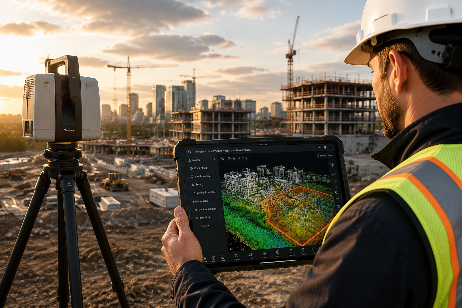
The foundation of any digital twin is accurate spatial data. In 2026, mobile 3D mapping has evolved well beyond fixed terrestrial laser scanners. Three core technologies now dominate:
1. 🛸 Mobile LiDAR Systems
LiDAR (Light Detection and Ranging) emits laser pulses and measures return times to build dense 3D point clouds. Mobile LiDAR units can be:
- Backpack-mounted for indoor and complex terrain capture
- Vehicle-mounted for rapid road and site corridor surveys
- Drone-integrated for aerial topographic mapping
Modern systems capture millions of points per second, producing centimetre-accurate models of entire development sites in hours rather than days. Premium drone survey services now routinely combine aerial LiDAR with photogrammetry for comprehensive site coverage.
2. 📷 Photogrammetry and Reality Capture
Photogrammetry uses overlapping photographs — taken by drones, handheld cameras, or 360° rigs — to reconstruct 3D geometry. In 2026, AI-powered photogrammetry software processes imagery up to 10× faster than five years ago, making it a cost-effective option for smaller sites.
Key advantages include:
- True colour texture mapped onto 3D geometry
- Accessible hardware (smartphones now support basic photogrammetric capture)
- Easy integration with GIS platforms
3. 📡 SLAM-Based Indoor Mapping
Simultaneous Localisation and Mapping (SLAM) technology allows handheld scanners to map indoor spaces without GPS. This is critical for:
- Existing building condition surveys
- Basement and underground space capture
- Listed building interiors where drilling or fixed equipment is prohibited
For complex existing structures, pairing SLAM data with a thorough building survey provides a complete picture of both spatial geometry and structural condition — data that feeds directly into the digital twin.
GIS Integration: Adding Intelligence to 3D Models
Raw 3D point clouds and mesh models are visually impressive but analytically limited on their own. GIS integration is what transforms a 3D model into a true digital twin by adding layers of contextual intelligence.
What GIS Layers Add to a Digital Twin
| GIS Layer | Development Value |
|---|---|
| Planning Zones | Confirms permitted use, density limits, height restrictions |
| Flood Risk Maps | Identifies surface water and fluvial risk zones |
| Utility Networks | Locates underground services for safe excavation |
| Transport Accessibility | PTAL scores, walking distances, public transport links |
| Environmental Constraints | Tree Preservation Orders, ecological designations |
| Demographic Data | Population density, income profiles for viability modelling |
| Heritage Overlays | Listed buildings and conservation area boundaries |
The Integration Workflow in 2026
Modern GIS platforms — including ESRI ArcGIS, QGIS, and emerging cloud-native tools — now support direct import of point cloud and mesh data. The typical integration workflow follows these steps:
- Capture — Mobile LiDAR or photogrammetry survey conducted on site
- Process — Point cloud registered, cleaned, and converted to mesh or BIM
- Georeference — Model aligned to real-world coordinate system (e.g., British National Grid)
- Layer — GIS datasets overlaid: planning, environment, infrastructure
- Analyse — Spatial queries run: zoning compliance, shadow studies, access analysis
- Visualise — Interactive 3D GIS environment shared with stakeholders
- Update — Model refreshed as site conditions change
💡 "The power of GIS integration is not in any single data layer — it is in the ability to ask spatial questions that no single dataset could answer alone."
Mobile 3D Mapping and GIS Integration: Creating Digital Twins for Property Development in 2026 — Practical Applications
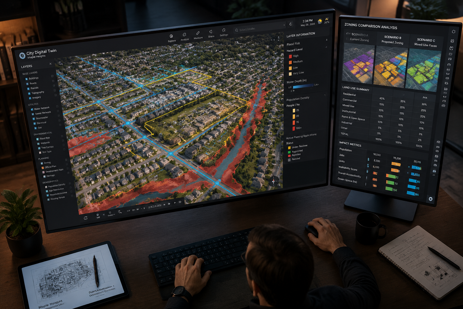
Understanding the technology is one thing. Seeing how it applies to real development scenarios is where the value becomes tangible.
🏘️ Residential Site Appraisal
Before a developer commits capital to a land acquisition, a mobile 3D survey combined with GIS analysis can answer critical questions within 24–48 hours:
- What is the actual topography, and how does it affect buildable area?
- Are there flood risk or ground stability constraints?
- What planning policy applies, and what density is achievable?
- How do neighbouring structures affect daylight and overshadowing?
This rapid appraisal capability is particularly valuable when evaluating land funding opportunities where speed of due diligence is a competitive advantage.
🏢 Mixed-Use Urban Regeneration
Large-scale urban projects involve dozens of stakeholders — planners, architects, engineers, community groups, and investors. A shared digital twin hosted on a cloud GIS platform allows all parties to:
- Navigate the proposed development in 3D
- Query planning compliance in real time
- Simulate construction phasing and access routes
- Assess environmental impact across the whole site
For block management professionals overseeing multi-unit developments, the property inspection process is also enhanced when inspectors can reference a current digital twin rather than outdated floor plans.
🏛️ Heritage and Conservation Projects
Working within conservation areas or with listed buildings demands millimetre-accurate documentation. SLAM-based indoor scanning combined with heritage GIS overlays allows:
- Non-invasive capture of fragile historic fabric
- Accurate record of existing conditions before any intervention
- Compliance documentation for planning and listed building consent applications
🌱 Garden Villages and New Communities
The UK's ongoing housing challenge — particularly around garden village development — is being addressed partly through better spatial planning tools. Digital twins of proposed garden village sites allow planners to test infrastructure layouts, green space provision, and phasing strategies before a single planning application is submitted.
Mobile 3D Mapping and GIS Integration: Creating Digital Twins for Property Development in 2026 — Benefits for Decision-Making
The ultimate purpose of this technology stack is to make better decisions, faster. Here is how each stakeholder group benefits:
For Property Developers 💼
- Reduced risk at acquisition through rapid site intelligence
- Faster planning submissions with accurate, GIS-verified supporting data
- Lower design costs by identifying constraints before architect fees accumulate
- Stronger investor confidence through professional visualisation of proposals
For Chartered Surveyors 📐
- More accurate valuations informed by precise spatial data — a key consideration when undertaking an independent property valuation
- Comprehensive building assessments that capture conditions traditional tape measures miss
- Defensible records for dispute resolution and expert witness reports
For Planners and Local Authorities 🏛️
- Better quality applications with 3D context models
- Faster assessment of impact on townscape and heritage
- Improved public engagement through accessible 3D visualisations
For Asset Managers 🔧
- Ongoing condition monitoring without repeated full surveys
- Maintenance planning informed by accurate spatial records
- Compliance documentation always up to date
Challenges and Considerations
No technology is without its complications. Developers and surveyors adopting mobile 3D mapping and GIS integration in 2026 should be aware of:
⚠️ Data Volume and Processing
Mobile LiDAR surveys generate enormous datasets — a single building survey can produce hundreds of gigabytes of point cloud data. Robust cloud storage and processing pipelines are essential.
⚠️ Coordinate System Accuracy
GIS integration depends on precise georeferencing. Errors in ground control points or coordinate transformations can misalign the 3D model with GIS layers, leading to flawed analysis. Always verify alignment against known survey benchmarks.
⚠️ Data Currency
A digital twin is only as useful as its most recent update. Establishing clear update protocols — particularly on active construction sites — is critical to maintaining accuracy.
⚠️ Interoperability
Not all 3D formats work seamlessly with all GIS platforms. Common exchange formats including IFC, OBJ, FBX, and LAS/LAZ are widely supported, but bespoke workflows may require format conversion steps.
⚠️ Skills and Training
The technology is advancing faster than the workforce. Investing in training — or partnering with specialist survey firms — is essential for organisations new to this workflow.
Choosing the Right Mobile Mapping Approach for Your Project
Not every project requires the same level of investment. A practical selection guide:
| Project Type | Recommended Approach | Typical Accuracy |
|---|---|---|
| Small residential plot | Drone photogrammetry | ±5–10 cm |
| Medium commercial site | Drone LiDAR + GIS | ±2–5 cm |
| Large urban regeneration | Mobile LiDAR + drone + GIS | ±1–3 cm |
| Indoor existing building | SLAM scanner + GIS | ±5–15 mm |
| Heritage/listed building | SLAM + photogrammetry + heritage GIS | ±2–5 mm |
For projects involving complex existing structures, combining mobile mapping with a Level 3 Full Building Survey ensures that the digital twin captures not just geometry but also material condition and defect data.
The Future of Digital Twins in UK Property Development
Several trends are shaping where this technology goes next:
- AI-powered change detection: Automated comparison of successive survey datasets to flag construction progress or defects
- IoT sensor integration: Live environmental data (temperature, humidity, structural movement) feeding into the digital twin in real time
- Augmented reality (AR) site access: Field teams wearing AR headsets that overlay the digital twin onto the physical site
- Regulatory integration: Planning portals in several UK local authorities are beginning to accept 3D GIS submissions as standard
- Democratisation of tools: Entry-level mobile mapping tools now available at price points accessible to small and medium-sized developers
Conclusion: Actionable Next Steps for 2026
Mobile 3D Mapping and GIS Integration: Creating Digital Twins for Property Development in 2026 represents a genuine step change in how property projects are planned, delivered, and managed. The technology is mature, the workflows are proven, and the competitive advantage for early adopters is real.
Here are the actionable next steps for developers, surveyors, and planners ready to move forward:
- ✅ Audit your current data workflows — identify where spatial data gaps are costing time or money
- ✅ Commission a pilot mobile 3D survey on an upcoming project to establish a baseline digital twin
- ✅ Identify the GIS layers most relevant to your project type and source them from national or local authority datasets
- ✅ Engage a specialist surveying firm experienced in both mobile mapping and GIS integration
- ✅ Establish update protocols so the digital twin remains current throughout the project lifecycle
- ✅ Train your team or recruit professionals with GIS and spatial data skills
- ✅ Start small, scale fast — even a basic drone survey with GIS overlay delivers immediate value
The developers and surveyors who invest in this capability now will be the ones shaping the built environment of the next decade. The data exists, the tools are ready — the only variable is the decision to act.