

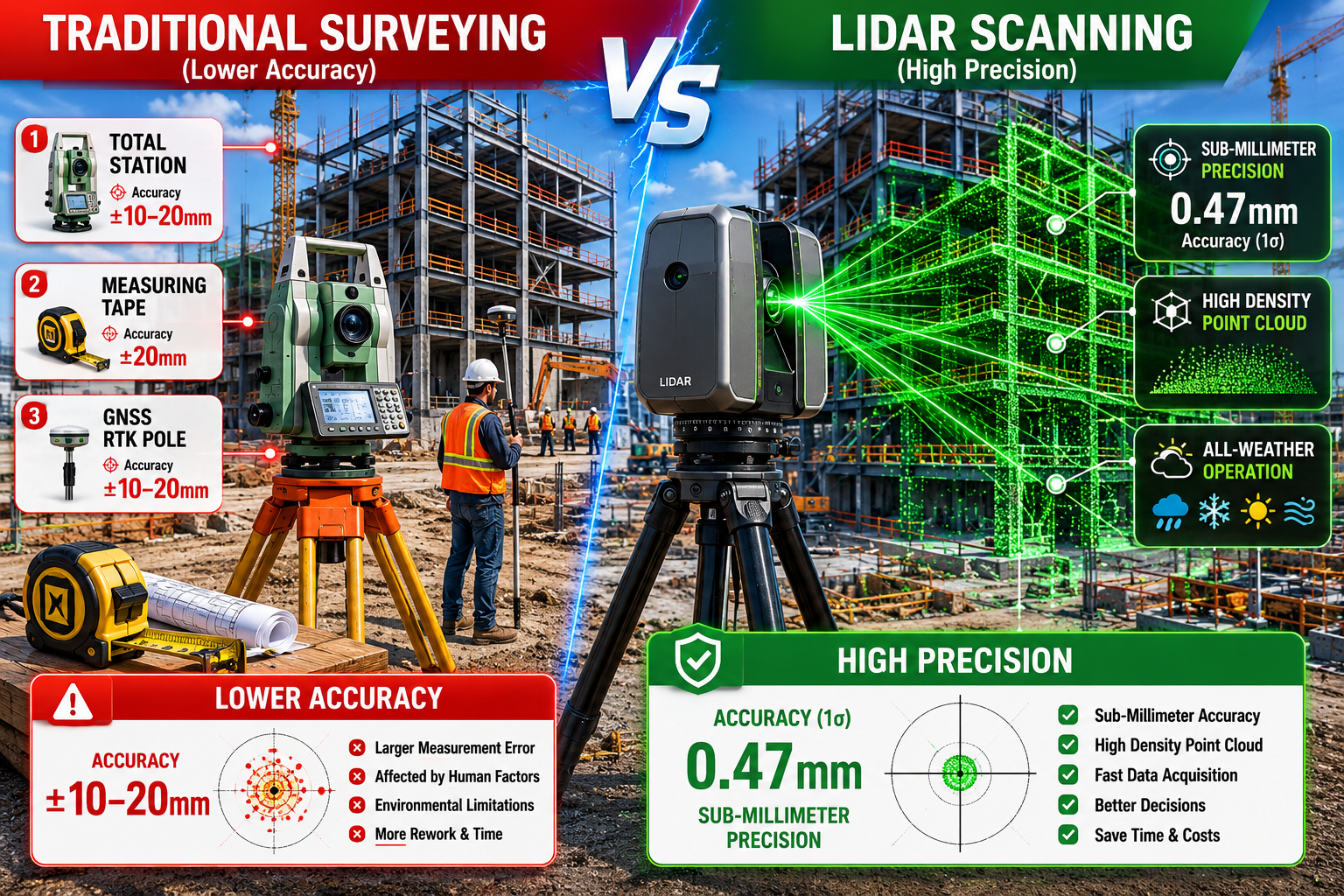
A traditional total station survey of a complex Victorian terrace can take two full days on site and still return positional errors of 10–20 mm. A modern terrestrial laser scanner covers the same building in under four hours and delivers point cloud data accurate to within ±6.2 mm at 30 metres — with emerging solid-state systems now reaching range precision of just 0.47 mm [2][3]. That gap is no longer a marginal improvement; it is a fundamental shift in what property surveying can deliver.
LiDAR and 3D Laser Scanning in 2026 Property Surveys: Achieving Sub-Millimeter Accuracy for Complex Projects represents the current frontier of measurement technology for built-environment professionals. From heritage restoration and high-rise structural assessments to urban masterplanning and boundary dispute resolution, the tools available in 2026 combine speed, precision, and data richness that traditional methods simply cannot match.
Key Takeaways
- Terrestrial laser scanning (TLS) achieves accuracies within ±6.2 mm at 30 metres, while advanced solid-state LiDAR systems now reach range precision of 0.47 mm [2][3].
- Real-time point cloud processing on site eliminates most return visits, cutting project timelines and costs significantly [1].
- Combining LiDAR with photogrammetry and GNSS RTK integration is now standard practice on commercial building surveys [1].
- UAV-based LiDAR has reached millimetre-level accuracy, making aerial scanning viable for deformation monitoring and large-site topographic surveys [6].
- Surveying control quality remains the most commonly overlooked factor in achieving reliable sub-millimetre results [5].
How LiDAR Compares to Traditional Surveying Methods
For decades, property surveyors relied on a combination of optical total stations, GNSS receivers, measuring tapes, and manual sketching to capture the geometry of buildings and land. These methods are well understood and remain legally accepted, but they carry inherent limitations when applied to complex or irregular structures.
The Limitations of Conventional Approaches
Traditional topographic and structural surveys depend heavily on the surveyor's ability to physically access measurement points. On a multi-storey facade with ornate stonework, or a basement with restricted headroom, this creates coverage gaps. Manual measurements also accumulate error over long chains of observation — a problem that compounds on large sites.
Key limitations of traditional methods include:
- Point-by-point data capture, meaning only selected locations are measured
- Typical positional accuracy of ±10–20 mm for general building surveys
- High labour intensity for complex geometries such as curved walls or vaulted ceilings
- No permanent digital record of the as-built condition at the time of survey
- Difficulty integrating with BIM (Building Information Modelling) workflows without significant rework
What LiDAR Changes
LiDAR (Light Detection and Ranging) works by emitting rapid pulses of laser light and measuring the time each pulse takes to return after striking a surface. A single scan position can capture millions of points per second, building a dense three-dimensional point cloud that records every visible surface simultaneously.
In controlled environments, terrestrial laser scanning (TLS) systems have demonstrated accuracies within ±6.2 mm at distances up to 30 metres [3]. For heritage buildings, structural assessments, and complex urban sites, this density and precision transforms what is possible in a single site visit.
Comparison table: LiDAR vs. traditional surveying methods
| Factor | Traditional Total Station | Terrestrial LiDAR (TLS) | Mobile/Handheld LiDAR |
|---|---|---|---|
| Typical accuracy | ±10–20 mm | ±6.2 mm at 30 m | ~4 mm vertical [1] |
| Data density | Point-by-point | Millions of pts/scan | Continuous capture |
| Complex geometry | Difficult | Excellent | Good |
| Site time (large building) | 1–2 days | 2–6 hours | 1–3 hours |
| BIM integration | Manual | Direct | Direct |
| Return visits required | Common | Rare [1] | Rare |
Understanding which survey type best fits a project is essential. For properties with significant structural complexity, a Level 3 Full Building Survey provides the most thorough assessment framework, and LiDAR data increasingly feeds directly into that reporting process.
GNSS RTK Integration
One of the most significant practical advances in 2026 is the seamless integration of GNSS Real-Time Kinematic (RTK) positioning with LiDAR scanning workflows. RTK systems provide centimetre-level absolute positioning by correcting satellite signals in real time against a fixed base station or network correction service.
When a LiDAR scanner is georeferenced using RTK, every point in the resulting cloud carries accurate real-world coordinates. This is critical for urban development projects where scan data must align with Ordnance Survey grid references, planning authority coordinate systems, or neighbouring survey datasets. Smartphone-based RTK systems have also matured considerably, and their combination with photogrammetry now enhances both accuracy and efficiency on commercial building surveys [1].
"The integration of LiDAR with photogrammetry and GNSS RTK is no longer a specialist niche — it is rapidly becoming the baseline expectation for any complex commercial or heritage property survey in 2026."

Achieving Sub-Millimeter Accuracy: Technologies and Techniques in 2026
The phrase "sub-millimetre accuracy" carries specific meaning in the context of LiDAR and 3D Laser Scanning in 2026 Property Surveys. It does not apply uniformly across all scanner types or all site conditions. Understanding where this level of precision is achievable — and where it is not — is essential for specifying the right equipment and workflow.
Solid-State LiDAR: The Precision Frontier
A landmark development in recent research introduced a large-array coherent flash LiDAR system achieving a range precision of 0.47 mm over a distance of 30.50 metres. This system operates at a frame rate of 10 Hz and captures up to 819,000 points per second [2]. These figures represent a significant step beyond conventional rotating-mirror TLS systems and point toward a future where sub-millimetre accuracy becomes accessible outside specialist laboratory conditions.
For property surveyors, solid-state LiDAR offers several practical advantages:
- No moving parts, reducing mechanical wear and improving reliability on site
- Faster frame rates, enabling capture of dynamic environments with less motion blur
- Compact form factors, making integration into mobile and UAV platforms more feasible
- Lower long-term maintenance costs compared to rotating-mirror systems
UAV-Based LiDAR for Complex Sites
Unmanned Aerial Vehicles (UAVs) equipped with LiDAR sensors have reached millimetre-level accuracy in recent deployments, making them viable for detailed deformation monitoring and large-site topographic surveys [6]. For urban development projects involving multi-building sites, infrastructure corridors, or inaccessible rooftop structures, UAV LiDAR provides coverage that ground-based scanning cannot achieve economically.
The combination of UAV LiDAR with ground-based TLS — often called a hybrid scanning approach — is now considered best practice for complex projects. The UAV captures the upper envelope and roof geometry while TLS handles facades, interiors, and ground-level detail.
For projects involving rooftop structures, chimneys, or parapet walls, this approach integrates naturally with a thorough roofing survey to provide a complete picture of the building envelope.
Mobile LiDAR: Speed vs. Precision
Mobile terrestrial LiDAR scanners — including handheld devices and trolley-mounted systems — have achieved vertical accuracies of approximately 4 mm in research settings [1]. While this falls short of fixed TLS at equivalent distances, mobile systems offer a compelling trade-off for large interior spaces such as shopping centres, industrial warehouses, or multi-storey car parks where the sheer volume of space makes fixed-station scanning impractical.
The key distinction is that mobile accuracy depends heavily on the quality of the Simultaneous Localisation and Mapping (SLAM) algorithm processing the data in real time. In environments with repetitive geometry — long corridors, open floors — SLAM drift can accumulate and degrade accuracy. Careful survey planning and the use of tie points or targets mitigates this risk.
The Critical Role of Surveying Control
Perhaps the most frequently overlooked factor in achieving reliable results is the quality of the surveying control network. A well-established principle in geodesy holds that control surveys must be significantly more accurate than the survey they support. With 3D laser scanning, this principle is routinely violated: the desired relative positional accuracy of the scan is often the same order of magnitude as the control survey itself, creating systematic errors that propagate through the entire dataset [5].
Best practice for surveying control in LiDAR projects:
- Establish a primary control network using GNSS RTK or total station traverses before scanning begins
- Use retro-reflective targets placed at known control points to register scan stations
- Verify registration residuals after each station is added — modern field software enables this in real time [1]
- Maintain a control accuracy that is at least three to five times better than the required survey accuracy
- Document all control observations independently for quality assurance
For projects requiring formal sign-off — such as those involving building regulation compliance or planning submissions — robust control documentation is not optional.
Accuracy Bands: Matching Technology to Project Requirements
Not every project requires sub-millimetre precision. Understanding accuracy bands prevents over-specification (and unnecessary cost) while ensuring the chosen technology is fit for purpose [4].
| Accuracy Band | Typical Application | Suitable Technology |
|---|---|---|
| 0.1–0.5 mm | Artefact scanning, forensic detail | Desktop/close-range scanners |
| 0.5–3 mm | Heritage stonework, structural joints | High-end TLS, solid-state LiDAR |
| 3–10 mm | Building as-built surveys, BIM capture | Standard TLS, mobile LiDAR |
| 10–50 mm | Topographic surveys, site layout | UAV LiDAR, GNSS RTK |
| 50 mm+ | Preliminary site appraisal | Aerial photogrammetry |
Real-World Applications in Urban Development and Complex Property Projects
The practical value of LiDAR and 3D Laser Scanning in 2026 Property Surveys extends well beyond technical precision figures. Across urban development, heritage conservation, structural assessment, and dispute resolution, the technology is reshaping how surveyors deliver value to clients.
Urban Development and Masterplanning
Large urban regeneration schemes routinely involve dozens of existing buildings, complex underground infrastructure, and tight construction tolerances. LiDAR scanning provides the accurate existing-conditions data that design teams need to avoid costly clashes between new construction and retained structures.
The adoption of 3D laser scanning has enabled surveyors to complete large and complex projects more efficiently, reducing fieldwork time and associated costs substantially [1]. On major commercial projects, eliminating return visits alone — made possible by real-time point cloud processing that flags coverage gaps on site — can represent savings of thousands of pounds per project.
For developers assessing sites with multiple structures, understanding the building materials present is a critical part of the survey scope, and LiDAR data increasingly informs this assessment by revealing construction details that are difficult to observe visually.
Heritage and Conservation Projects
Historic buildings present some of the most demanding surveying challenges: irregular geometry, fragile surfaces that cannot be touched, restricted access, and the need for millimetre-level accuracy to inform conservation decisions. LiDAR excels in this environment.
A recent study demonstrated the use of mobile laser scanning combined with semantic 3D models to extract radiometric fingerprints of object surfaces — revealing recurring material patterns that enhance the analytical capabilities of urban digital twins [7]. For heritage surveyors, this means scan data can now inform not just geometry but material identification, supporting decisions about repair specifications and conservation approaches.
Structural Monitoring and Deformation Analysis
One of the most technically demanding applications is the use of repeat LiDAR surveys to monitor structural deformation over time. By comparing point clouds captured months or years apart, engineers can quantify settlement, deflection, or movement with millimetre precision — without installing physical monitoring instruments.
This application is particularly relevant for properties near major infrastructure projects, tunnelling works, or in areas with known ground movement. Understanding urgent or dangerous building issues early, through precise deformation data, allows owners and engineers to intervene before conditions become critical.
Measured Building Surveys and BIM Integration
The most common commercial application of LiDAR in property work remains the measured building survey — producing accurate floor plans, sections, and elevations from scan data. Understanding what a measured building survey involves is the starting point for any client commissioning this type of work.
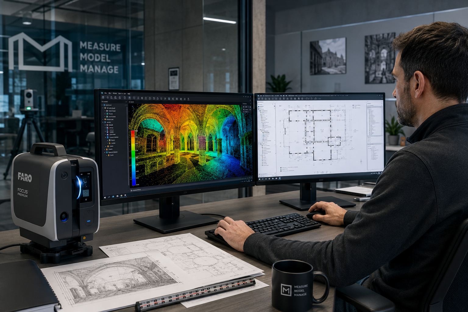
Modern scan-to-BIM workflows extract geometry directly from point clouds into Revit, ArchiCAD, or other BIM platforms, dramatically reducing the manual drafting time that traditional survey methods require. For renovation projects, this accuracy is essential: a 10 mm error in an as-built drawing can translate into a £10,000 fabrication mistake for bespoke joinery or structural steelwork.
For those planning significant renovation works, understanding the correct order of renovation activities alongside accurate measured survey data helps prevent costly sequencing errors.
Boundary Disputes and Legal Evidence
Point cloud data from LiDAR surveys is increasingly accepted as evidence in boundary disputes and party wall matters. The objective, time-stamped nature of scan data — capturing the exact position of walls, fences, and structures at a specific date — provides a level of documentary certainty that photographs and manual measurements cannot match.
For complex disputes, the combination of LiDAR data with a formal measured survey provides the strongest possible evidentiary foundation.
Conclusion
LiDAR and 3D Laser Scanning in 2026 Property Surveys: Achieving Sub-Millimeter Accuracy for Complex Projects is no longer a specialist niche reserved for large infrastructure contracts. The technology has matured to the point where it delivers measurable advantages — in accuracy, efficiency, and data richness — across a wide range of property survey types.
The evidence is clear: solid-state systems achieving 0.47 mm range precision [2], TLS delivering ±6.2 mm accuracy at 30 metres [3], UAV platforms reaching millimetre-level results [6], and real-time processing eliminating costly return visits [1] all point to a technology that is redefining professional standards.
Actionable next steps for property professionals and clients:
- Specify accuracy requirements before selecting technology. Use the accuracy band framework to match scanner type to project needs and avoid over- or under-specification.
- Invest in surveying control quality. The control network is the foundation of reliable results; do not allow it to become the weakest link in the accuracy chain [5].
- Adopt hybrid scanning workflows. Combining UAV LiDAR for upper envelope capture with TLS for facades and interiors delivers comprehensive coverage on complex sites.
- Integrate GNSS RTK from the outset. Georeferenced point clouds are far more valuable for planning, BIM, and legal purposes than locally registered data.
- Commission a Level 3 Building Survey for complex properties. Where LiDAR data reveals areas requiring deeper investigation, a full Level 3 Building Survey provides the professional framework to interpret and act on those findings.
The surveyors and developers who build LiDAR and 3D scanning into their standard workflows in 2026 will not simply be using better tools — they will be delivering fundamentally better outcomes for every complex project they undertake.
References
[1] Lidar And 3d Laser Scanning In 2026 Property Surveys Achieving Unmatched Accuracy And Efficiency – canterburysurveyors.com
[2] S41467 026 69188 4 – nature.com
[3] Lidar Surveying Accuracy Comparison – surveyingpedia.com
[4] 3d Scanner Beginners Guide – voxelio.app
[5] Surveying Control Its Misuse Effects Accuracy – lidarnews.com
[6] Uav Point Clouds At Millimeter Accuracy 2 – lidarmag.com
[7] arxiv – arxiv.org