In an era marked by economic volatility, geopolitical instability, and rapid regulatory shifts, property transactions have become increasingly complex and risky. Buyers, sellers, investors, and developers all face heightened uncertainty—yet one profession stands uniquely positioned to provide the clarity they desperately need. Certainty in Property Transactions: How Surveyors Can Leverage Data-Driven Solutions to Reduce Risk in 2026's Uncertain Market represents not just a technological evolution, but a fundamental transformation in how surveyors deliver value to clients navigating today's challenging landscape.
The traditional surveying model—static reports, manual data processing, and isolated deliverables—no longer meets the demands of stakeholders who need real-time insights, transparent decision-making frameworks, and quantifiable risk assessments. As market conditions remain unpredictable throughout 2026, surveyors who embrace artificial intelligence, cloud-based collaboration platforms, and advanced spatial analytics are differentiating themselves by offering something increasingly rare: data-backed certainty.
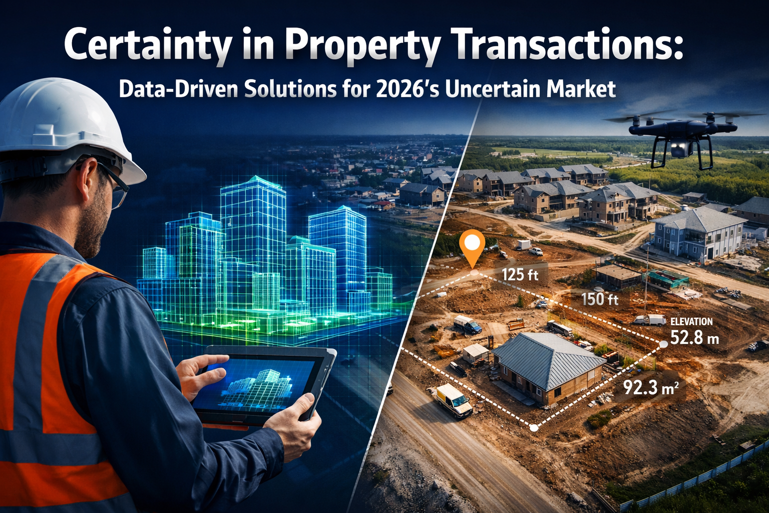
Key Takeaways
✅ AI-powered automation accelerates data processing by up to 75%, enabling faster transaction timelines and reducing client uncertainty in volatile markets
✅ Real-time 3D digital twins transform static survey documents into interactive decision-making tools that visualize risks before they materialize
✅ Cloud-based collaboration platforms eliminate miscommunication and version control issues, creating transparent audit trails that reduce transaction disputes
✅ Data-driven site selection frameworks replace subjective assessments with evidence-based predictions that investment committees can review and validate
✅ Integrated spatial intelligence consolidates multiple data layers—zoning, utilities, environmental factors—into unified dashboards that reveal hidden transaction risks
The 2026 Market Context: Why Certainty Has Become the Ultimate Competitive Advantage
The property market in 2026 faces unprecedented challenges. Interest rate fluctuations, regulatory changes affecting energy performance standards, shifting planning policies, and economic uncertainty have created an environment where traditional due diligence approaches often fall short. Buyers face increased scrutiny from lenders who demand more comprehensive risk assessments. Sellers need to prepare their property for market with detailed documentation that addresses potential concerns before they derail negotiations.
In this context, surveyors who can provide quantifiable certainty rather than qualified opinions gain significant competitive advantage. The difference lies in moving from descriptive observations to predictive analytics—from "here's what we found" to "here's what this means for your investment decision, backed by data."
The Cost of Uncertainty in Property Transactions
Transaction failures cost all parties significantly. When surveys reveal unexpected issues late in the process, deals collapse, deposits are lost, and months of negotiation evaporate. According to industry observations, miscommunication between stakeholders—often stemming from outdated information or unclear survey deliverables—represents a major source of project delays and cost overruns.
Data-driven surveying directly addresses these pain points by:
- Providing transparent, auditable decision logic that all stakeholders can review
- Delivering real-time updates as new information becomes available
- Creating visual, interactive presentations that non-technical clients can understand
- Establishing clear risk metrics that inform negotiation strategies
For clients considering how to negotiate house price down after survey, having precise, data-backed assessments of defects and repair costs provides significantly stronger negotiating positions than traditional narrative reports.
How Data-Driven Solutions Transform Survey Workflows and Client Outcomes

AI-Powered Automation: From Manual Processing to Intelligent Classification
The most immediate impact of data-driven solutions appears in processing speed and accuracy. Traditional surveying workflows required surveyors to manually sort through thousands of data points, classify terrain features, identify markers, and flag potential issues—a time-consuming process prone to human error and inconsistency.
In 2026, artificial intelligence systems now handle these tasks automatically[1]. Machine learning algorithms trained on millions of survey data points can:
- Automatically classify terrain types and surface features
- Identify boundary markers and reference points with centimeter-level precision
- Flag anomalies that deviate from expected patterns
- Generate preliminary surface models without manual intervention
This automation delivers 75% faster survey completion times and 40-60% cost reductions[2], directly improving project economics and timeline certainty. For clients operating under tight transaction deadlines, this speed advantage can mean the difference between securing a property and losing it to faster-moving competitors.
Beyond speed, AI-powered point cloud classification spots errors and patterns that human reviewers might miss[6]. Deep learning algorithms analyze spatial data with precision, highlighting inconsistencies and potential issues while maintaining data privacy through anonymization techniques. When conducting a Level 3 full building survey, these AI tools ensure comprehensive coverage and consistent quality standards across all property types.
Real-Time 3D Digital Twins: Interactive Risk Visualization
Perhaps the most transformative development in certainty-focused surveying is the shift from static documents to dynamic digital twins[1]. Traditional survey deliverables—PDF reports, 2D plans, photographic appendices—present information at a fixed point in time. Once printed or emailed, they immediately begin aging as site conditions change.
Real-time 3D digital twins fundamentally change this paradigm. These high-fidelity, interactive models update continuously as new data is collected, enabling clients to:
- Visualize slope erosion projections over time based on current conditions
- Simulate water flow patterns during extreme weather events
- Track vegetation changes that might affect boundaries or structural stability
- Test infrastructure stress scenarios before committing to development plans
All of this occurs within a single, unified model rather than across multiple disconnected documents[1]. For clients evaluating building materials assessments or environmental issues, this integrated approach reveals relationships between different risk factors that static reports cannot effectively communicate.
Advanced GPS/GNSS Systems: Centimeter-Level Precision as the New Baseline
Accuracy has always been fundamental to surveying, but 2026's enhanced Global Navigation Satellite System implementations deliver centimeter-level precision as standard[1]. This improvement in baseline measurement reliability cascades through all downstream decisions, reducing uncertainty in:
- Boundary determinations that affect property rights and development potential
- Topographical modeling that informs drainage and foundation design
- Volumetric calculations for earthworks and material estimates
- As-built verification confirming construction matches approved plans
When combined with mobile 3D mapping systems, these GNSS advancements enable rapid, accurate data capture even in challenging environments[2]. Surveyors can now provide reliable measurements in urban canyons, under tree canopy, and in other conditions that previously required time-consuming workarounds.
Cloud-Based Collaboration: Eliminating Information Silos and Version Control Nightmares

Common Data Environments (CDEs): From Static Deliverables to Living Datasets
One of the most significant barriers to transaction certainty has been information fragmentation. In traditional workflows, surveyors deliver their findings, architects create designs based on those findings, engineers perform calculations, and contractors develop construction plans—each working from their own copies of data that quickly become outdated as revisions occur.
Common Data Environments (CDEs) eliminate this fragmentation[3]. Rather than delivering isolated point clouds or static plans, surveyors now contribute to shared environments where spatial data informs real-time decision-making across all project phases. This transformation enables:
- Instant file sharing with automatic notification of new uploads
- Real-time revision syncing ensuring all stakeholders view the latest version
- Integrated communication with engineers, architects, and contractors within the data context
- Seamless digital handoffs at project completion for long-term asset management
The result? Significantly reduced miscommunication-related delays and disputes[1]. When everyone works from the same data source, questions about "which version" or "what did the survey actually say" disappear. For projects requiring building regulation compliance testing, this unified approach ensures all parties reference the same baseline conditions throughout the approval process.
AI-Enhanced Reality Capture: Continuous Progress Tracking and Stakeholder Alignment
Beyond static baseline surveys, AI-enhanced reality capture enables continuous documentation of site conditions throughout project lifecycles[3]. Machine learning algorithms combined with cloud-based platforms allow:
- Visual documentation of construction progress with automated comparison to design intent
- Real-time collaboration as stakeholders review current conditions remotely
- Auditable records of site conditions and decisions that reduce liability exposure
- Reduced misunderstandings through visual communication that transcends technical jargon
This continuous monitoring capability proves particularly valuable for property maintenance planning and dilapidations assessments, where documenting condition changes over time supports evidence-based negotiations.
BIM Integration: Conflict Reduction Before Construction Begins
Building Information Modeling (BIM) integration represents another critical collaboration advancement[1]. When surveyors integrate geospatial data directly into BIM systems, architects, engineers, and construction professionals can:
- Identify conflicts between existing conditions and proposed designs before breaking ground
- Optimize site layouts based on accurate topographical and utility data
- Coordinate trades more effectively with shared spatial understanding
- Reduce costly on-site surprises that trigger change orders and delays
This integration extends survey value far beyond the initial data collection phase, positioning surveyors as ongoing project partners rather than one-time service providers. For complex projects involving structural engineering considerations, this collaborative approach ensures structural solutions account for actual site conditions rather than assumptions.
Data-Driven Site Selection: Transforming Investment Decision-Making
From Gut-Feel to Evidence-Based Location Intelligence
Historically, site selection for development projects relied heavily on subjective assessments and local knowledge—valuable inputs, but difficult to validate, compare, or defend to investment committees. In 2026's risk-averse market, this approach no longer satisfies institutional investors and lenders who demand transparent, auditable decision frameworks[5].
Data-driven site selection platforms centralize information from multiple sources into unified dashboards that enable:
- Documented decision logic that investment committees can review, challenge, and improve
- Quantitative comparisons across multiple potential sites using consistent criteria
- Predictive modeling of development costs, market performance, and risk factors
- Scenario testing showing how different assumptions affect investment returns
This transformation from subjective to evidence-based assessment reduces investment risk while simultaneously accelerating decision-making. Rather than endless debates about which location "feels right," stakeholders can evaluate objective data about demographics, accessibility, competition, regulatory constraints, and development costs[5].
GIS Integration: Consolidating Multi-Layered Spatial Intelligence
Geographic Information Systems (GIS) integration enables surveyors to overlay multiple data layers in single, comprehensive maps[4]:
- Zoning information showing permitted uses and development restrictions
- Boundary data clarifying property limits and easements
- Utility locations revealing infrastructure capacity and connection costs
- Flood zones and environmental constraints affecting insurability
- Transportation networks influencing accessibility and logistics
- Demographic patterns indicating market demand and competition
This consolidated view reveals relationships between factors that isolated reports cannot effectively communicate. For example, a site might appear attractive based on zoning alone, but GIS analysis might reveal that utility capacity limitations would require expensive infrastructure upgrades that undermine project economics.
When evaluating properties in specific markets like Guildford, Hertfordshire, or Clapham, this layered spatial intelligence provides crucial local context that generic valuation models miss.
Practical Applications: How Surveyors Deliver Certainty Across Transaction Types
Residential Purchases: Empowering Buyers with Actionable Intelligence
For residential buyers, uncertainty about property condition represents one of the most stressful aspects of transactions. Questions like "what questions should you be asking during a building survey?" reveal buyers' anxiety about missing critical issues.
Data-driven surveys address this anxiety by providing:
- Interactive 3D models that buyers can explore remotely, understanding spatial relationships and defects in context
- Quantified repair cost estimates derived from databases of similar work, supporting negotiation strategies
- Prioritized maintenance schedules showing which issues require immediate attention versus long-term planning
- Historical comparison data revealing how the property's condition compares to similar properties of the same age and construction type
When buyers understand the difference between Level 2 and Level 3 surveys, data-driven deliverables make the value proposition of comprehensive surveys more tangible. Rather than simply receiving more pages of text, buyers receive actionable intelligence that directly informs their purchase decision.
Commercial Transactions: Supporting Due Diligence with Institutional-Grade Data
Commercial property transactions involve significantly higher stakes and more sophisticated stakeholders. Institutional investors, pension funds, and REITs require institutional-grade data quality and transparent methodologies that satisfy their risk management frameworks.
Data-driven surveying meets these requirements through:
- Standardized data collection protocols ensuring consistency across portfolio assets
- Automated quality control flagging potential errors or inconsistencies before delivery
- Integration with valuation models enabling direct import of survey data into financial analysis tools
- Long-term asset management support extending survey value beyond the transaction phase
For clients requiring commercial valuations or evaluating exclusive properties to buy, this institutional-grade approach provides the certainty that sophisticated investors demand.
Development Projects: Reducing Planning Risk Through Predictive Modeling
Development projects face particularly acute uncertainty around planning approval, construction costs, and timeline reliability. Data-driven surveying reduces these risks through:
- Accurate topographical modeling that informs drainage design and foundation engineering
- Utility mapping revealing infrastructure capacity and connection requirements
- Environmental constraint identification highlighting potential planning obstacles early
- Volume calculations supporting accurate material estimates and cost projections
When combined with premium drone surveys for large sites, these capabilities enable developers to identify and address potential issues before committing significant capital. Understanding property market legislation changes affecting development rights makes this proactive approach even more valuable in 2026's evolving regulatory landscape.
Specialized Applications: Party Walls, Dilapidations, and Dispute Resolution
Data-driven approaches prove particularly valuable in contentious situations where objective evidence determines outcomes:
- Party wall matters: Detailed condition surveys with photographic and 3D documentation establish baseline conditions before works commence, reducing disputes about damage causation
- Dilapidations claims: Continuous monitoring throughout lease terms provides auditable records of deterioration versus normal wear and tear
- Boundary disputes: Centimeter-accurate GNSS measurements combined with historical records resolve disagreements with objective evidence
For clients navigating party wall agreements or understanding the cost of party wall surveyors, data-driven documentation provides defensible evidence that reduces both dispute frequency and resolution costs.
Infrastructure Asset Lifecycle Management: Extending Survey Value Beyond Transactions
From Project-Specific to Long-Term Asset Intelligence
Traditional surveying focused on discrete project phases—baseline surveys for transactions, as-built surveys at completion, condition surveys for maintenance planning. Each survey existed as an isolated snapshot, with limited connection to previous or future assessments.
Infrastructure asset lifecycle management transforms this model by recognizing that data collected during planning and construction retains value for decades[3]. Municipalities and private asset owners increasingly understand that survey data should feed into:
- Predictive maintenance programs that schedule interventions before failures occur
- Capital planning models that forecast replacement needs and budget requirements
- Performance monitoring systems tracking asset condition against design expectations
- Risk management frameworks identifying vulnerable assets requiring priority attention
This shift creates ongoing opportunities for surveyors to provide decision support through 3D GIS, advanced modeling, and continuous monitoring services[3]. Rather than one-time transactions, surveyors become long-term asset intelligence partners.
Municipal Applications: Supporting Public Infrastructure Investment
Local authorities face particular challenges in managing aging infrastructure with constrained budgets. Data-driven surveying helps municipalities:
- Prioritize limited capital budgets by identifying highest-risk assets
- Optimize maintenance scheduling to extend asset life and reduce lifecycle costs
- Support grant applications with objective evidence of infrastructure needs
- Demonstrate accountability to taxpayers through transparent asset management
For surveyors, this represents a significant market opportunity as public sector clients recognize the value of data-driven asset management over reactive maintenance approaches.
Implementing Data-Driven Solutions: Practical Steps for Surveying Practices
Technology Investment Priorities for 2026
Practices looking to deliver certainty-focused services should prioritize investments in:
- Mobile 3D mapping systems with integrated GNSS RTK for rapid, accurate data capture[2]
- Cloud-based collaboration platforms enabling real-time stakeholder access to survey data[1]
- AI-powered processing software for automated point cloud classification and anomaly detection[6]
- GIS integration tools allowing multi-layer spatial data visualization[4]
- BIM-compatible deliverable formats supporting seamless project workflow integration[1]
The business case for these investments rests on quantifiable efficiency gains—75% faster surveys and 40-60% cost reductions[2]—that enable practices to either reduce prices (gaining market share) or maintain prices while improving margins.
Skills Development and Training
Technology alone doesn't deliver certainty—skilled professionals who understand how to leverage these tools make the difference. Practices should invest in:
- Data analytics training enabling surveyors to extract meaningful insights from large datasets
- Visualization skills for creating client-friendly presentations of complex spatial data
- Collaboration platform proficiency ensuring smooth integration with project teams
- Risk assessment frameworks translating technical findings into business implications
Understanding common defects in older homes or pitched roof types and common defects becomes more valuable when surveyors can quantify risk severity and predict future deterioration using data-driven models.
Client Communication Strategies
The most sophisticated data-driven survey delivers limited value if clients don't understand it. Effective communication strategies include:
- Interactive presentations using 3D models rather than static reports
- Executive summaries highlighting key risks and decision points for busy stakeholders
- Visual risk matrices showing probability and impact of identified issues
- Scenario modeling demonstrating how different decisions affect outcomes
For clients unfamiliar with modern surveying capabilities, explaining what roof surveyors do or why you need a roofing surveyor becomes easier when you can demonstrate value through data rather than simply asserting expertise.
Overcoming Implementation Challenges
Data Security and Client Confidentiality
Cloud-based collaboration raises legitimate concerns about data security and confidentiality. Practices must address these through:
- Enterprise-grade security protocols with encryption and access controls
- Clear data governance policies specifying who can access what information
- Compliance with data protection regulations including GDPR requirements
- Client education about security measures and risk mitigation
Transparency about security measures builds trust and positions practices as professional organizations rather than technology experimenters.
Integration with Existing Workflows
Introducing data-driven tools into established workflows can create temporary disruption. Successful implementation requires:
- Phased rollout starting with pilot projects before full deployment
- Parallel running maintaining traditional methods during transition periods
- Staff involvement in tool selection and process design
- Continuous improvement based on user feedback and client response
Practices that manage change effectively minimize disruption while maximizing adoption rates and ultimate benefits.
Cost-Benefit Analysis and ROI Measurement
Technology investments require clear business justification. Practices should track:
- Time savings per project type and complexity level
- Error reduction rates comparing data-driven versus traditional methods
- Client satisfaction metrics including repeat business and referral rates
- Competitive win rates for projects where data-driven capabilities differentiated the proposal
Demonstrating ROI justifies continued investment and supports expansion into additional capabilities.
Future Outlook: The Evolving Role of Surveyors in Risk Reduction
From Reporters to Risk Advisors
The fundamental shift enabled by data-driven solutions is the evolution of surveyors from reporters of conditions to advisors on risk management. Rather than simply documenting what exists, surveyors increasingly:
- Predict future conditions based on current trajectories
- Quantify risk severity using probabilistic models
- Recommend mitigation strategies with cost-benefit analysis
- Support ongoing monitoring throughout asset lifecycles
This advisory role commands higher fees and stronger client relationships than traditional reporting services.
Market Differentiation in Competitive Landscapes
As data-driven capabilities become more widespread, early adopters gain significant competitive advantages:
- Premium pricing justified by superior deliverables and faster turnaround
- Market share gains from clients seeking certainty in uncertain times
- Referral networks built on reputation for reducing transaction risk
- Institutional relationships with sophisticated clients requiring data-driven approaches
Practices that position themselves as certainty providers rather than survey producers capture disproportionate value in competitive markets.
Regulatory and Standards Evolution
Industry standards continue evolving to reflect data-driven capabilities. Surveyors should anticipate:
- Updated professional standards incorporating digital deliverable requirements
- Enhanced quality assurance protocols for AI-processed data
- Standardized data formats enabling cross-platform compatibility
- Professional development requirements ensuring competency with new tools
Staying ahead of these changes positions practices as industry leaders rather than reluctant followers.
Conclusion: Building Client Confidence Through Data-Backed Certainty
In 2026's uncertain property market, Certainty in Property Transactions: How Surveyors Can Leverage Data-Driven Solutions to Reduce Risk in 2026's Uncertain Market represents more than a technological upgrade—it's a fundamental reimagining of professional value. As geopolitical tensions, economic volatility, and regulatory changes create unprecedented transaction complexity, clients desperately need what data-driven surveying uniquely provides: transparent, auditable, quantifiable certainty.
The transformation from static reports to interactive digital twins, from isolated deliverables to collaborative Common Data Environments, and from descriptive observations to predictive analytics directly addresses the pain points that cause transaction failures, project delays, and investment losses. Surveyors who embrace AI-powered automation, cloud-based collaboration, and integrated spatial intelligence don't just work faster—they deliver fundamentally different value that justifies premium positioning.
Actionable Next Steps for Surveying Practices
🎯 Assess current capabilities: Evaluate existing technology stack against 2026 best practices to identify specific gaps
🎯 Prioritize strategic investments: Focus first on tools delivering the highest efficiency gains—mobile 3D mapping and cloud collaboration platforms
🎯 Develop staff competencies: Invest in training that enables teams to extract insights from data, not just collect it
🎯 Refine client communication: Transform deliverables from technical documents to decision-support tools that non-technical stakeholders can understand and act upon
🎯 Build strategic partnerships: Collaborate with technology providers, BIM specialists, and other professionals to create comprehensive solutions
🎯 Track and demonstrate ROI: Measure time savings, error reduction, and client satisfaction to justify continued investment and support premium pricing
The practices that thrive in 2026's challenging market will be those that recognize certainty itself as the product—with data-driven surveying as the means of delivery. By positioning themselves as risk reduction partners rather than compliance-driven reporters, surveyors can capture greater value while delivering genuinely differentiated services that clients cannot find elsewhere.
The technology exists. The client need is acute. The competitive advantage awaits those willing to embrace the transformation from traditional surveying to data-driven certainty solutions.
References
[1] Future Land Surveying 2026 – https://haller-blanchard.com/future-land-surveying-2026/
[2] The Future Of Land Surveying Technology 2026 Trends In Mobile 3d Mapping And Gnss Rtk Systems – https://nottinghillsurveyors.com/blog/the-future-of-land-surveying-technology-2026-trends-in-mobile-3d-mapping-and-gnss-rtk-systems
[3] Doubling Down On Digital – https://amerisurv.com/2026/02/01/doubling-down-on-digital/
[4] The Future Of Land Surveying Technology And Upcoming Trends In 2026 – https://metricop.com/blogs/land-surveying/the-future-of-land-surveying-technology-and-upcoming-trends-in-2026
[5] Data Driven Site Selection Guide – https://www.growthfactor.ai/resources/blog/data-driven-site-selection-guide
[6] Surveying Geospatial Industry Trends 2025 Ai Mobile Mapping 3d – https://www.geoweeknews.com/blogs/surveying-geospatial-industry-trends-2025-ai-mobile-mapping-3d