

Construction projects that skip proper geospatial integration into their BIM workflows run a 30% higher risk of costly rework — a figure that translates into millions of pounds lost on large-scale builds. That stark reality is driving a fundamental shift in how land surveyors operate. BIM Integration for Surveyors: Streamlining Construction Projects with Geospatial Data in 2026 is no longer a specialist niche — it is the new baseline for professionals who want to remain competitive, reduce conflict, and deliver data that architects and engineers can actually use.
This article explores how surveyors collaborate through BIM models to cut clashes before they become disputes, what steps professionals can take to upskill right now, and how integrated geospatial data is reshaping construction delivery across the UK.
Key Takeaways 📌
- BIM and geospatial data together eliminate a significant proportion of design clashes before construction begins.
- Land surveyors play a central role in feeding accurate, georeferenced data into BIM environments.
- Upskilling in BIM software, IFC standards, and GIS tools is essential for surveyors in 2026.
- Integrated workflows reduce project delays, rework costs, and legal disputes between project stakeholders.
- Chartered surveyors who embrace BIM collaboration become indispensable connectors between field reality and digital design.

Why Geospatial Data Is the Foundation of Every BIM Model
A BIM model is only as reliable as the real-world data it is built on. Without accurate, georeferenced survey data at its core, even the most sophisticated 3D model becomes a work of educated guesswork.
The Surveyor's Role in the BIM Ecosystem
Land surveyors are the first professionals on site. They capture the existing conditions — topography, boundaries, underground utilities, structural positions — that every other discipline depends on. When that data is formatted correctly and fed into a BIM environment, it creates a shared digital foundation that architects, structural engineers, mechanical engineers, and contractors all work from simultaneously.
Key geospatial inputs surveyors provide to BIM models include:
| Data Type | Survey Method | BIM Use |
|---|---|---|
| Topographic survey | Total station / drone LiDAR | Site grading, drainage design |
| Measured building survey | 3D laser scanning | Existing structure modelling |
| Boundary data | GPS/GNSS | Legal compliance, plot layout |
| Underground utilities | Ground-penetrating radar | Clash detection |
| Setting-out data | GNSS, total station | Construction positioning |
Understanding what is a measured building survey and how it feeds into BIM workflows is a critical starting point for any surveyor looking to integrate their practice with modern construction processes.
Clash Detection: Where BIM Saves Real Money 💰
One of the most powerful benefits of BIM integration is automated clash detection. When a surveyor's georeferenced existing conditions model is combined with the architect's design and the engineer's structural or MEP (mechanical, electrical, plumbing) drawings, software can identify conflicts automatically — before a single brick is laid.
"Clash detection in a coordinated BIM model can eliminate up to 40% of unplanned changes during construction — changes that are exponentially more expensive to fix on site than on screen."
Common clashes that accurate geospatial data prevents:
- Structural foundations conflicting with underground drainage runs
- New walls encroaching on boundary lines due to inaccurate site positioning
- Roof structures clashing with neighbouring party walls
- Service routes conflicting with load-bearing elements
For complex builds, understanding construction law advice becomes essential when disputes do arise — but the goal of BIM integration is to prevent those disputes from occurring in the first place.
How BIM Integration for Surveyors Is Streamlining Construction Projects with Geospatial Data in 2026
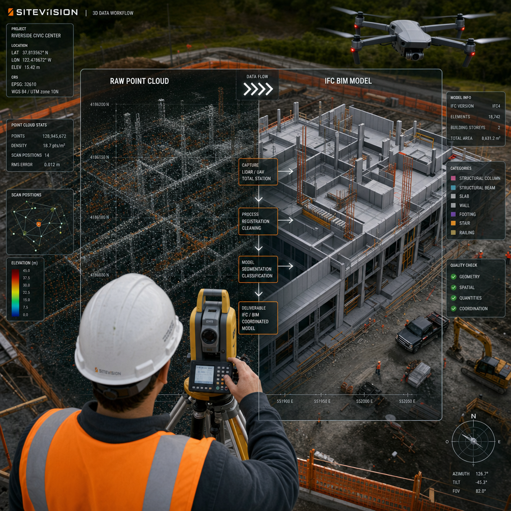
The construction industry in 2026 operates in a world of mandatory BIM requirements on publicly funded projects and rapidly increasing adoption on private developments. Surveyors who understand how to deliver data in BIM-compatible formats are not just adding value — they are meeting a baseline expectation.
The Data Handover Problem (and How to Fix It)
Historically, surveyors delivered data as 2D CAD drawings or PDF reports. Architects then had to manually re-enter that information into their design software — introducing errors, delays, and misinterpretations at every step.
BIM integration solves this through standardised data formats and shared environments:
- IFC (Industry Foundation Classes): The open standard format that allows survey data to be imported directly into BIM platforms like Revit, ArchiCAD, and Bentley.
- COBie (Construction Operations Building Information Exchange): Structures asset data for facilities management handover.
- Point Cloud to BIM (PC2BIM): Converts 3D laser scan data into intelligent BIM objects that carry geometric and attribute information.
- GIS-BIM Integration: Links geographic information systems with building models, allowing large infrastructure projects to maintain spatial accuracy across wide areas.
Reducing Conflicts Through Collaborative BIM Models
The shift from sequential to concurrent workflows is where BIM delivers its greatest conflict-reduction benefits. Rather than each discipline working in isolation and then attempting to merge drawings at the end of a design stage, BIM enables real-time collaboration.
A surveyor's role in this collaborative model includes:
- Establishing the project coordinate system — ensuring all disciplines work from the same georeferenced origin point
- Delivering existing conditions models in IFC format at project inception
- Updating models during construction to reflect as-built conditions
- Flagging discrepancies between design intent and site reality through model-based reporting
- Supporting setting-out with BIM-derived coordinates that feed directly into GNSS equipment
This workflow is particularly valuable on complex projects where why hire a project manager becomes a relevant question — because a skilled project manager working with a BIM-integrated surveyor can coordinate all disciplines against a single source of truth.
The Role of Drones and LiDAR in 2026 🚁
Unmanned Aerial Vehicles (UAVs) equipped with LiDAR sensors have transformed how surveyors capture geospatial data. In 2026, drone surveys can produce:
- Centimetre-accurate point clouds of entire construction sites in hours
- Photogrammetric 3D models suitable for direct BIM import
- Regular progress monitoring models that track construction against design
- Thermal imaging overlays for building performance assessments
These outputs feed directly into BIM environments, giving the entire project team a live, accurate picture of site conditions. For building surveys specifically, understanding what do roof surveyors do illustrates how drone technology is enhancing traditional inspection workflows with data that can be captured, stored, and shared within a BIM model.
Steps for Surveyors to Upskill and Deliver Integrated Geospatial Data
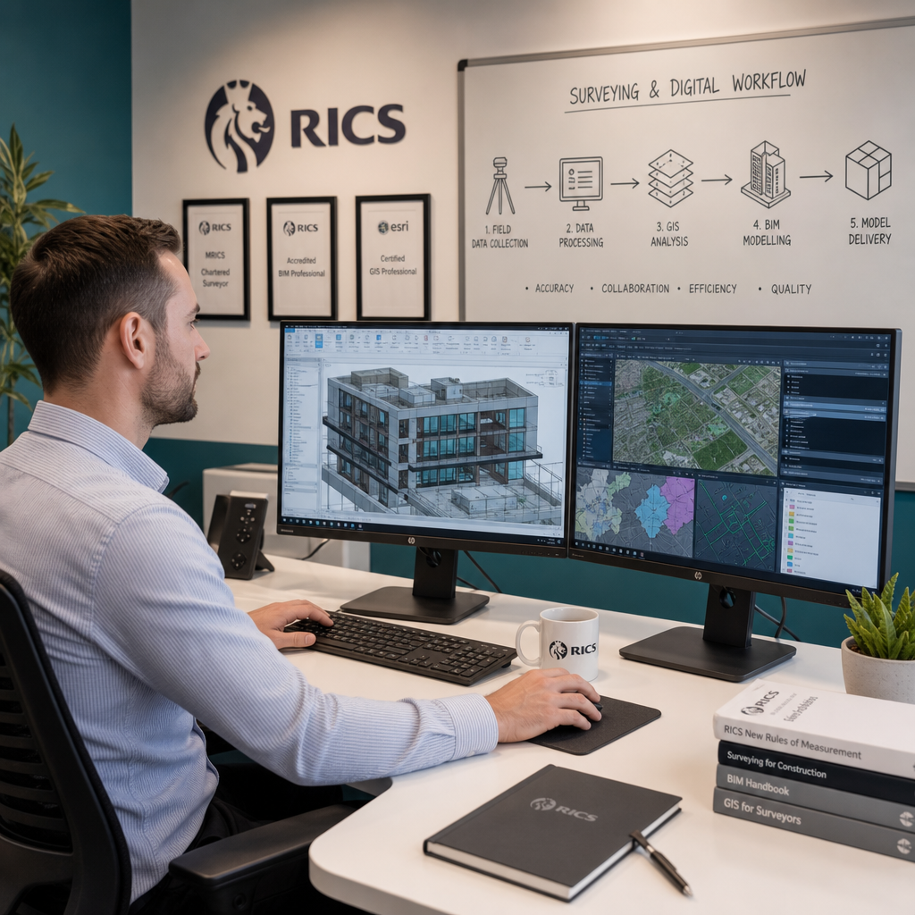
The gap between a surveyor who delivers a PDF plan and one who delivers a georeferenced IFC model is significant — but it is entirely bridgeable. Here is a structured pathway for professionals looking to build genuine BIM competency in 2026.
Step 1: Understand BIM Levels and Standards
Before touching software, surveyors need to understand the UK BIM Framework and what is expected at each level of maturity:
- BIM Level 2: Collaborative working with federated models — now standard on UK government projects
- BIM Level 3 (Golden Thread): A fully integrated, single shared model environment — the direction of travel for the industry
- ISO 19650: The international standard governing information management across the built environment
Step 2: Master the Core Software Tools
| Software Category | Key Tools | Surveyor Application |
|---|---|---|
| BIM Authoring | Autodesk Revit, ArchiCAD | Creating/editing BIM models |
| Point Cloud Processing | Leica Cyclone, Trimble RealWorks | Converting scan data to BIM |
| GIS Integration | ESRI ArcGIS, QGIS | Linking geographic data to BIM |
| Clash Detection | Autodesk Navisworks | Identifying model conflicts |
| Drone Photogrammetry | DJI Terra, Pix4D | Processing UAV survey data |
Step 3: Obtain Recognised Qualifications
Professional development is essential. Relevant qualifications and training include:
- RICS BIM Manager pathway
- Autodesk Certified Professional in Revit
- GIS Professional (GISP) certification
- UAV/Drone operator licence (CAA in the UK)
- Continuing Professional Development (CPD) through RICS-accredited providers
Staying connected with the professional surveying community — including attending chartered surveyor events — provides valuable insight into how BIM integration is evolving in practice across different regions and project types.
Step 4: Build a BIM-Ready Workflow
A practical, repeatable workflow for delivering BIM-integrated survey data looks like this:
- ✅ Brief — Agree BIM Execution Plan (BEP) with project team before mobilising
- ✅ Capture — Use appropriate survey methods (LiDAR, GNSS, drone) to collect data
- ✅ Process — Convert raw data into georeferenced point clouds or surface models
- ✅ Model — Build or update IFC-compliant BIM objects from processed data
- ✅ Validate — Check model against survey tolerances and project requirements
- ✅ Deliver — Upload to Common Data Environment (CDE) such as Autodesk BIM 360 or Trimble Connect
- ✅ Update — Maintain model currency throughout construction and handover
Step 5: Communicate Data to Architects and Engineers Effectively
Technical accuracy means nothing if the data cannot be understood and used by other disciplines. Surveyors should:
- Annotate models clearly with survey tolerances and confidence levels
- Use agreed naming conventions from the project's BIM Execution Plan
- Provide clash reports in formats that non-surveyors can act on
- Attend BIM coordination meetings to resolve issues collaboratively
- Document assumptions clearly within the model metadata
This communication layer is where surveyors transition from data providers to strategic project collaborators — a role that significantly increases their value on any project.
Regional Considerations for BIM-Integrated Surveyors
BIM adoption rates and project requirements vary across the UK. Surveyors working across different regions — from chartered surveyors in Surrey to chartered surveyors in North West London — will encounter different client expectations, planning authority requirements, and infrastructure project scales. Understanding local context while delivering nationally consistent BIM standards is a key competency for 2026.
Similarly, surveyors working on residential projects should understand how building survey services are evolving to incorporate digital data capture and BIM-compatible outputs, even at the residential scale where BIM adoption has historically lagged behind commercial construction.
Common Challenges and How to Overcome Them ⚠️
Even with the best intentions, BIM integration for surveyors faces real-world obstacles:
Challenge 1: Data interoperability
Different software platforms do not always communicate seamlessly. Solution: Always export and import using open IFC standards rather than proprietary formats.
Challenge 2: Client awareness
Many clients — particularly on smaller projects — do not yet understand the value of BIM-integrated survey data. Solution: Quantify the cost savings from clash detection and reduced rework in client proposals.
Challenge 3: Upfront investment
BIM-capable hardware and software represent a significant investment. Solution: Phase investment strategically, starting with point cloud processing software and building capability incrementally.
Challenge 4: Keeping models current
BIM models become unreliable if not updated as conditions change. Solution: Establish clear model update protocols in the BIM Execution Plan at project outset.
Challenge 5: Skill gaps within teams
Not all surveyors in a practice will have equal BIM competency. Solution: Identify BIM champions within the team and build structured internal training programmes around their expertise.
Conclusion: The Surveyor as Digital Project Integrator
The construction industry's shift toward digital delivery has placed surveyors at an unexpected but entirely logical crossroads. The data they capture — the precise, georeferenced, real-world measurements that define what actually exists — is the single most important input into any BIM model. BIM Integration for Surveyors: Streamlining Construction Projects with Geospatial Data in 2026 is not simply about learning new software. It is about recognising and claiming the central role that surveyors play in making digital construction work.
Actionable Next Steps for Surveyors in 2026:
- Audit your current data delivery formats — are they BIM-compatible?
- Enrol in at least one BIM or GIS qualification this year
- Invest in point cloud processing capability if not already in place
- Attend a BIM coordination meeting on an active project, even as an observer
- Update your service offering to explicitly include IFC model delivery and clash support
- Connect with architects and engineers in your network to understand what data formats they actually need
Surveyors who take these steps will not just keep pace with the industry — they will lead it. The professionals who master the intersection of geospatial precision and BIM collaboration are the ones who will define how construction projects are delivered in the decade ahead.