The surveying profession stands at a technological crossroads that would have seemed like science fiction just a decade ago. Autonomous drones equipped with multiple sensors simultaneously capture terrain data while artificial intelligence systems process millions of data points in seconds, and real-time 3D digital twins allow stakeholders thousands of miles away to explore construction sites as if standing on the ground. The future of land surveying technology: key trends shaping 2026 represents not merely incremental improvements to existing tools, but a fundamental transformation in how surveyors collect, process, and deliver critical spatial information that underpins billions of dollars in development, infrastructure, and environmental projects.
As 2026 unfolds, surveying professionals find themselves equipped with capabilities that dramatically exceed what was possible even two years ago. The convergence of artificial intelligence, machine learning, autonomous systems, and cloud computing has created an ecosystem where accuracy improves, project timelines compress, and the scope of what surveyors can accomplish expands exponentially. This article explores the emerging innovations reshaping the surveying landscape and predicts their impact on efficiency and accuracy for professionals navigating this rapidly evolving field.
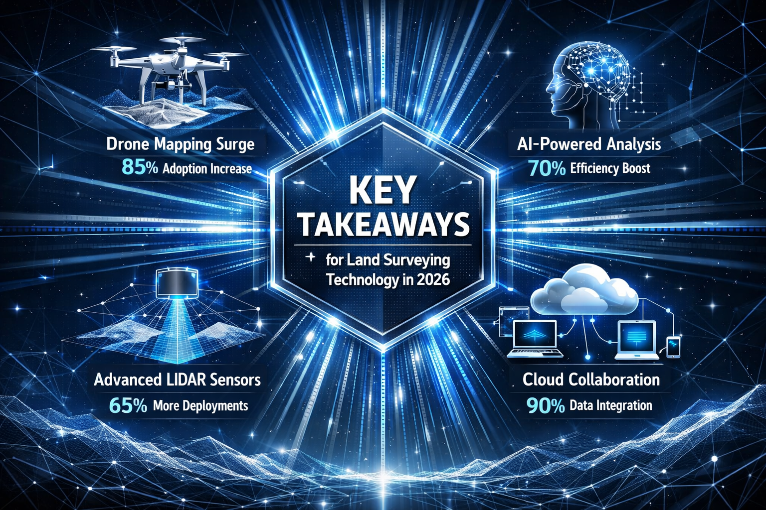
Key Takeaways
- AI-driven automation has moved from experimental to essential, with intelligent systems now handling data classification, anomaly detection, and preliminary modeling—cutting processing time by up to 75% while improving consistency
- Multi-sensor drone platforms combining LiDAR, photogrammetry, thermal imaging, and multispectral sensors now complete in a single flight what previously required multiple site visits with different equipment
- Real-time 3D digital twins and cloud-based collaboration platforms are replacing static document deliverables, enabling continuous updates and simultaneous stakeholder access to high-fidelity interactive models
- Centimeter-level GPS accuracy through RTK and PPK systems has become standard rather than exceptional, enabling precise work in challenging environments without traditional ground control networks
- Integration with Building Information Modeling (BIM) and environmental assessment workflows positions surveyors as central coordinators in sustainable development projects rather than isolated data collectors
Understanding the Technological Revolution in Modern Surveying
The surveying profession has always embraced technological advancement—from the theodolite to total stations to GPS. However, the pace and scope of change in 2026 represents something qualitatively different. Traditional surveying focused primarily on improving measurement precision and reducing manual calculation errors. Today's innovations fundamentally alter the surveyor's role, workflow, and value proposition.
The Shift from Data Collection to Data Intelligence
Modern surveying technology has shifted the profession's bottleneck from data collection to data intelligence. Where surveyors once spent days establishing control networks and weeks processing measurements, they now face the opposite challenge: managing the overwhelming volume of high-quality data that modern sensors generate in hours or even minutes.
This transformation affects every aspect of surveying practice:
- Field time decreases dramatically while data richness increases exponentially
- Processing workflows require new skills in software management and quality control
- Client deliverables evolve from static documents to dynamic, interactive platforms
- Project timelines compress, creating competitive advantages for early adopters
- Accuracy standards improve as technology removes human measurement error
The professionals who thrive in this environment understand that technology doesn't replace surveying expertise—it amplifies it. The fundamental knowledge of boundary law, geodetic principles, construction methodology, and regulatory compliance remains essential. Technology simply allows surveyors to apply this expertise more efficiently across larger, more complex projects.
Integration Across the Development Lifecycle
Perhaps the most significant shift in the future of land surveying technology: key trends shaping 2026 involves integration. Modern surveying platforms no longer operate in isolation but connect seamlessly with architectural design software, engineering analysis tools, construction management systems, and facility management databases.
This integration transforms surveyors from isolated data providers into central coordinators within multidisciplinary teams. A single surveying dataset now feeds directly into:
- Architectural modeling for building survey applications
- Engineering analysis for structural and civil design
- Construction planning and progress monitoring
- Environmental impact assessment and mitigation
- Facility management and lifecycle maintenance
- Land value assessment and investment analysis
AI and Machine Learning: The Intelligence Behind Modern Surveying
Artificial intelligence represents perhaps the most transformative element in the future of land surveying technology: key trends shaping 2026. Unlike previous technological advances that improved specific tasks, AI integration fundamentally restructures surveying workflows from data capture through final deliverable production.
Automated Data Classification and Processing
AI-driven data processing has moved beyond exploratory use into embedded surveying workflows. Modern AI systems now automatically perform tasks that previously consumed the majority of post-field processing time[2]:
Terrain Classification: Machine learning algorithms analyze point cloud data to automatically distinguish between ground surface, vegetation, buildings, infrastructure, and other features—a process that once required manual sorting through millions of data points.
Marker and Control Point Identification: Computer vision systems trained on thousands of survey marker images can now automatically locate and precisely measure control points within photogrammetric datasets, eliminating tedious manual identification.
Anomaly Detection: AI systems flag unusual features, measurement inconsistencies, or data gaps that require surveyor review, providing an automated first-pass quality control layer that catches issues before they propagate through project workflows.
Preliminary Surface Modeling: Intelligent algorithms generate initial terrain models, contour maps, and volumetric calculations without human intervention, allowing surveyors to focus on refinement and validation rather than basic model construction[2].
These capabilities eliminate manual raw data sorting and accelerate project turnaround times by 50-75% compared to traditional processing workflows. More importantly, they maintain consistency across projects and reduce the variability that comes from different technicians processing similar datasets.
Machine Learning Pattern Recognition
Machine learning algorithms excel at processing massive datasets to identify patterns, detect changes, and predict future developments—analytical work that previously required extensive manual interpretation[1]. In practical surveying applications, this translates to:
🔍 Change Detection: Algorithms compare multi-temporal datasets to automatically identify terrain modifications, structural changes, or environmental alterations with precision that exceeds manual comparison methods.
📊 Predictive Modeling: Machine learning systems analyze historical survey data alongside environmental factors to predict erosion patterns, settlement behavior, or infrastructure degradation—providing proactive insights rather than reactive documentation.
🎯 Quality Assurance Enhancement: AI-assisted quality control processes identify inconsistencies, outliers, and potential errors before projects reach drafting stages, providing automated safeguards that enhance rather than replace traditional surveyor standards[2].
The integration of machine learning doesn't diminish the surveyor's role—it elevates it. Professionals spend less time on repetitive data manipulation and more time applying expertise to complex boundary determinations, regulatory compliance, and strategic project guidance.
AI-Enhanced Visualization and Communication
Beyond processing efficiency, AI technologies improve how surveyors communicate findings to clients who may lack technical surveying knowledge. Natural language generation systems can automatically create narrative descriptions of site conditions, measurement results, and notable features. Intelligent visualization tools highlight areas of concern, simplify complex 3D models for specific audiences, and generate customized reports based on stakeholder roles.
These communication enhancements prove particularly valuable when coordinating with diverse project teams including architects, engineers, developers, and regulatory officials—each requiring different information formats and detail levels from the same underlying survey data.
Drone Technology and Multi-Sensor Systems Revolutionizing Data Capture
The transformation of unmanned aerial vehicles (UAVs) from expensive novelties to essential surveying tools represents one of the most visible changes in the profession. The future of land surveying technology: key trends shaping 2026 sees drones not as alternatives to traditional methods but as integrated components of comprehensive surveying strategies.
From Single-Purpose to Multi-Sensor Platforms
Early surveying drones typically carried a single camera for photogrammetry. Modern UAV systems now carry synchronized sensor arrays that combine multiple data collection technologies in a single flight[2]:
| Sensor Type | Primary Application | Key Advantage |
|---|---|---|
| LiDAR Scanners | Precise 3D terrain mapping | Penetrates vegetation to capture ground surface |
| High-Resolution Cameras | Photogrammetry and visual documentation | Rich texture and color information |
| Multispectral Sensors | Vegetation analysis and environmental assessment | Identifies plant health, moisture content, species |
| Thermal Imaging | Infrastructure inspection and energy assessment | Detects temperature variations indicating issues |
| GPS/GNSS Receivers | Precise positioning and georeferencing | Centimeter-level accuracy with RTK correction |
This multi-sensor approach allows complex site documentation that previously required multiple visits with different equipment to be completed in a single flight. The synchronized data collection ensures perfect temporal alignment—all sensors capture the same site conditions simultaneously, eliminating discrepancies from changing weather, lighting, or site activity.
Autonomous Flight Planning and Execution
Modern drone surveying extends beyond remote piloting to autonomous flight path planning using predictive modeling[2]. Surveyors now define project boundaries, specify required accuracy and resolution, and identify obstacles or restricted areas. Intelligent flight planning software then:
- Calculates optimal flight paths considering terrain elevation, sensor capabilities, and overlap requirements
- Adjusts altitude dynamically to maintain consistent ground sampling distance over varying terrain
- Identifies and navigates around obstacles including buildings, trees, and power lines
- Optimizes battery usage and plans multi-battery missions for large sites
- Ensures regulatory compliance with airspace restrictions and flight limitations
This automation dramatically reduces the skill barrier for drone operations while improving consistency and safety. The surveyor's role shifts from piloting to mission planning and data validation—higher-value activities that leverage professional expertise.
Enhanced GPS/GNSS Accuracy for Drone Operations
The integration of Real-Time Kinematic (RTK) and Post-Processing Kinematic (PPK) positioning systems has fundamentally improved drone-based surveying precision. RTK GPS technology now provides centimeter-level accuracy in real-time, enabling faster and more accurate work even in challenging environments[4].
RTK systems maintain continuous communication with base stations or correction networks, adjusting position measurements in real-time to achieve accuracies of 1-2 centimeters horizontally and 2-3 centimeters vertically. This precision rivals traditional ground-based surveying for many applications.
PPK systems record raw GPS data during flight and apply corrections during post-processing, offering similar accuracy without requiring continuous base station communication during flight. This approach proves particularly valuable in remote areas or when radio interference affects RTK connections[1].
These positioning technologies reduce or eliminate the need for extensive ground control point networks, dramatically decreasing field setup time while maintaining survey-grade accuracy. For many projects, surveyors now establish minimal control points primarily for validation rather than as essential georeferencing infrastructure.
Expanded Accessibility and Adoption
Drones have transitioned from cost-prohibitive tools to standard surveying equipment due to declining costs and increased accessibility[1]. Professional-grade surveying drones that cost $50,000-100,000 five years ago now have capable successors available for $10,000-25,000. This democratization means:
- Small surveying firms can afford drone capabilities previously limited to large organizations
- Multi-drone fleets become economically viable, enabling simultaneous multi-site operations
- Specialized drones for specific applications (confined spaces, long-range, heavy payload) expand operational flexibility
- Regular equipment updates keep pace with rapidly advancing sensor and processing technology
The result is an industry where drone surveying has moved from competitive advantage to baseline expectation. Clients increasingly assume drone capabilities when engaging surveying services, particularly for large parcels, difficult terrain, or time-sensitive projects.
LiDAR Technology: From Specialized Tool to Industry Standard
Light Detection and Ranging (LiDAR) technology has evolved from a specialized technique used primarily for large-scale government mapping projects to a standard surveying tool accessible to practitioners across the profession. The future of land surveying technology: key trends shaping 2026 positions LiDAR as a core technology for achieving higher precision and flexibility in surveying both manmade and organic structures[1][3].
How LiDAR Transforms Surveying Capabilities
LiDAR systems emit rapid laser pulses—often hundreds of thousands per second—and precisely measure the time required for each pulse to reflect back from surfaces. This creates dense point clouds containing millions of precisely positioned measurements that capture complex three-dimensional geometry with remarkable detail.
The advantages over traditional surveying methods include:
✅ Vegetation Penetration: LiDAR pulses can penetrate gaps in tree canopy to measure ground surface beneath, enabling accurate terrain modeling in forested areas where photogrammetry fails
✅ Rapid Data Density: LiDAR captures hundreds of measurements per square meter in minutes, documenting complex structures and terrain features that would require hours or days with traditional surveying
✅ Consistent Accuracy: Measurement precision remains uniform regardless of lighting conditions, surface texture, or feature complexity—eliminating variables that affect photogrammetric accuracy
✅ Multi-Return Capability: Advanced LiDAR systems record multiple returns from each pulse, capturing both canopy and ground surface simultaneously to build comprehensive vegetation and terrain models
✅ Integration Flexibility: LiDAR data integrates seamlessly with photogrammetry, creating hybrid models that combine geometric precision with rich visual texture
Diverse Applications Across Industries
LiDAR's versatility has driven adoption across numerous surveying specializations[1][3]:
Agriculture: Precision terrain modeling for drainage planning, soil conservation, and irrigation design; vegetation analysis for crop health monitoring and yield prediction
Archaeology: Non-invasive documentation of historical sites; detection of subtle terrain features indicating buried structures invisible to other survey methods
Infrastructure Monitoring: Detailed documentation of bridges, dams, and transportation corridors; change detection for deformation monitoring and maintenance planning
Wind Energy: Precise turbine placement planning considering terrain and wind flow; as-built documentation for installation verification
Mining and Quarrying: Volumetric calculations for material extraction; slope stability monitoring; reclamation planning and compliance documentation
Forestry: Timber volume estimation; forest health assessment; habitat mapping for environmental management
This breadth of application means LiDAR skills have become valuable across surveying specializations rather than remaining confined to niche practices. Surveyors who develop LiDAR expertise find opportunities across diverse project types and client sectors.
Mobile and Terrestrial LiDAR Systems
While airborne LiDAR mounted on aircraft or drones captures large areas efficiently, mobile and terrestrial LiDAR systems serve complementary roles. Mobile mapping systems mounted on vehicles enable rapid corridor mapping for highways, railways, and utility infrastructure. Terrestrial laser scanners provide ultra-high-resolution documentation of buildings, industrial facilities, and complex structures.
Mobile 3D mapping systems now allow surveyors to create detailed 3D models from diverse indoor and outdoor environments without bulky equipment, enabling rapid digital replica creation without extended processing wait times[1]. This flexibility means a single surveying firm can deploy the appropriate LiDAR platform for each project's specific requirements—aerial for large sites, mobile for linear infrastructure, terrestrial for detailed structural documentation.
The integration of these complementary systems creates comprehensive documentation strategies that capture sites at multiple scales and resolutions, providing complete spatial information from regional context through component-level detail.
Real-Time 3D Digital Twins and Cloud-Based Collaboration

Perhaps no trend better exemplifies the future of land surveying technology: key trends shaping 2026 than the shift from static deliverables to dynamic digital twins. This transformation fundamentally changes how surveyors create value and how clients consume surveying information.
Understanding Digital Twin Technology
Digital twins are high-fidelity, interactive 3D models that update continuously as new data is collected, enabling developers, engineers, and planners to visualize land behavior under various conditions[2]. Unlike traditional survey drawings or even conventional 3D models, digital twins:
- Maintain living connections to data sources, automatically incorporating new measurements as they become available
- Support simulation and analysis, allowing stakeholders to test scenarios and predict outcomes before physical implementation
- Provide multi-temporal views, documenting site evolution and enabling historical comparison
- Enable collaborative interaction, with multiple users simultaneously exploring and annotating the same model
- Integrate diverse data types, combining survey measurements with design models, construction schedules, environmental sensors, and facility management information
This represents a fundamental shift from static document deliverables to dynamic information platforms. Rather than receiving a survey drawing that captures conditions at a single moment, clients access evolving models that remain current throughout project lifecycles.
Cloud-Based Platform Integration
Cloud platforms are fundamentally changing client interactions, providing instant file sharing, 3D browser-based visualization, real-time revision syncing, and integrated communication with architects and engineers—replacing traditional static document workflows[2].
Modern cloud-based surveying platforms offer capabilities that were impossible with traditional delivery methods:
📱 Universal Access: Stakeholders view high-fidelity 3D models directly in web browsers without specialized software, using desktop computers, tablets, or smartphones from any location
🔄 Automatic Synchronization: When surveyors update models with new measurements or refined processing, all users automatically access the latest version without manual file distribution
💬 Integrated Communication: Team members add comments, questions, and annotations directly to 3D models, creating spatially-referenced conversations that eliminate ambiguity about which features or areas are under discussion
📊 Analytics and Reporting: Cloud platforms track model usage, generate automated reports, and provide project dashboards that give stakeholders instant status visibility
🔒 Security and Permissions: Sophisticated access controls ensure sensitive information reaches only authorized users while maintaining audit trails of all model interactions
These capabilities transform surveyors from isolated data producers into central coordinators within collaborative project teams. The surveying model becomes the common reference that aligns diverse specialists around shared spatial understanding.
Impact on Project Workflows and Decision-Making
Real-time digital twins enable fundamentally different decision-making processes. Rather than waiting for survey completion to begin design work, architects and engineers can start preliminary planning as soon as initial data becomes available. As surveyors refine measurements and add detail, designs automatically update to reflect improved information.
This parallel workflow compression can reduce project timelines by 30-40% compared to traditional sequential processes. More importantly, it enables iterative refinement where design feedback informs additional surveying focus areas, and surveying discoveries prompt design adjustments—creating adaptive workflows that respond to emerging information rather than following rigid predetermined sequences.
For clients investing in building surveys or measured building surveys, these technologies provide unprecedented insight into property conditions and development potential.
Integration with Building Information Modeling (BIM) and Construction Technology
The convergence of surveying technology with Building Information Modeling (BIM) represents a critical trend shaping professional practice in 2026. Surveyors increasingly serve as the essential bridge between existing conditions and proposed designs, with their data forming the foundation upon which entire BIM workflows build.
Automated BIM Data Acquisition
UAVs now enable photogrammetry, multispectral mapping, thermal imaging, and 2D/3D orthomosaic map creation alongside traditional surveys, with capabilities extending to automated BIM data acquisition[1]. Modern surveying platforms can automatically convert point cloud data into BIM-compatible formats, creating intelligent 3D models where individual building components are recognized and classified.
This automation means:
- Existing building documentation for renovation projects generates BIM models rather than simple drawings
- As-built verification compares constructed elements directly against design BIM models with automated deviation reporting
- Facility management receives BIM models of existing infrastructure without manual modeling effort
- Design teams work with survey-derived BIM elements that maintain measurement accuracy and real-world relationships
The integration eliminates the traditional gap between surveying deliverables and design models, where architects manually recreated surveyed information in their modeling software—a process that introduced errors, consumed time, and created version control challenges.
Construction Progress Monitoring and Quality Control
Surveying technology now enables continuous construction monitoring that provides unprecedented quality assurance. Regular drone flights or terrestrial scans document construction progress, automatically comparing built conditions against design models to identify:
- Dimensional deviations that exceed tolerance specifications
- Sequence variations where construction departs from planned methodology
- Material placement verification for earthwork and concrete operations
- Safety compliance monitoring for fall protection, access routes, and hazard zones
- Progress quantification for payment applications and schedule verification
This monitoring capability transforms quality control from periodic inspections that discover problems after significant work has proceeded to continuous verification that catches deviations immediately. The cost savings from early problem detection often exceed the entire surveying budget for projects.
For professionals conducting building defects surveys or identifying urgent building issues, these technologies provide objective documentation that supports professional assessments.
Lifecycle Integration from Design Through Operations
The most sophisticated implementations extend BIM integration beyond construction into facility operations and maintenance. Survey-derived BIM models become the foundation for facility management systems that track:
- Equipment locations, specifications, and maintenance histories
- Space utilization and occupancy patterns
- Energy consumption and building performance
- Renovation and modification records
- Regulatory compliance documentation
This lifecycle approach means initial surveying investments continue providing value for decades, with models evolving alongside buildings they represent. Surveyors who understand this extended value proposition position themselves as strategic partners rather than transactional service providers.
Environmental Monitoring and Sustainability Applications
Surveyors are increasingly playing crucial roles in assessing and mitigating environmental impacts, with heightened emphasis on sustainability and using surveying data to support responsible land development and resource management[2]. The future of land surveying technology: key trends shaping 2026 includes significant expansion of environmental applications.
Precision Environmental Assessment
Modern surveying technologies enable environmental monitoring at scales and resolutions previously impossible:
🌱 Vegetation Health Analysis: Multispectral sensors detect plant stress, disease, and species composition—supporting habitat assessment, agricultural management, and ecosystem monitoring
💧 Hydrological Modeling: High-resolution terrain data enables precise watershed delineation, flood modeling, and stormwater management planning that protects water quality and reduces flood risk
🏔️ Erosion and Sedimentation Monitoring: Repeated surveys detect subtle terrain changes indicating erosion, landslide risk, or sediment accumulation—enabling proactive intervention before significant damage occurs
🌡️ Thermal Mapping: Infrared sensors identify heat islands, building energy losses, and temperature variations affecting ecosystems and human comfort
These capabilities support community housing projects and sustainability initiatives by providing objective data for environmental planning and compliance verification.
Supporting Regulatory Compliance
Environmental regulations increasingly require detailed spatial documentation of site conditions, impact assessments, and mitigation measures. Surveying technology provides the precise, defensible data that regulatory agencies demand:
- Wetland delineation with accuracy sufficient for jurisdictional determinations
- Tree inventories documenting protected species and calculating replacement requirements
- Contamination mapping showing pollutant distribution and remediation verification
- Habitat assessment quantifying critical areas and species populations
- Carbon sequestration measurement for environmental credit programs
The objective, technology-based documentation that modern surveying provides reduces regulatory disputes and accelerates approval processes. Agencies increasingly prefer high-resolution spatial data over narrative descriptions or conventional site plans.
Renewable Energy and Green Infrastructure
Surveying technology plays essential roles in renewable energy development and green infrastructure implementation. Solar farm planning requires precise terrain modeling to optimize panel placement and predict energy production. Wind energy projects depend on detailed topographic analysis for turbine siting. Green stormwater infrastructure needs accurate grading plans to ensure proper drainage and infiltration.
These applications position surveyors as key contributors to climate change mitigation and adaptation efforts—expanding the profession's relevance and social impact beyond traditional development support roles.
Challenges and Considerations in Adopting New Technologies
While the future of land surveying technology: key trends shaping 2026 offers tremendous opportunities, professional adoption faces real challenges that require thoughtful navigation.
Investment and Training Requirements
Advanced surveying technologies require significant capital investment. A comprehensive modern surveying capability including drones, LiDAR systems, GPS equipment, and processing software can easily exceed $100,000-200,000. For small firms or individual practitioners, this represents a substantial financial commitment with uncertain return timelines.
Beyond equipment costs, training requirements are substantial. Effective use of AI-enhanced processing, autonomous drone operations, and BIM integration demands skills that extend well beyond traditional surveying education. Professionals must invest in:
- Software training for specialized processing and modeling applications
- Regulatory knowledge for drone operations and airspace compliance
- Data management skills for handling massive datasets and cloud platforms
- Interdisciplinary communication for effective collaboration with diverse project teams
This learning curve can temporarily reduce productivity as practitioners develop proficiency with new tools and workflows.
Data Management and Cybersecurity
Modern surveying generates enormous data volumes—a single drone flight can produce hundreds of gigabytes of imagery and sensor data. Managing this information requires:
- Robust storage infrastructure with redundancy and backup systems
- Efficient processing workflows that handle large datasets without excessive time or computing resources
- Organization systems that enable rapid retrieval of specific project information
- Long-term archival strategies that maintain data accessibility as formats and software evolve
Additionally, cybersecurity concerns grow as surveying data moves to cloud platforms and becomes more valuable to clients. Surveyors must implement security measures protecting sensitive information from unauthorized access, data breaches, and ransomware attacks.
Regulatory and Liability Considerations
Emerging technologies sometimes outpace regulatory frameworks, creating uncertainty about compliance requirements and liability exposure. Drone operations face evolving airspace regulations. AI-enhanced processing raises questions about professional responsibility when algorithms make decisions. Digital deliverables create ambiguity about document authenticity and long-term accessibility.
Surveyors adopting new technologies must carefully consider:
- Professional liability insurance coverage for technology-specific risks
- Client contract language addressing data ownership, format specifications, and long-term accessibility
- Regulatory compliance for drone operations, data privacy, and professional standards
- Quality assurance procedures that validate technology outputs against professional standards
These considerations don't argue against technology adoption but rather emphasize the need for thoughtful implementation that maintains professional standards and protects both practitioners and clients.
Balancing Technology and Traditional Skills
Perhaps the most nuanced challenge involves maintaining traditional surveying expertise while embracing technological innovation. The fundamental principles of boundary law, geodetic science, construction methodology, and professional ethics remain essential regardless of measurement technology.
Effective practitioners understand that technology amplifies professional expertise rather than replacing it. The surveyor who can operate advanced equipment but lacks deep professional knowledge produces data without insight. Conversely, the expert who dismisses technological tools finds themselves increasingly unable to compete or serve client needs effectively.
The solution lies in integrated development that builds technological proficiency alongside traditional expertise, creating professionals who apply timeless principles through modern tools.
Preparing for the Future: Strategic Recommendations for Surveying Professionals

As the future of land surveying technology: key trends shaping 2026 continues unfolding, professionals can take concrete steps to position themselves for success.
Develop a Phased Technology Adoption Strategy
Rather than attempting to implement all emerging technologies simultaneously, develop a strategic roadmap that prioritizes investments based on:
- Client demand: Which technologies address the most frequent client requests or pain points?
- Competitive positioning: What capabilities do competitors offer that risk making your services appear outdated?
- Return on investment: Which technologies offer the clearest path to revenue generation or cost reduction?
- Skill alignment: What technologies leverage existing team expertise and require minimal training?
- Scalability: Which investments support future expansion rather than serving narrow applications?
This phased approach allows manageable investment increments, provides time to develop proficiency before adding complexity, and enables course corrections based on actual experience rather than theoretical projections.
Invest in Continuous Learning
Technology evolution demands ongoing education rather than one-time training. Establish learning systems that keep pace with rapid change:
- Allocate dedicated time and budget for professional development
- Participate in industry conferences, webinars, and workshops focused on emerging technologies
- Join professional organizations and online communities where practitioners share experiences and insights
- Develop relationships with equipment vendors and software developers who provide training and support
- Consider formal education in complementary fields like data science, GIS, or BIM management
The most successful practitioners view learning as continuous professional investment rather than occasional necessity.
Build Collaborative Relationships
Modern surveying increasingly operates within multidisciplinary teams rather than as isolated practice. Cultivate relationships with:
- Architects and engineers who can provide insight into how surveying data feeds their workflows
- Construction managers who understand field implementation challenges and opportunities
- Environmental consultants who require specialized spatial data for assessments
- Technology vendors who offer early access to emerging capabilities and can customize solutions for specific needs
- Other surveyors who may become collaboration partners for large projects or complementary specializations
These relationships create referral networks, learning opportunities, and strategic partnerships that expand practice capabilities beyond what individual firms can develop independently.
Communicate Value Beyond Traditional Metrics
As surveying deliverables evolve from documents to data platforms, value communication must evolve correspondingly. Help clients understand benefits beyond traditional accuracy and completeness:
- Time savings from compressed project schedules and parallel workflows
- Risk reduction through early problem detection and continuous monitoring
- Decision quality improvement from interactive visualization and scenario testing
- Lifecycle value of data that serves multiple purposes across project phases
- Competitive advantage from faster, more informed development processes
Clients who understand these broader value propositions become willing to invest in advanced surveying capabilities and view surveyors as strategic partners rather than commodity service providers.
Conclusion: Embracing Transformation While Honoring Professional Foundations
The future of land surveying technology: key trends shaping 2026 presents both extraordinary opportunities and significant challenges for surveying professionals. Artificial intelligence, autonomous drone systems, LiDAR technology, real-time digital twins, and cloud-based collaboration platforms are fundamentally transforming how surveyors collect, process, and deliver spatial information.
These technologies don't diminish the surveying profession—they elevate it. Surveyors equipped with modern tools can accomplish in hours what previously required weeks, can document sites with detail and accuracy that exceed traditional methods, and can provide clients with dynamic information platforms that support decision-making throughout project lifecycles.
However, technology alone doesn't create professional value. The expertise that distinguishes professional surveyors—deep understanding of boundary law, geodetic principles, construction methodology, regulatory requirements, and ethical practice—remains as essential as ever. Technology amplifies this expertise, enabling its application across larger, more complex projects with greater efficiency and impact.
Actionable Next Steps
For surveying professionals ready to embrace these emerging trends:
- Assess your current capabilities honestly, identifying gaps between existing tools and emerging client expectations
- Develop a technology roadmap that prioritizes investments based on strategic value rather than technological novelty
- Invest in education for yourself and your team, building proficiency with new tools while deepening traditional expertise
- Start small with pilot projects that test new technologies in controlled environments before full-scale implementation
- Build partnerships with technology vendors, complementary professionals, and innovative clients willing to explore new approaches
- Communicate value effectively, helping clients understand the broader benefits of advanced surveying capabilities
- Maintain professional standards as technology evolves, ensuring that innovation enhances rather than compromises the integrity that defines professional practice
The surveying profession stands at an inflection point where those who embrace technological transformation while honoring professional foundations will find unprecedented opportunities. The tools available in 2026 enable surveyors to provide value that extends far beyond traditional measurement services—becoming strategic advisors, project coordinators, and essential contributors to sustainable development.
Whether you're considering which building survey you need, comparing Level 2 and Level 3 survey options, or exploring advanced applications like land value calculation, understanding these technological trends helps you make informed decisions and select professionals equipped to deliver modern surveying capabilities.
The future belongs to surveyors who view technology as a tool for amplifying expertise rather than replacing it—professionals who combine cutting-edge capabilities with timeless principles to deliver exceptional value in an increasingly complex and demanding built environment.
References
[1] The Future Of Land Surveying Technology And Upcoming Trends In 2026 – https://metricop.com/blogs/land-surveying/the-future-of-land-surveying-technology-and-upcoming-trends-in-2026
[2] Future Land Surveying 2026 – https://haller-blanchard.com/future-land-surveying-2026/
[3] The Future Of Engineering Surveying Technology Tools And Trend – https://2survey.com.au/the-future-of-engineering-surveying-technology-tools-and-trend/
[4] Future Of Surveying Technology Unveiled – https://mcclurevision.com/future-of-surveying-technology-unveiled/